Part 5 of a six-part series on the dams, reservoirs, power generation and some diversion dams located on the North Platte River. The series will follow a chronological order of the history and construction of these projects.
Related Articles:
- Part 1: The North Platte River Basin Projects — Background
- Part 2: The North Platte Project – Pathfinder, Guernsey and Whalen
- Part 3: The Kendrick Project — Seminoe and Alcova
- Part 4: The Pick-Sloan Missouri River Basin Project — Kortes
- Part 5: The Pick-Sloan Missouri River Basin Project — Glendo
- Part 6: Other Dams, Reservoirs and Powerplants – Nebraska and Wyoming
The Pick-Sloan Missouri River Basin Project — Glendo
The Glendo Unit is part of the Pick-Sloan Missouri Basin Program (formerly the Missouri Basin Project). The Pick-Sloan program was authorized in 1944 under the Flood Control Act. This was a general comprehensive plan for the control, beneficial use and conservation of water for the entire Missouri River Basin. Uses include flood control, irrigation, hydropower generation, municipal and industrial water supplies, sediment control, pollution abatement, fish and wildlife habitat, endangered species and recreation.
When the Glendo Unit was proposed, it became a point of contention between Colorado, Nebraska and Wyoming. Each state had competing interests in the water that would be impounded by the dam. (For more information on water law, see the series Water Law 101.) Colorado believed the extra water stored would be grounds for increasing the amount of water that could be used in the North Park region of their state (the headwaters of the North Platte River). Nebraska thought river flows would be decreased into Lake McConaughy. Congress passed Public Law 841 which stated that no money would be appropriated for any part of the Glendo Unit until a definite plan would be agreed to by the three states.
The U. S. Bureau of Reclamation produced a plan that satisfied all three states in 1954. The plan outlined that the reservoir would store approximately 800,000 acre-feet. This capacity was divided into 100,000 acre-feet designated for irrigation; 310,000 acre-feet for hydro-power generation; 275,000 acre-feet for flood control; and 115,000 acre-feet for sediment retention.
This plan required an amendment to the 1954 Supreme Court decree for Nebraska and Wyoming allocating the North Platte River flow in these states. Although 100,000 acre-feet could be stored in the reservoir for irrigation, only 40,000 acre-feet could be used in any one year — 25,000 acre-feet to Nebraska and 15,000 acre-feet to Wyoming. The additional power generated would serve all three states.
The Glendo Unit consists of Glendo dam, reservoir and powerplant. It also includes Gray Reef dam, reservoir and the Fremont Canyon powerplant. Glendo dam is the sixth dam on the North Platte River, approximately 25 miles upstream of Guernsey dam.
Construction of Glendo dam started in 1954 and competed in 1958. The dam is an earthfill structure 190 feet high and 2,096 feet long. Current water allocations are 454,337 acre-feet for irrigation and power generation, 271,917 acre-feet for flood control, and an additional 329,251 acre-feet surcharge capacity. Current capacity of the reservoir is approximately 789,402 acre-feet, due to sediment accumulation. The Glendo powerplant has two generators each producing 19,000 kilowatts of power.
The Glendo reservoir provides significant benefits to the area. In addition to providing irrigation, the river flows can be re-regulated, allowing water to be released upstream for hydropower generation year-round from those hydropower plants for Colorado, Nebraska and Wyoming. It provides for flood control, wildlife habitat, and is a major recreational site during the summer for many states.
Gray Reef dam is the fifth on the North Platte River in Wyoming. It is approximately two miles downstream from the Alcova dam. Construction started in 1959 and completed in 1961. Gray Reef dam and reservoir serves to re-regulate the flow from Alcova. Gray Reef is an earthfill structure 36 feet high and 600 feet long. Capacity of the reservoir is approximately 1,800 acre-feet. Recreational activities are limited to fishing and some boating.
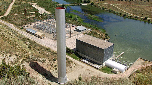
Pathfinder dam and reservoir were the first to be constructed on the North Platte River, but the last to receive a powerplant. Fremont Canyon powerplant is located approximately three miles downstream from the Pathfinder dam. The powerplant is connected to the reservoir by an 18-foot diameter, concrete-lined pressure tunnel. This tunnel then splits into two 10-foot penstocks to feed the two turbines for the generators. Construction for the powerplant and tunnels started in 1956 and completed in 1961. Fremont Canyon powerplant has two generators each producing a combined 66,800 kilowatts.
Still the question from my Water Law 101 series, what is water worth?
References
Bell, Tina Marie, “Glendo Unit – Oregon Trail Division, Pick-Sloan Missouri Basin Program”, Bureau of Reclamation, 1996
The National Park Service, “History of Glendo Dam”, www.waterhistory.org, 2014
“Pick Sloan Missouri Basin Program”, U.S. Department of the Interior, Bureau of Reclamation, Pick Sloan Missouri Basin Program (usbr.gov)

