Key Takeaways
Surface-water supplies are tightening across Nebraska, with some irrigation districts already planning reduced allocations, delayed starts, or shorter delivery windows.
The Platte River Basin faces the most immediate pressure, with low snowpack and Lake McConaughy near 51% capacity limiting available water.
In the Panhandle, late starts and shorter irrigation seasons may impact crop emergence and early growth, increasing yield risk.
Central Platte districts are taking a defensive approach, delaying canal charging and conserving storage for peak summer demand.
The Republican River Basin faces the tightest constraints, where drought conditions are compounded by interstate compact requirements.
Dry conditions across much of Nebraska are creating mounting uncertainty for surface‑water irrigation districts as the 2026 irrigation season approaches. While groundwater remains widely used and available in many regions, surface‑water systems are facing reduced storage, early operational decisions, and — in some cases — meaningful cutbacks.
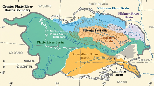
Irrigation districts’ responses vary sharply across Nebraska’s three primary surface‑water basins: the Loup River Basin in north‑central Nebraska, the Platte River Basin stretching west to east across the state, and the Republican River Basin in southern Nebraska. Differences in hydrologic drivers, storage capacity, water right seniority, and interstate compacts are shaping how districts assess risk and manage limited supplies this year.
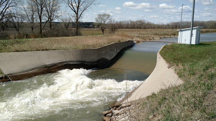
Loup River Basin: Calm Vigilance
The narrative in the Loup River Basin is one of calm vigilance. Unlike snowmelt‑driven river systems, the Loup is hydrologically distinct. The flows of this basin are primarily sustained by the vast groundwater reserves of the Nebraska Sandhills, acting as a natural “sponge,” slowly releasing water to the river network. This baseflow has historically allowed the system to withstand short‑term drought shocks better than many other basins. However, managers across the basin are increasingly aware of what they describe as a “drought lag.” After several consecutive dry years, there is growing concern that prolonged moisture deficits may finally be catching up to the system.
The dominant drought response for 2026 across the basin has been earlier than normal startup. The Farwell Irrigation District has already begun diverting water from the Middle Loup River and filling Sherman Reservoir approximately three weeks ahead of schedule. This early fill strategy is designed to capture available flows before potential mid‑season declines and to ensure the reservoir reaches full pool to meet collaborative agreements with neighboring districts. Sherman Reservoir also serves as a critical buffer; for Farwell, storage provides a safety net that allows deliveries to continue even if river diversions are later restricted by senior water rights.
Similarly, the Middle Loup Public Power and Irrigation District is advancing their startup dates by roughly one to two weeks. The objective is to provide early irrigation water for crop emergence in dry soils while river levels remain high.
For now, allocations remain stable across the basin. For instance, Twin Loups Irrigation District, which serves more than 56,000 irrigated acres, is holding at its traditional 18‑inch‑per‑acre allocation, and no seasonal curtailments are planned. With roughly 80% of acres under center pivots, delivery efficiency helps reduce risk. Still, managers emphasized that streamflows are being monitored closely as summer approaches.
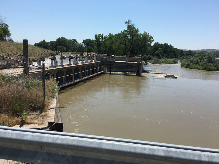
Platte River Basin: Storage Pressure and Growing Urgency
Tracing the Platte River from the Wyoming border east toward Nebraska’s central plains reveals a sense of urgency. This basin depends heavily on the “frozen bank account” of mountain snowpack, which remains well below average. Compounding concerns, Lake McConaughy — the state’s largest storage reservoir — entered the season at roughly 51% capacity, nearly 30 percentage points below typical levels.
Upstream Districts Face Limited Supply
At the upstream end of Nebraska’s Platte River system are three closely connected districts operating on opposite sides of the North Platte River — Pathfinder Irrigation District on the north side, and Goshen and Gering-Fort Laramie Irrigation Districts on the south side. All three districts are part of the historic North Platte Project, commissioned in 1902 under President Theodore Roosevelt and administered by the Bureau of Reclamation.
Pathfinder Irrigation District is navigating one of its tightest seasons in memory. As of late March, Pathfinder reported only about 25 days of available water in its reservoirs. With large uncertainty in mountain runoff, the district is preparing for a reduced allocation of 0.90 feet per 80 acres, down from the normal 1.0 foot. Strict enforcement of pivot nozzle standards and accurate water measurement will be required to distribute limited supplies fairly.
On the south side of the river, Goshen Irrigation District and Gering-Fort Laramie Irrigation District (GFLID) have reported about 38–41 days of water supply, including 17 days carried over from 2025.
Like Pathfinder, both districts emphasize uncertainty tied to spring weather and mountain runoff. No firm start date has been announced, with decisions expected after May 1, once updated Bureau of Reclamation forecasts are available.
Panhandle Impacts Emerging
Another water provider in the region, Farmers Irrigation District, has warned producers that 2026 could be a water‑short year, with a possible mid‑ to late June startup and an uncertain total number of irrigation days. Managers have indicated that rotation of laterals will likely be needed again to stretch limited supplies.
For major crops in the Panhandle, the very likely late and shortened water delivery implies yield reductions across all major crops (corn, sugar beet, dry beans and alfalfa), particularly to sugar beet and alfalfa, which rely on early water for emergence and establishment.
Central Platte Districts Conserve Storage
Moving east from the Panhandle to Dawson County, the Cozad Ditch Company faces more acute pressure. Cozad typically relies on natural river flows to supplement its purchased storage water from Nebraska Public Power District (NPPD). With natural flow essentially absent this year, internal projections suggest the system could run out of water by approximately Aug. 20, roughly two to three weeks earlier than normal. That potential early cutoff poses significant risk for late‑season soybean yield and complicates decisions about system startup and operating rates.
The situation becomes more defensive for the Thirty-Mile and Southside Irrigation Districts, also located in Dawson County. As junior water‑right holders, these districts are among the first to be curtailed when supplies tighten. In an unprecedented step, management is keeping canals dry as long as possible this spring to preserve limited storage for peak summer demand. The district manager described the start of 2026 as the most difficult he has seen in nearly 50 years of operating the system.
Within this central Platte corridor, Nebraska Public Power District (NPPD) plays a critical role in surface‑water management, both in terms of delivering irrigation water to more than 75,000 acres in Dawson and Buffalo counties and in supporting hydroelectric generation and cooling water supply for the Gerald Gentleman Station. NPPD is very aware of and concerned about current hydrologic conditions. At this time, NPPD believes it will be able to provide a full surface‑water supply to its irrigation customers if central Nebraska receives a few timely rains.
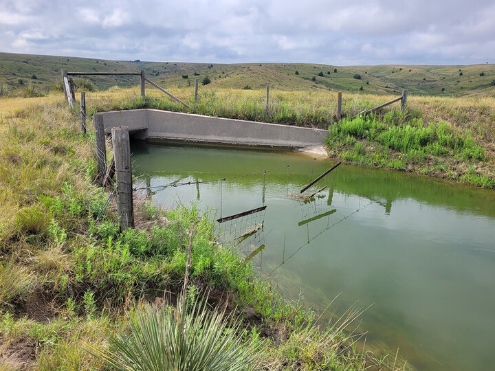
Republican River Basin: Drought Plus Compact Constraints
The Republican River Basin represents the most complex management environment in Nebraska, where climatic drought is compounded by legal obligations under the Republican River Compact with Kansas and Colorado.
For the Frenchman–Cambridge Irrigation District (FCID), the 2026 season has already been reshaped by a mandatory 35‑day bypass of reservoir inflows earlier this year to meet interstate obligations, causing FCID to lose a significant portion of potential storage at a critical time.
The operational impacts have been substantial. FCID has decided to keep one of its canals entirely shut down this year and severely limit operations on another canal, as available water supplies are simply too thin. Two other major canals of FCID have allocations set at 7-8 inches per acre. At these levels, traditional gravity irrigation is largely impractical.
To manage these tight constraints in recent years, many producers have transitioned from gravity irrigation to center pivots. Today, roughly 90% of FCID acreage is under center pivots. Additionally, the district has invested more than $8 million in canal automation and a suite of flexible management tools. Producers can pool surface‑water allocations, combine surface and groundwater use, and participate in a water‑banking system that allows buying and selling water among neighbors.
This adaptive, data‑driven approach is essential in a year when total available surface water is extremely limited. Even with aggressive efficiency measures, FCID officials emphasized that drought combined with compact compliance leaves little margin for error.
Looking Ahead
Across Nebraska, surface‑water irrigation districts are entering the 2026 irrigation season with heightened awareness, early operational shifts, and in some cases, significant reductions. While the Loup River Basin currently benefits from groundwater‑sustained flows, Platte River districts are confronting storage limits and runoff uncertainty, and Republican River systems face the added burden of interstate obligations.
Common themes include earlier starts where surface flows are still strong, delayed canal charging and reduced allocations where water is limited, stricter efficiency requirements, and close communication with producers. As one manager noted, “If we could predict the weather, everything would be good.” For now, Nebraska’s surface‑water systems are balancing experience and caution while hoping for timely rainfall to stabilize an increasingly tight year.
We sincerely thank the managers of the irrigation districts who generously shared their time and experience, helping us understand the evolving dry conditions and how they are shaping operational decisions across Nebraska’s river basins.
Additional Information
- Water Law 101: Part 6, Sharing Water with Other States and Water Use Within the State
- The North Platte River — Multi-Use Water, Part 1
- The North Platte River — Multi-Use Water, Part 2
- The North Platte River — Multi-Use Water, Part 3
- The North Platte River — Multi-Use Water, Part 4
- The North Platte River — Multi-Use Water, Part 5
- The North Platte River — Multi-Use Water, Part 6
