Storm Chances This Weekend
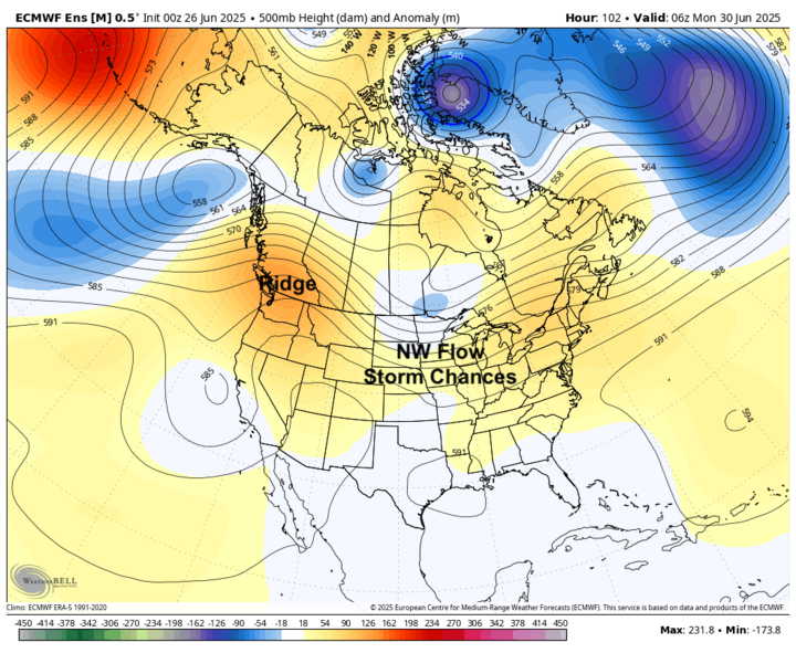
Ridging will be prominent over the northwestern U.S. this weekend, which will bring northwest flow and a few different shortwaves that look to additional precipitation to most of the state. Precipitation chances look good across the northern and western sections of the state on Saturday afternoon into Saturday night, June 28. Southern and eastern sections of the state will have a good chance of showers and storms starting later Sunday afternoon, June 29 into early Monday morning, June 30.
Temperatures will be seasonally warm this weekend, especially in eastern sections of the state where highs in the lower to mid-90s are probable. With dewpoints likely getting into the 70s, some areas may be flirting with heat advisory criteria on Saturday afternoon.
Rain Chances on the Fourth?
The first half of next work week looks relatively quiet with somewhat cooler temperatures than this weekend and only slight chances for precipitation. Rain chances will increase again later in the week as a slow-moving cutoff low moves into the southwest U.S. The trough will help open up a broader area of rising motion from the southwest into the central U.S. Moisture flow from hurricane remnants may also make its way into the Central Plains, which would further enhance precipitation.
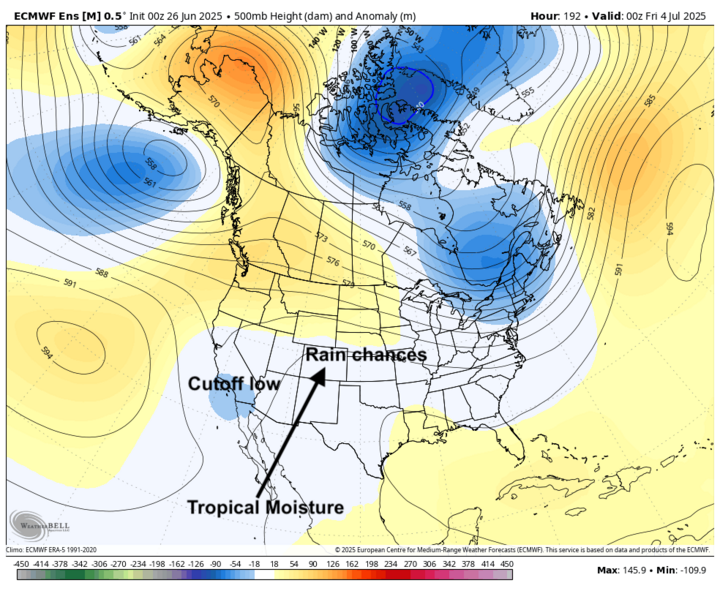
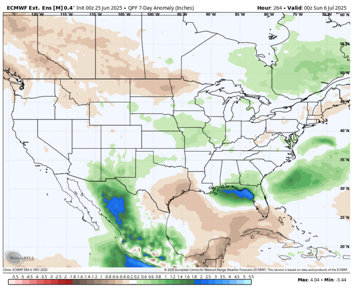
It's a little early to pinpoint exact timing of precipitation chances and amounts but there will be chances of showers and thunderstorms statewide and around the broader region starting Thursday evening, July 3 and persisting through next weekend. That doesn't mean the Fourth of July will be a complete washout. But the evening fireworks might have a damper on them in some places as evening into overnight would be a more favored time for storms. Regardless, it does appear that most of the state will have a chance to pick up above average precipitation in the first week of July. Will send out an update early next week with (hopefully) more precise information about the timing of rainfall chances.
Seasonal Temperatures
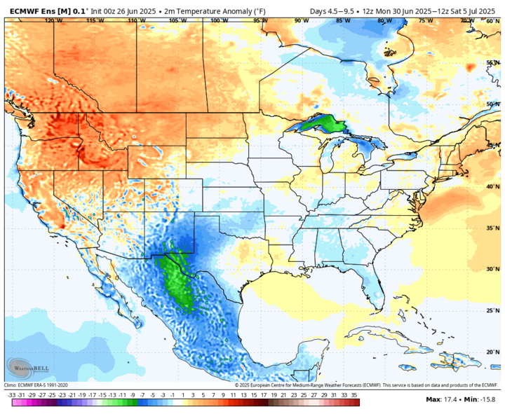
Temperatures next week look to be mostly seasonal with no really hot days and no abnormally cool weather. Highs mostly in the mid- to upper 80s and lows in the 50s (west) and 60s (central and east) are likely. Temperatures may flirt with 90°F next Thursday around Valentine and south of I-80 if there is enough sunshine. Overall, temperatures should be right around average next week statewide with a minimal southeast-northwest gradient in temperature.
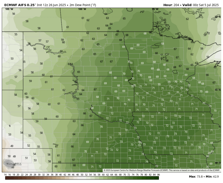
Muggy Fourth
Highs on the Fourth look to be in the 80s, but dewpoints likely will be in the low 70s in central Nebraska and possibly the mid- to upper 70s in southeastern Nebraska. So, in addition to the rain chances, it will feel quite muggy for many of us. Western Nebraska will (as usual) have much more pleasant levels of humidity for outdoor festivities.