Warm Weekend and Start to Next Week Ahead
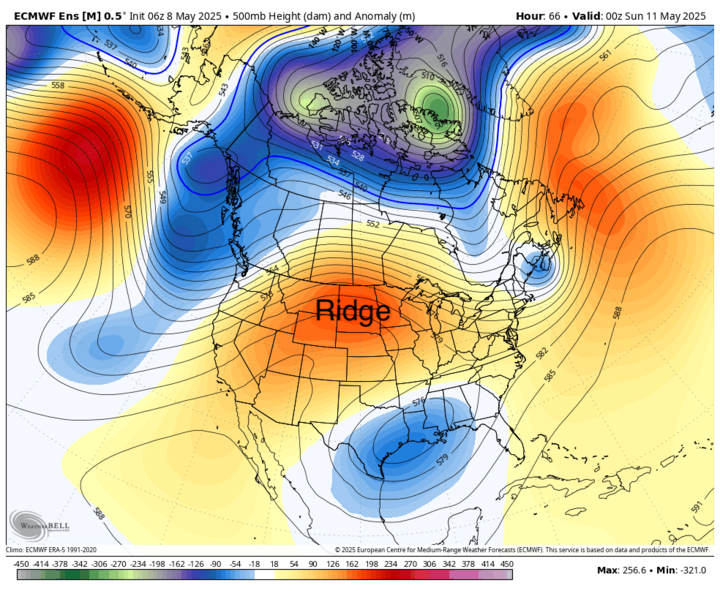
A strong upper-level ridge will be dominant the next several days and will keep the entire state dry and warm.
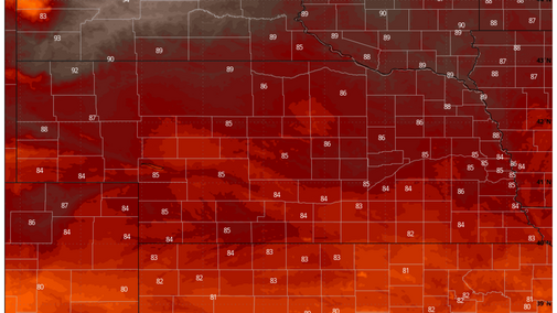
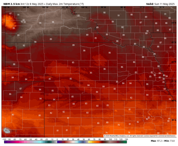
Temperatures will warm up a bit more tomorrow compared to May 8 and then will shoot up another 3-6°F on Saturday, May 10. Highs in the 80s will prevail statewide and may get close to 90°F in northeast Nebraska. Sunday, May 11 will see temperatures drop off just slightly in the southern half of the state but likely will be even warmer in the northern part of the state where mixing of warmer air aloft will be optimal. Highs in the lower 90s are likely across the northern Panhandle. Given the long-term drought conditions that prevail across much of the northwestern part of the state, it is possible that those temperatures are a bit under forecast.
Fire Danger
Winds will pick up from the south on Saturday in western Nebraska and on Sunday further east. It will remain breezy from the south to southwest statewide through Tuesday, May 13. Sustained winds over 20 mph look probable across most of the Sandhills on Sunday and Monday, May 12. With lower relative humidity and stressed vegetation, fire danger will be elevated. The burn ban expires on Sunday across the western two-thirds of the state, but extreme caution is still advised. It is possible that Gov. Pillen may extend the burn ban for another week for some areas. Danger is a bit less in eastern Nebraska where it has rained more this spring and vegetation is healthier. But with breezy conditions and low RH in the afternoon hours, controlled burns would not be advised in the eastern part of the state and are strongly discouraged between in areas in severe to extreme drought.

Cooling Off Then Storm Chances in Panhandle
It will remain warm Monday and Tuesday with temperatures generally running 85-90°F statewide. Might be a bit warmer in the northern Panhandle on Monday and will likely be under 85°F in the southeast corner of the state. As we get to Wednesday, May 14, a trough in the western U.S. will move into the Northern Plains and at the surface a cold front will be moving through the state.

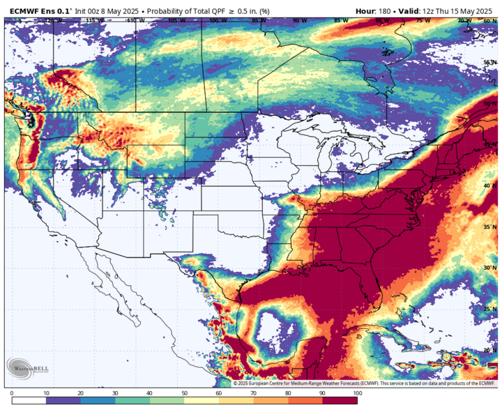
Ahead of the front, temperatures will be well above average, likely pushing 90°F or a little higher in the eastern half of the state. Behind the front, more seasonal temperatures in the upper 60s to mid-70s will be common. The best atmospheric forcing (rising motion) to produce showers and storms will be north of the state and the trough off the southeast coast means moisture return to the High Plains will not be optimal. Nevertheless, the Panhandle and northwestern Sandhills should see a reasonable chance for moisture on Tuesday night into Wednesday morning.
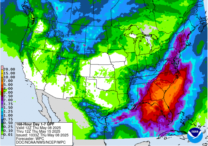
The WPC shows a possibility of getting an inch from Hay Springs to Chadron and the ECMWF shows some probability of a half-inch of moisture, which would be very welcome if it came to fruition. But if that trough off the southeast hinders moisture return to that area, amounts are more likely to be in the 0.10- to 0.33-inch range. Better than nothing, but not drought busting rain.
Storms may go up later Wednesday along the front in eastern Nebraska, but between sub-optimal moisture return and elevated temperatures aloft, the front likely will go through most of the state dry. Best chance at getting moisture on Wednesday afternoon/evening would be across the northeast corner where convergence will be better.
After the front passes, the last part of the week will be more seasonal with temperatures in the 60s and 70s. Thursday, May 15 and Friday, May 16 should be dry statewide and may be a bit breezy. Another trough, perhaps a potent one, will be coming into the central U.S. next weekend.
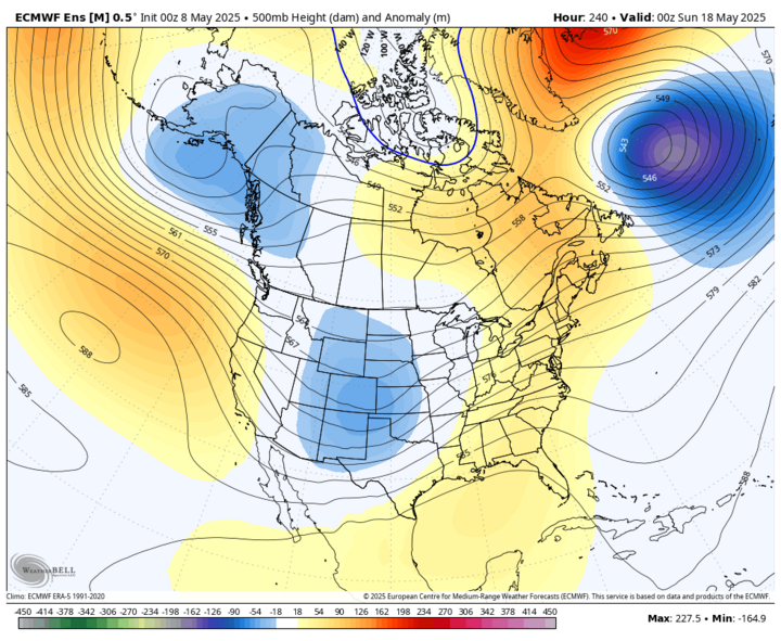
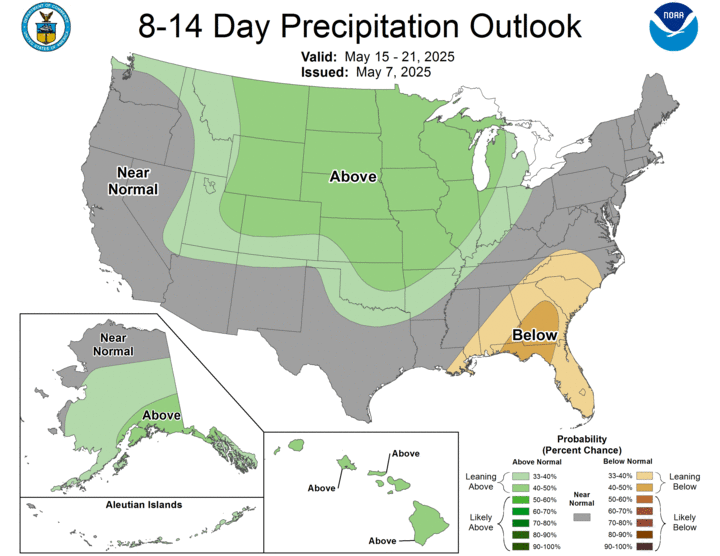
This would increase rain chances for the state, particularly for central and eastern sections of the state. Severe weather may be possible on Saturday afternoon, May 17 into Sunday morning, May 18, and it is possible that significant precipitation may fall in the eastern half of the state next weekend. Too early to get super excited about moisture prospects but things are lining up for the possibility of getting much-needed moisture in the region next weekend. The CPC does have the entire state and region leaning above average on precipitation in the eight- to 14-day outlook.
It also is looking likely to cool back down to seasonal and possibly below-seasonal temperatures the week after next, especially for afternoon high temperatures if that upper-level low is slow to exit the region and cloud cover is extensive. Additional precipitation may be possible the middle of the week after next as well. This would be very welcome as drought conditions across the state are getting worse quickly.

Drought Worsens in Nebraska
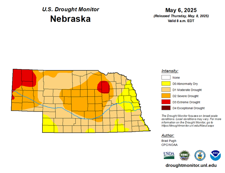
The latest U.S. Drought Monitor was released May 8 and showed a wide expansion of severe drought in central Nebraska and introduction of extreme drought into an area centered on Antelope County. Drought was introduced to more of southeast Nebraska and abnormal dryness was introduced to the southwest corner. Additional degradation in eastern Nebraska is likely next week with a warm, dry forecast.
Precipitation Deficits and Soil Moisture
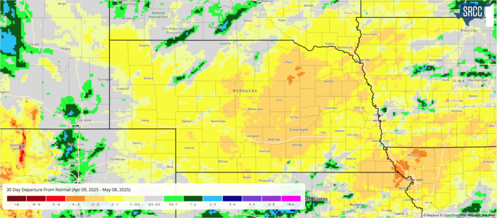
With a few exceptions, most of the state has had a dry to very dry last 30 days and deficits of 1-2 inches during that timeframe are common. It is even worse in central Nebraska where deficits in excess of 2-3 inches are common. We are getting into our wettest time of year and are starting to get to a point where these deficits will be hard to offset, especially between O'Neill and Grand Island, unless above-average precipitation can be sustained for several weeks. That is not impossible, but it is not the most likely outcome.
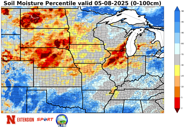
The dry weather has also led to further depletion of soil moisture, especially across the central section of the state, where soil moisture percentiles are generally below the 10th percentile. Many areas are below the fifth percentile. According to CMOR reports, pivots have already been running in the central part of the state to ensure crops have enough water to get started. Above-average precipitation for the next several weeks would be welcome, but with thirsty vegetation and summer temperatures around the corner, it will be difficult to fully recharge the profile without going over super wet like they have in the southern Plains the last 30 days.
VegDRI Update
Most of the state is experiencing some level of drought stress according to VegDRI, which combines precipitation and satellite reflectance to estimate vegetation health. This signal is worst in the Panhandle and Sandhills, with Antelope County possibly experiencing the worst conditions relative to normal. Pockets of southern and eastern Nebraska are in better shape but will likely see rangelands deteriorate over the next week with abnormally warm, dry and breezy conditions prevailing.
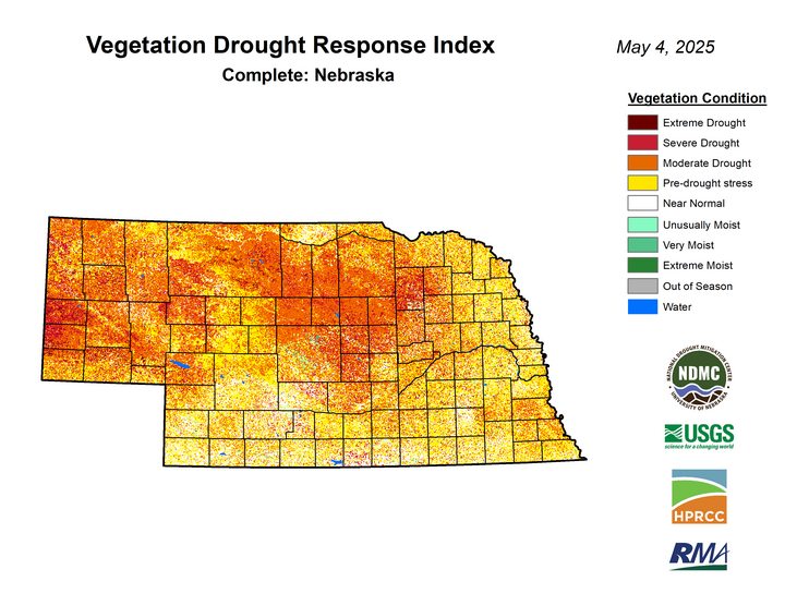
Fire danger will be elevated to critical across much of the state Sunday, May 11-Wednesday, May 14, especially between Highways 183 and 281 where drought conditions are the most acute and winds will be strongest. A burn ban issued by Gov. Pillen in April is currently set to expire this weekend. But controlled burns are strongly discouraged through at least Wednesday and likely through next weekend.
