BLUF
Temperatures will be on the rebound Friday, April 11 and everyone should sneak in at least one day in the 80s this weekend. Some parts of southwest Nebraska may get into the 90s on Saturday.
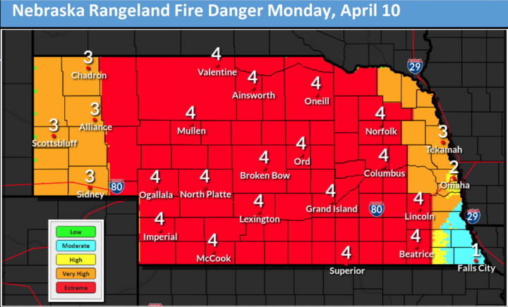
Fire danger will be elevated to high in western Nebraska Friday and statewide Saturday, April 12-Monday, April 14. Most critical day for fire danger will be Monday when sustained winds over 25 mph will be likely over a majority of the state.
Conditions should remain dry next week and when combined with seasonal to above average temperatures, planting windows look wide open for a while. They may start getting shut later in April when a more active pattern returns, which would bring increased chances for robust moisture and severe weather to the central U.S. That moisture would be quite welcome by then; the hail and wind not so much.
Warm to Hot and Windy
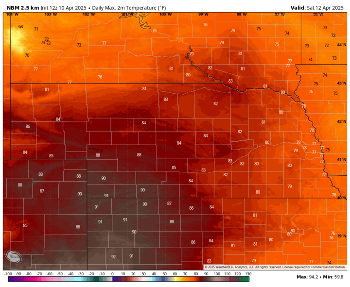
Temperatures will be on the way up Friday across the western 3/4 of the state, with highs over 80 likely in the Panhandle. Ridging will continue to build east into the Plains on Saturday and it will be a warm to downright hot day across the state. Temperatures should hit 80°F everywhere west of Lincoln on Saturday and may exceed 90°F in southwest Nebraska.
With a tight pressure gradient developing by Saturday morning across the central U.S., it will be breezy in western Nebraska and windy in the eastern 2/3 of the state. Red flag warnings likely will be posted east of Ogallala as the lower humidity combined with high wind speeds will lead to elevated fire danger. A front will move through the state on Sunday, which will bring cooler temperatures to the western half of the state, but still above average for mid-April. There will be chances for rain later Sunday or early Monday along and south of Highway 6 but any precipitation that does fall will be light.
Temperatures will be in the 60s statewide on Monday and it will be windy from the northwest after the frontal passage. Relative humidity will be low for April as well, so fire danger will be especially elevated on Monday. Winds should be lighter for a few days after that, which would reduce the risk of fire danger a bit. Temperatures will start rebounding on Tuesday, April 15 and should be in the 70s statewide on Wednesday, April 16 and Thursday, April 17.
A front may move through the state later in the week, which would bring a slight chance for showers in the eastern half of the state and more seasonal temperatures as we head into Easter weekend. But right now, the chance of meaningful moisture (or enough to sideline planting) looks low.
Open Planting Windows
A look at the projected upper air pattern next week shows us sandwiched between ridging along the west coast and troughing in the northeast U.S.
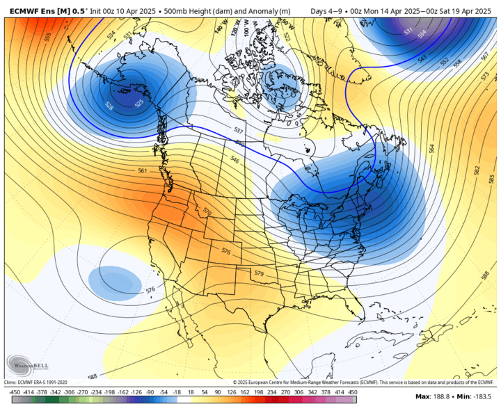
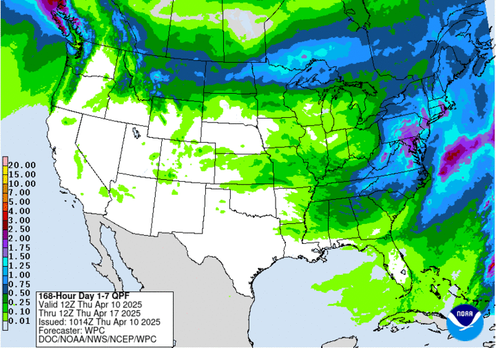
This will generally keep us on the warm side of average and dry. As mentioned earlier, there may be a chance for showers early in the week south of Highway 6 and later next week east of Highway 183. But we are most likely to be pretty dry until Easter Sunday or shortly thereafter. The WPC shows little to no precipitation falling across the state over the next seven days and that map would likely be fairly accurate in Nebraska if it went out 10 days.
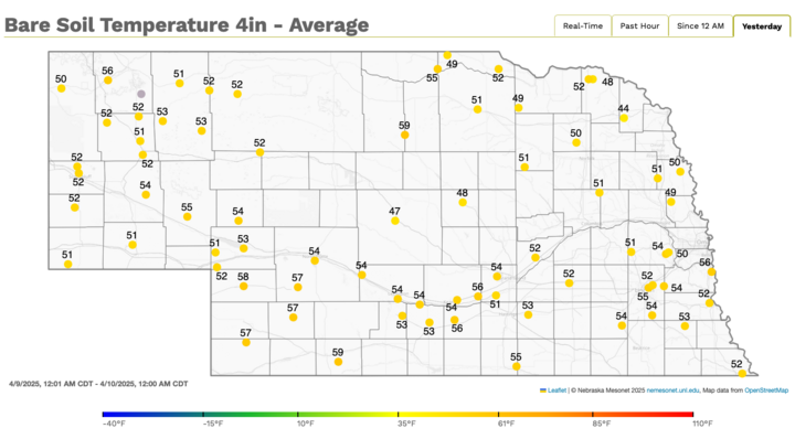
Soil temperatures are currently over 50°F at four inches across most of eastern and southern Nebraska where early corn planting is permitted. With the warmer temperatures forecast over the next week, soil temperatures should remain safely above that 50°F threshold. There also appears to be a very low risk of a freeze in the near future for most of eastern and south-central Nebraska. Thus, the next seven to 10 days should be favorable for planting (in areas eligible).
Late April Moisture
It does appear that moisture will return to the region later this month. The ECMWF AI model has been favoring troughing over the western U.S. right after Easter, possibly picking up on some signal from MJO hanging around in Phase 7 over the next few weeks.
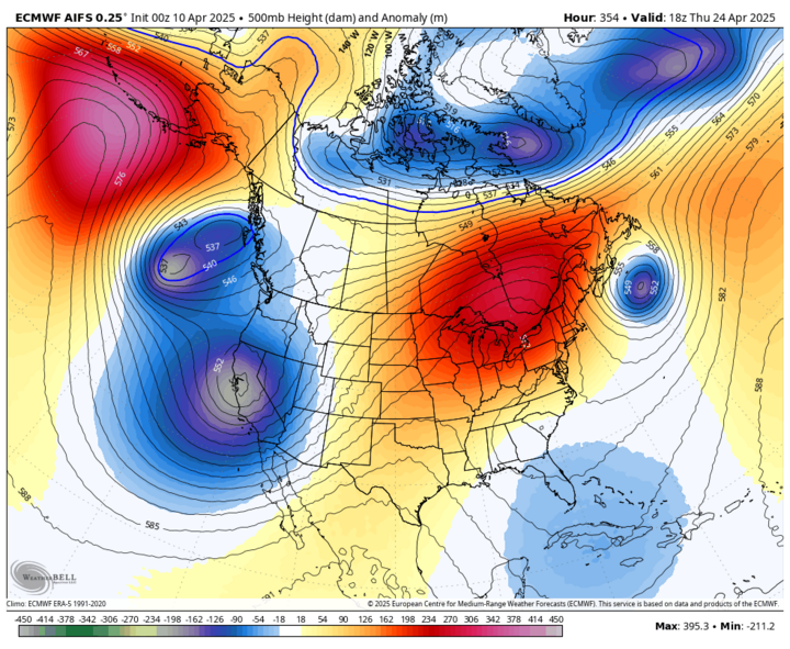
In plain English, this means we would start see a more active pattern open up again in 10-14 days. This would bring chances for regular moisture across a broad section of the central U.S., including severe weather.
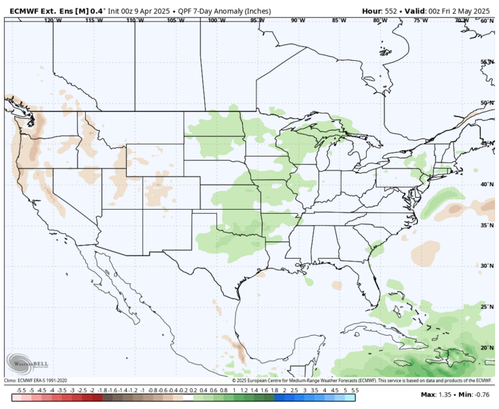
A quick peek at the ECMWF weeklies for the seven-day period ending on Friday, May 2 does show above-average moisture favored for at least the southeastern quadrant of the state. The good news is the outlook does not have any dry signal in our region, which it certainly does through Easter. By the end of the month, above-average precipitation compared to climatology would mean non-trivial, perhaps significant moisture.
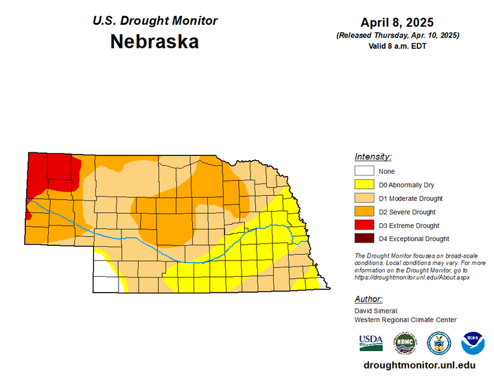
Drought Update
By later this month, we will certainly need the moisture, especially in areas still mired in severe or extreme drought. The latest Drought Monitor shows there was some improvement in the northern Sandhills, from eastern Cherry County into western Boyd County. Some of the abnormal dryness in south-central Nebraska may well be back in drought soon with the warm, dry and windy weather forthcoming.