Cooler Finish to Week
Temperatures will be seasonally cool across the eastern half of Nebraska and chilly out in the western side of the state Friday, April 25. Highs likely holding under 60 for all and may struggle to get out of the lower 40s Friday afternoon in the highest elevations. Scattered showers will also be possible though most of the rain should be out of the state by daybreak. It will generally be cloudy statewide Friday.
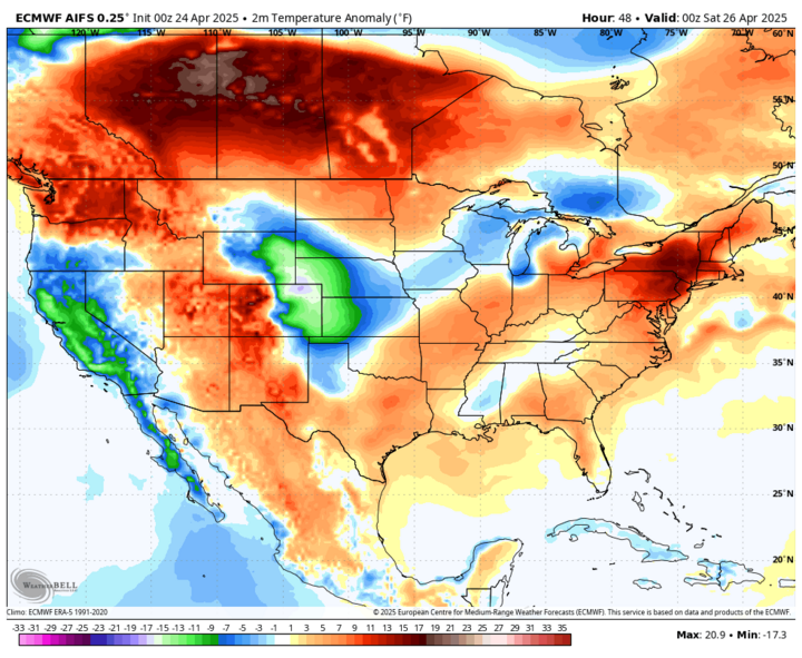
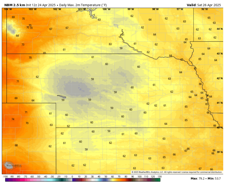
Saturday, April 26 should be a bit warmer across the state, albeit still seasonally cool with highs mostly 58-65°F statewide. Might be closer top 70°F in the Panhandle where there will be more sun.
Precipitation Chances Over the Weekend
Showers will be likely across west-central and central sections of the state in the afternoon and will slide east into eastern Nebraska on Saturday night, April 26 into Sunday morning, April 27. Significant precipitation is not likely but any rainfall would be welcome, particularly in the Sandhills. Additional precipitation will be possible in the eastern side of the state on Sunday afternoon. Winds will be a bit breezy on Sunday across the state and on Monday, April 28 in eastern Nebraska as well. Fire danger may be elevated in areas of west-central Nebraska that didn't get recent precipitation.
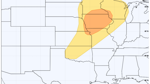
Severe Storms Possible Monday
The Storm Prediction Center has put much of the middle of the country in the risk area for severe weather on Monday afternoon and evening, including eastern Nebraska.
The culprit is an upper-level trough that will be moving out of the southwestern U.S. into the north-central region of the country between Sunday and Monday.
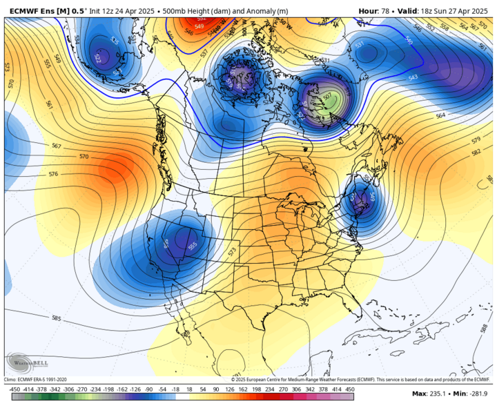
At the surface low, pressure will develop on Sunday in eastern Colorado and move into the Dakotas on Monday. The exact track of the low pressure and its trailing cold front to its south-southwest will have a major impact on what happens on Monday. If the surface low is closer to Aberdeen, South Dakota on Monday afternoon, then thunderstorms likely wouldn't develop west of Highway 81 as the front (and drier air) will have already moved through that section of the state. If it ends up being closer to Bismarck, North Dakota, then that severe weather risk (including the enhanced risk) would expand into areas between Highway 281 and Highway 77.
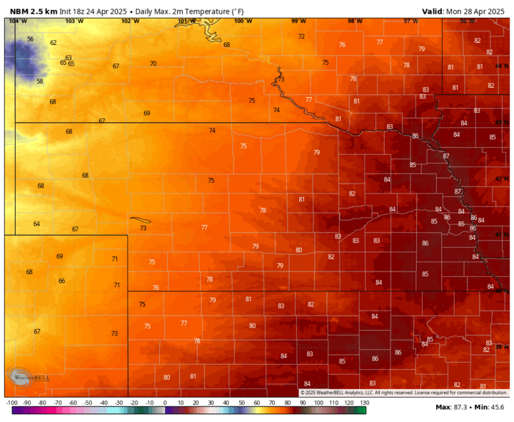
Right now, it would seem that storms developing south and east of a line from Wayne to Fairbury would be most likely with the far eastern side of the state having the best chance of hail, damaging winds and tornadoes. This could produce very large hail if everything lines up right. Recommend paying close attention to the forecast this weekend as we get more details about how this is likely to evolve. It also will be a warm day in eastern Nebraska with temperatures perhaps making a run at 90°F in spots.
More Rain Chances Thursday and Then a Dry Stretch
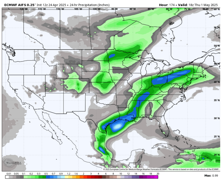
After a few quiet days, a trough will move from Canada into the north-central U.S. by Wednesday, April 30, and at the surface a cold front will push through the region. If moisture return is sufficient, there will be a good chance of showers across the southeastern two-thirds of the state early Thursday, May 1. How much rain may fall is uncertain, but the latest ECMWF AI model does show a chance at over a quarter of an inch for much of central Nebraska.
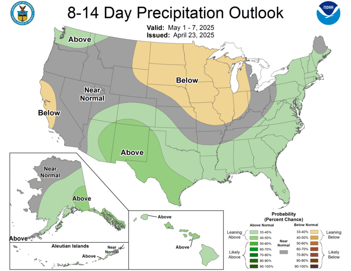
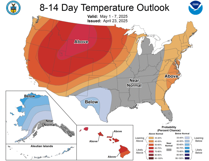
After next Thursday, it does appear that the state and most of the north-central region are likely to go over dry for a stretch of four to seven days. Chances for moisture may increase closer to the end of the eight- to 14-day outlook period from the CPC. But it is possible that the first half of May is pretty dry across the state and region, which is not good news for areas needing to recover from drought. Temperatures are also likely to be above average in the first part of May.
Fire and Drought Update
A controlled burn in Brown County got out of control on Monday afternoon, April 21 and is likely still trying to be contained. Several thousand acres have burned, 45 cattle have died, and at least one cabin has been destroyed. Governor Pillen has issued a statewide burn ban through the end of the month. More information on the burn ban can be found here.
Observations from Ainsworth show that relatively calm conditions earlier in the day gave way to gusty winds in the afternoon as a cold front moved into the area with a line of showers that mostly didn't reach the ground. The radar loop from that afternoon indicates a line of showers moved through the area in the middle of the afternoon but no precipitation was reported. It did bring temporary cloud cover but unfortunately, also brought gusty winds and no rain.
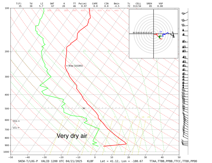
A look at the sounding from North Platte that morning shows the air mass was very dry, so even though radar returns were picking up light precipitation, it was evaporating before it hit the ground. In other words, the cold front had sufficient enough forcing to produce precipitation, but the air mass was too dry to oblige north-central Nebraska with any rainfall and instead just brought gusty winds. The observations and archived radar loop are available online.
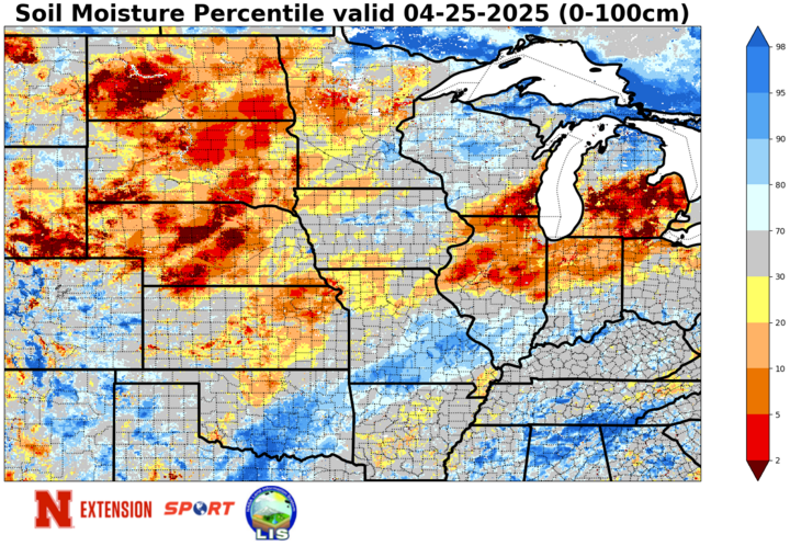
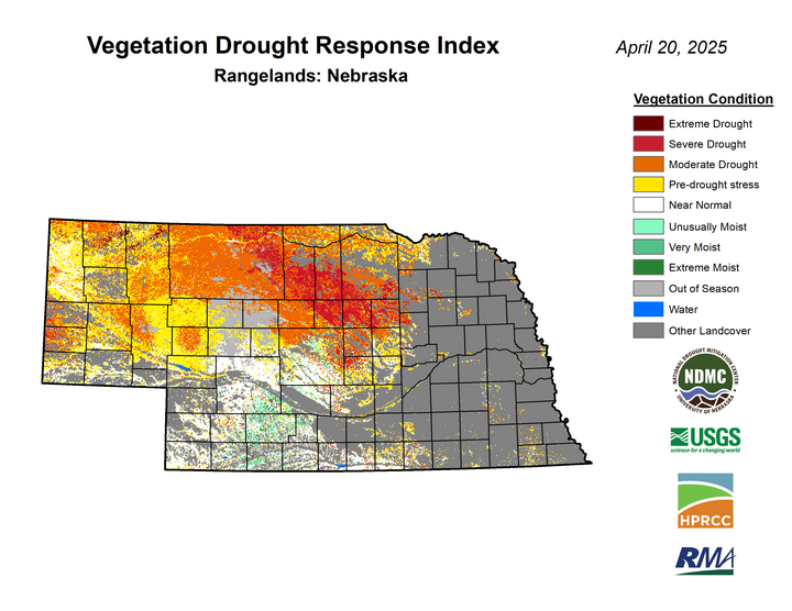
This area of the state is currently in moderate drought on the U.S. Drought Monitor and conditions look worse according to the latest soil moisture percentiles and VegDRI maps. Most of the Drought Monitor map remained unchanged this week, but there was a pocket of degradation to severe drought in the eastern Sandhills (Valley, Garfield and Wheeler counties) and a small area of degradation in the southeast corner of the state. The map released yesterday was based on data through Tuesday morning so the rainfall in southeast Nebraska on Wednesday afternoon wasn't considered.

Omaha Area Flooding April 24
An upper-level low moved through the region Thursday and brought some very beneficial rain to areas in south-central and eastern Nebraska. Amounts over a half inch were common in those areas with amounts of 1-2 inches more common in Saline, Jefferson, Dodge, Sarpy and Washington counties. Peak near the Kansas border was found in western Jefferson County, which had 3.15" (Gilead 3.17 E).
Flooding was a big problem in the eastern half of Omaha yesterday. Two separate rounds of storms in the late afternoon and early evening hours produced very intense rainfall rates, which were over 4 inches/hour at Omaha Eppley around 6 p.m. and may have been worse in the hardest hit area around Saddle Creek. The storms also brought hail and a tornado just across the river in Iowa. A CoCoRaHS observer near the flooding video reported 3.15 inches total and it is likely much of that fell in two separate 20-25 minute bursts. Video coverage and the archived radar loop from yesterday are available online.
