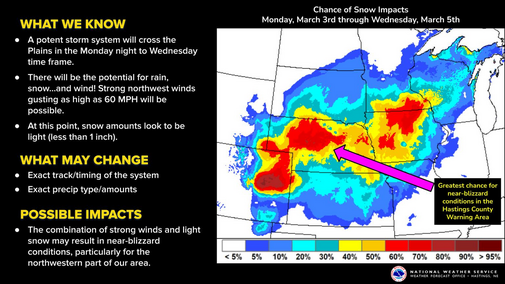
Strong Storm
A deep upper-level trough will be moving from the southwest into the central U.S. over the next 48 hours and will have favorable upper-level dynamics (i.e., left exit region of the jet stream) to help create rapid strengthening of a surface low once it moves into Kansas from Colorado. A bomb cyclone is classified as a 24-mb drop in pressure over a 24-hour period and while that is not the official forecast, that level of strengthening is possible as it moves from western Kansas into Missouri. Regardless, this will be an impactful storm and everyone in the state stands to get some moisture from this.
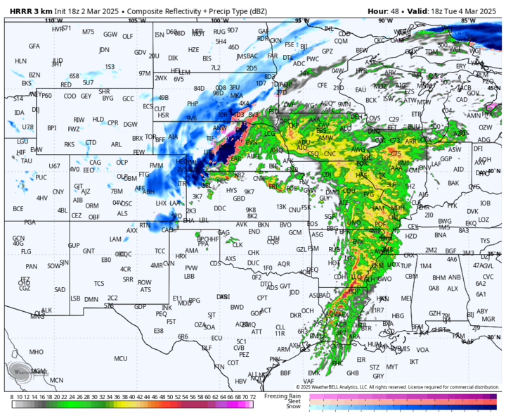
Precipitation should begin in the Panhandle Monday evening, March 3 as rain and then turn to snow overnight. By early Tuesday morning, March 4, precipitation will have spread further east into the Sandhills and into southwestern sections of the state, where snow may be heavy at times.
In eastern Nebraska, showers and thunderstorms will be possible, with the far eastern side of the state most likely to pick up significant rainfall during the early portion of the day on Tuesday.
A dry slot is likely to keep areas south of Norfolk and between Grand Island and Eagle from getting much precipitation on Tuesday morning. Some peaks of sun will even be possible and temperatures will shoot up into the 50s for eastern sections of the state by early Tuesday afternoon. Low 60s will be possible from York to Plattsmouth.
Rain will turn to snow across the Sandhills into central sections of the state by early Tuesday afternoon and may be on the heavy side. Winds will also be strong in the central and western sections of the state by early Tuesday afternoon and blizzard conditions will be possible in places like Thedford, Broken Bow and Cozad.
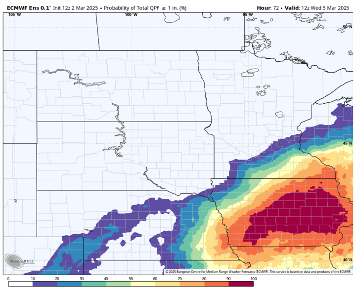
As the surface low moves east, precipitation will "fill in" on the northwest quadrant during the afternoon hours in eastern Nebraska. Rainfall rates aren't likely to be excessive and the ground has thawed a good bit with recent warmth. Nevertheless, rainfall may be on the heavier side at times in the afternoon in eastern Nebraska. Rain will change over to snow for all of central Nebraska during the afternoon hours.
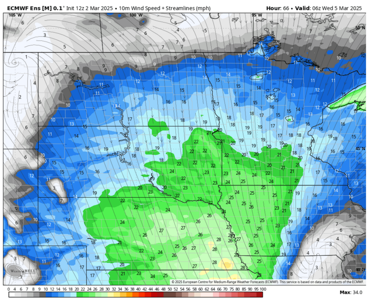
The front will also be pushing through the state during the afternoon hours and temperatures will crash from 55-60°F to the mid-30s in places like York, Wahoo, Omaha, Beatrice and Nebraska City. With the surface low gaining strength to our southeast and high pressure building to our northwest, it will be windy to very windy across most of the state by Tuesday evening. Winds will be less of an issue in the Panhandle. Guests of 50 mph are likely across the eastern half of the state and may gust close to 60 mph in southeast Nebraska on Tuesday night. If you live in the eastern third of the state, consider this a warning that it will be sharply colder with wind chill at 5 p.m. than it will be at noon.
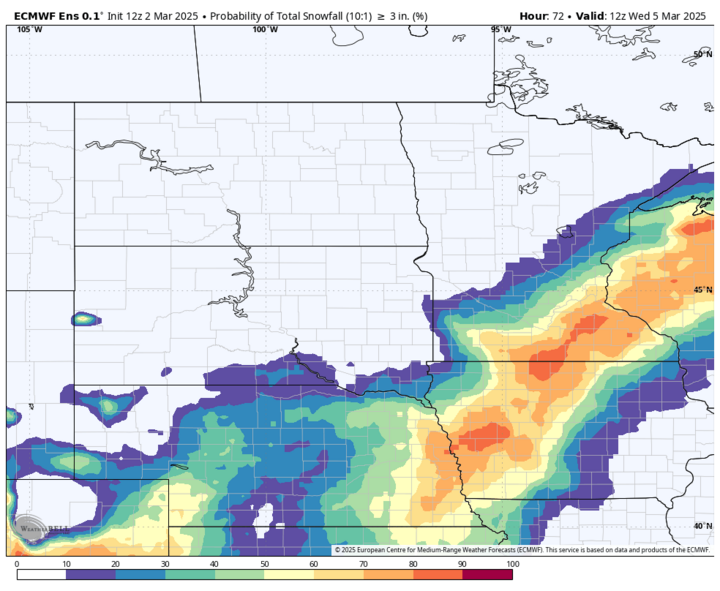
Rain is likely to transition over to snow in northeastern Nebraska by late afternoon and during the evening hours in southeast Nebraska. Exactly how much snow may fall is tricky, but the latest ECMWF ensemble shows a strong probability of 3 inches in the eastern third of the state and some chance at 6-plus inches, particularly around Omaha. Unlike what fell back in February, this will be a very wet snow. It also will be very wind-driven, and it wouldn't surprise me to see blizzard warnings issued for much of the state on Tuesday night.
Temperatures are likely to be in the 20s statewide on Wednesday morning and may struggle to get above freezing in parts of eastern Nebraska on Wednesday, March 5 if higher end snow accumulations are realized. Winds should start backing off a little on Wednesday morning and will be much lighter by Wednesday night.