May 8, 2009
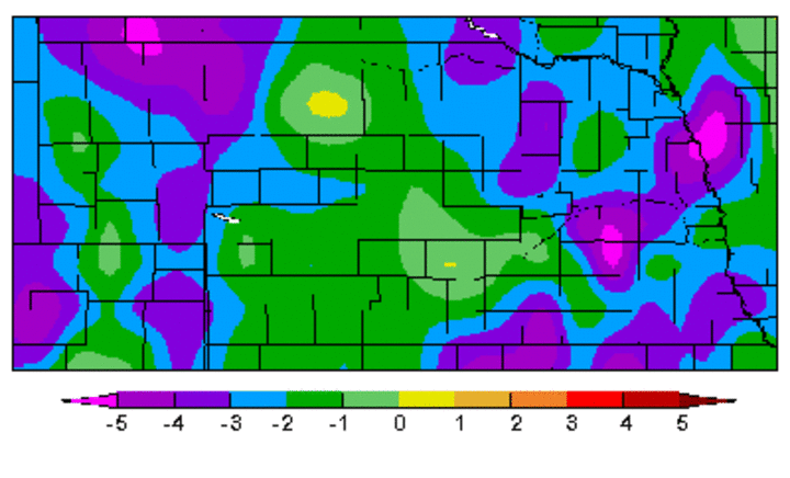
April brought below normal average temperatures to the entire state, with departures of 2 to 6 degrees across the western and eastern thirds. In central Nebraska temperatures were generally less than 2 degrees below normal.
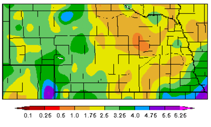
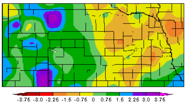
Above normal precipitation was confined to the western half of Nebraska where they had several strong storm systems with heavy rain and significant accumulations of snow. This temporarily eliminated drought concerns and improved soil moisture reserves.
Eastern Nebraska missed out on much of this moisture. During the first four months, much of eastern Nebraska had below normal moisture; however, generous fall moisture resulted in above normal soil moisture recharge in the top 5 feet so the recent dry trend has only affected moisture in the top foot of soil. One or two moderate precipitation events could quickly refill this.
Precipitation
There were 15 days in April when measurable moisture was recorded in Nebraska. A storm April 4-5 resulted in significant accumulations of snowfall north and west of a line from McCook to West Point. Within this region, snowfall totals in excess of six inches were observed across the northern Panhandle, northern Sandhills, along with pockets of northeast and east central Nebraska.
Unofficial reports indicate that 26 inches of snow were recorded near Harrison with 16 inches at Merriman. Butte recorded 12 inches, while Arthur and Tekamah received 10 inches. In the warm sector of the storm, a tornado touched down near Fairfield on April 4 and represented the only confirmed touchdown in Nebraska in April.
Of the 166 observation sites in Nebraska having at least 80% of their data available for analysis, 90 failed to receive normal moisture. Most sites receiving above normal moisture were in the western half of Nebraska. A few isolated locations in extreme southeastern Nebraska received above normal moisture, mostly during severe thunderstorms April 27.
Temperatures
April, like March, generally sees rapid temperature swings due to frequent frontal passages, but this April was an exception as prolonged periods of above or below normal temperatures prevailed.
The first 14 days of April saw normal to below normal temperatures. The greatest daily departures occurred April 5-6 when temperatures averaged 10-15 degrees below normal. From April 15-24 temperatures were above normal with the greatest departure on April 24 with temperatures 15-20 degrees above normal. Below normal temperatures returned April 25-28, with departures as much as 8-12 degrees below normal. Temperatures averaging 5 degrees above normal were recorded April 29-30.
Of the 148 temperature sites having at least 90% of the their data available for analysis, only one station reported above normal temperatures for the month. Average temperatures approached 5 degrees below normal across the northern Sandhills, Panhandle, and northeastern Nebraska, the same areas that received heavy snowfall in early April.
Al Dutcher
State Climatologist


