Hot
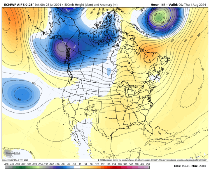
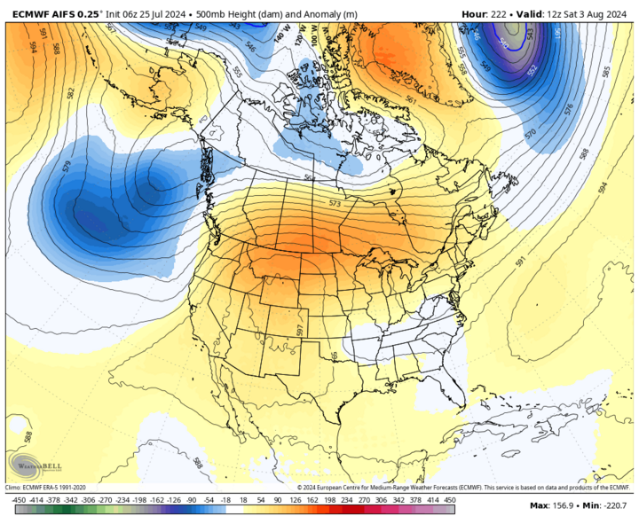
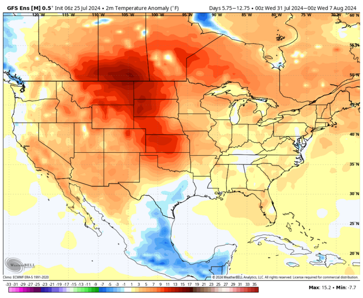
Next week the jet stream will be paying Santa Claus a visit and the overall flow in the upper air pattern in this part of the Northern Hemisphere will be quite weak. This means an unwanted atmospheric tenant, such as a strong mid-level ridge, isn't going to get an eviction notice very quickly.
Translation: the heat in the central U.S. will stay turned on for an extended period of time.
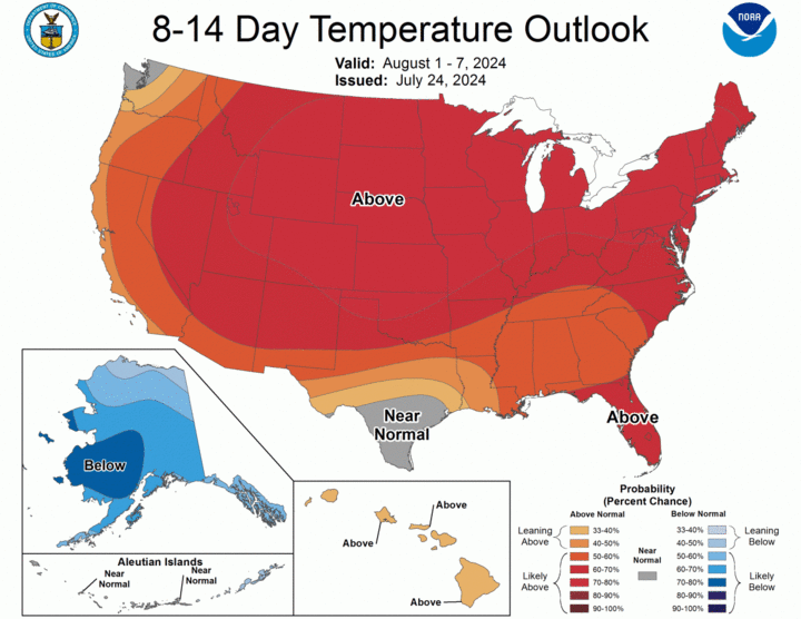
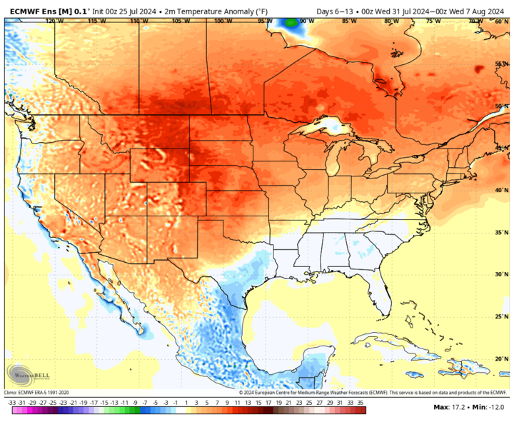
Not every single day in the next two weeks will be brutally hot. But temperatures will be mostly above average through at least the first full week of August and there is some chance we are entering into a quite prolonged stretch of heat too. That will really put pressure on crops, especially those in areas where moisture is already short, should this forecast pan out.
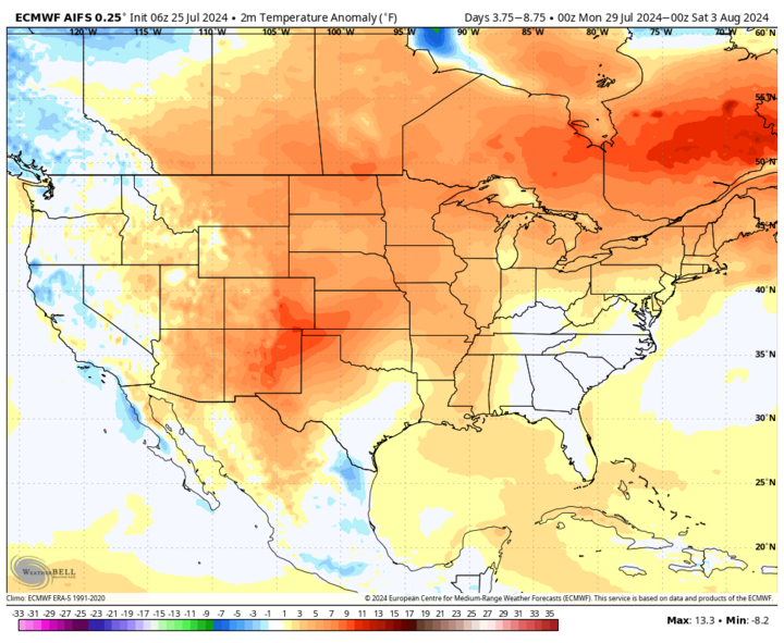
Temperatures will be especially warm in the western side of the state in the coming days and all of Nebraska will be pretty warm by early next week. Current indications show that Wednesday, July 31 or Thursday, Aug. 1 will be the hottest day — temperatures both days will be well into the 90s statewide, with much of western and southern border counties topping 100.
In the more heavily irrigated areas of central Nebraska and across all of eastern Nebraska, there will likely be plenty of humidity as well. Thus, expect heat index values to be at least 100°F for much of next week, with possibility of the heat index getting into the 110-120°F range at times in the late afternoon and evening hours in southeast Nebraska on Tuesday, Wednesday and maybe Thursday. There should be some breeze during this time but conditions for humans and livestock will be less than ideal, if not downright dangerous at times. Be careful at county fairs!
The ridge will gradually shift westward over to the Front Range by this weekend and there is some indication we could get a frontal passage by Friday, Aug. 2, which would help knock back temperatures closer to seasonal values. Any break in the heat between now and Wednesday, Aug. 7 will be fairly short-lived though.
No Rain
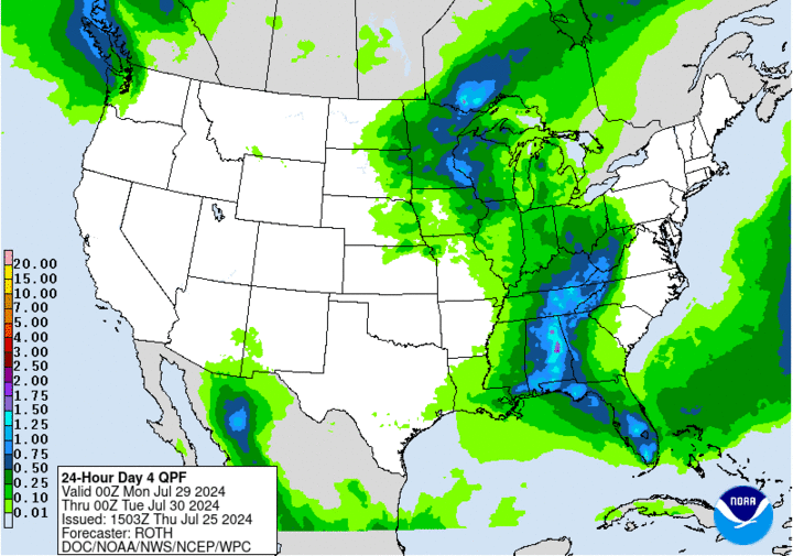
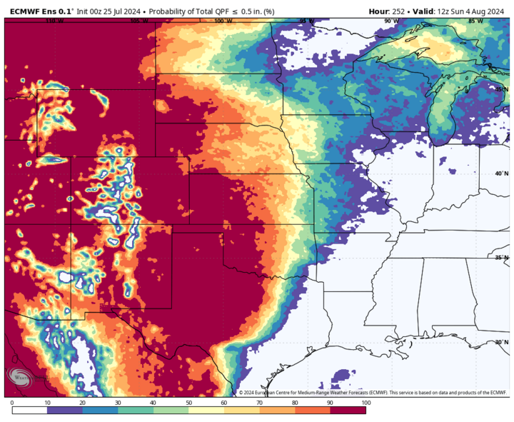
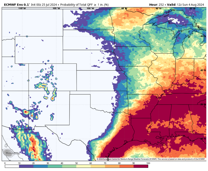
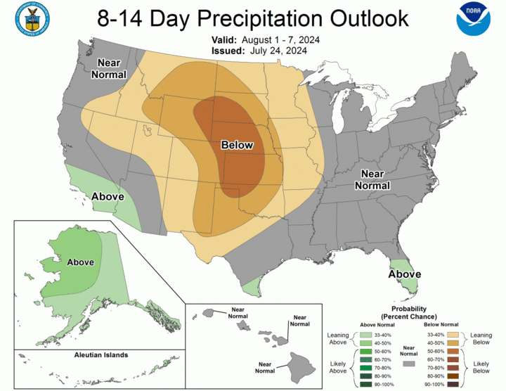
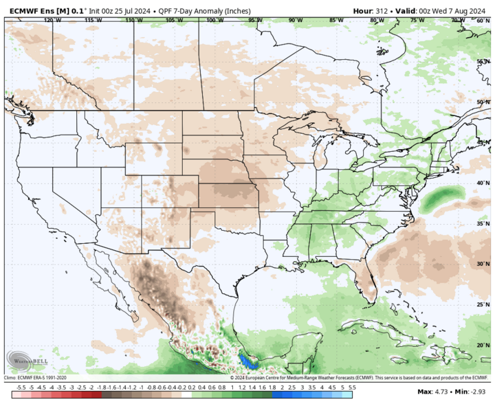
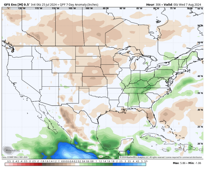
Actually, there is some chance of rain ... just no guarantee of rain. A shortwave moving into the Northern Plains will bring a chance for showers and thunderstorms to develop in central Nebraska on Sunday afternoon, July 28, and move east into the eastern section of the state. This would bring Grand Island, Columbus, Lincoln, David City, Wayne and Plattsmouth a chance to pick up a quarter to half inch of moisture. But there is not good agreement in the models yet, so this could be a false promise. Biggest impediment will be overcoming warmer temperatures aloft. But if forcing is sufficient and surface-based energy is better than currently projected (certainly possible given model tendency to underestimate dewpoints), then residents of eastern Nebraska could get a beneficial rain.
Later in the week, there will be possibilities for "ridge riding" storms across eastern Nebraska, though this potential is higher in Iowa and Illinois. Areas west of Kearney are quite unlikely to pick up any moisture next week and unfortunately that may be the case going past the first part of August.
Drought
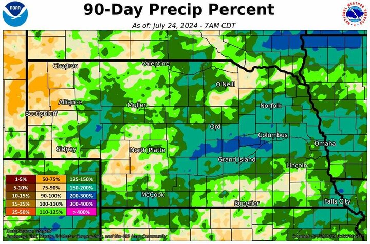
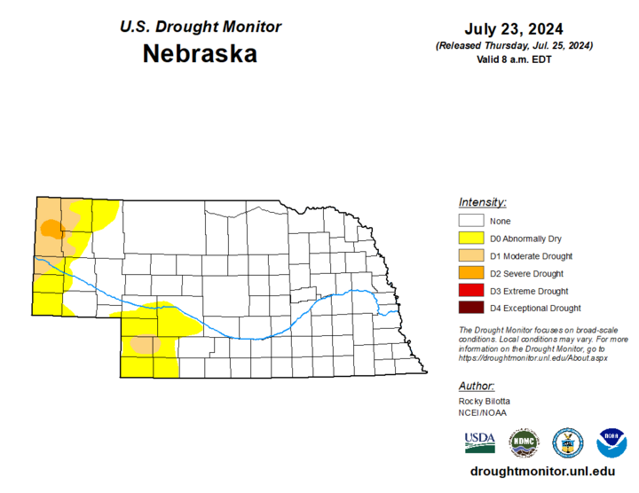
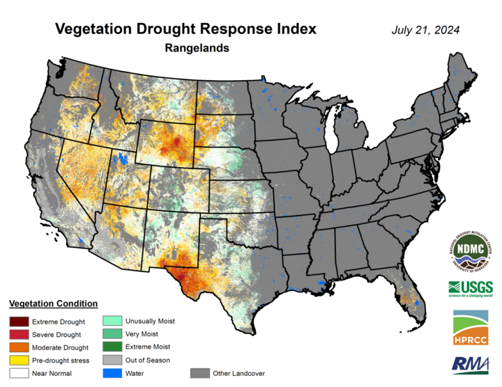
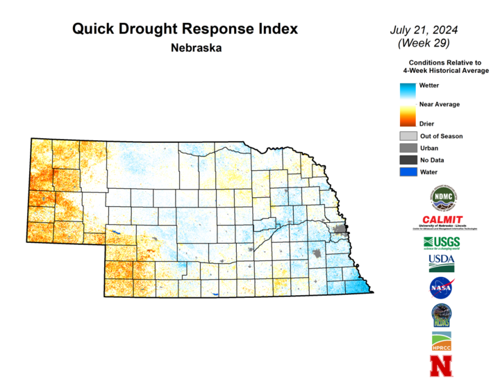
After a three-month absence, severe drought has returned to Nebraska. The latest U.S. Drought Monitor shows severe drought (D2) in central Sioux and far southwest Dawes counties. The reasons for asking for the D2 status in that area were increasing precipitation deficits going back to early spring and increasingly severe depiction of vegetation health in products like VegDRI.
With limited chances for significant precipitation and an extended stretch of heat forecast, it is likely that there will be additional degradation and drought development in much of the Panhandle.
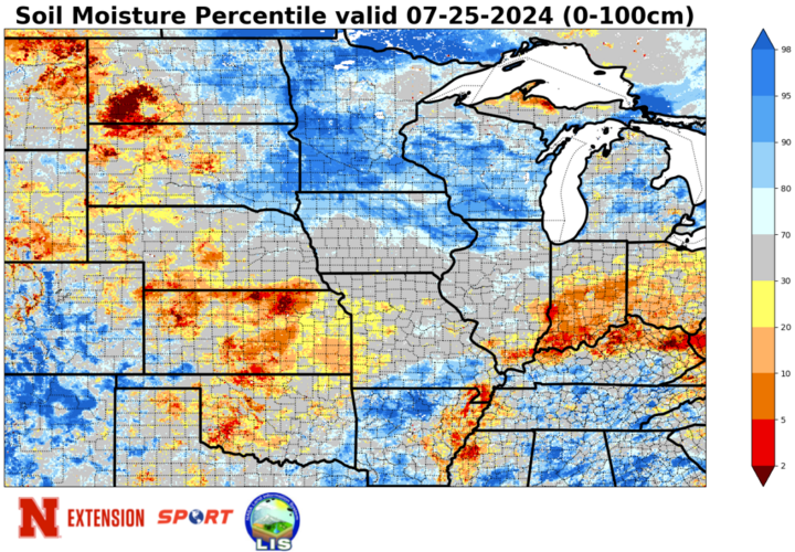
The latest U.S. Drought Monitor also shows moderate drought (D1) across much of Chase and portions of Perkins, Hayes, and Lincoln counties. This section of the state is also an area of concern given the forecast and more limited reserve of root zone soil moisture.
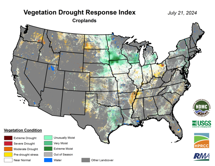
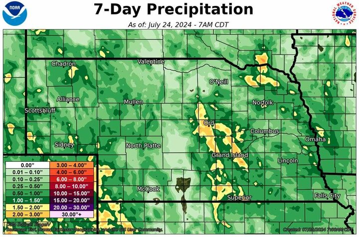
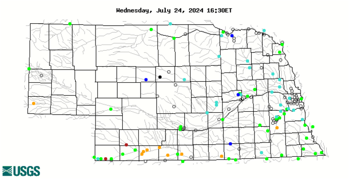
Further east, conditions are generally pretty good ... for now. Heavier precipitation that fell last Friday in parts of Knox and Cedar counties was welcome, as that area had been missing out over the previous month. Beneficial moisture also fell in the last week from Loup and Garfield counties down to Webster Counties, with some areas picking up over two inches. That moisture will come in handy this next week.
In east-central and southeastern Nebraska, there is still some reserve of soil moisture according to SPoRT LIS. But it is not a big reserve like it was earlier in the month and pockets of crop stress will start appearing on rainfed crops in early August if no rain falls in the next 10 days. The season to date has been mostly favorable in terms of moisture and temperature, so most locations can rule out a true disaster like 2012 or last year. But the crops are still several weeks to maturity and a developing flash drought certainly will knock down yields from their current potential. Note that this flash drought potential is not particularly high in the central and eastern Corn Belt.
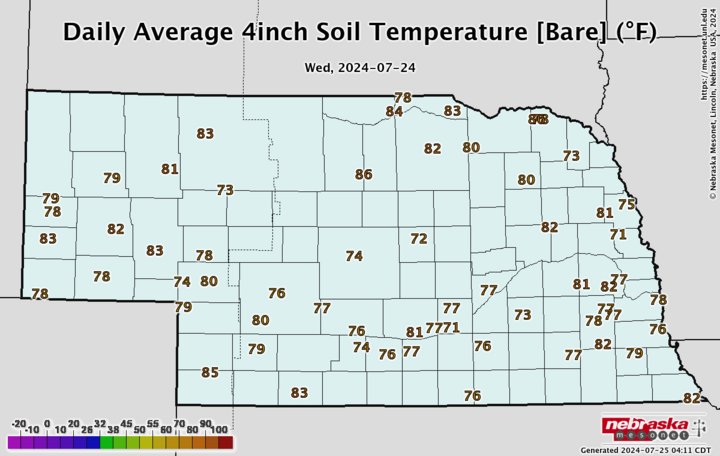
Temperature and Precipitation Roundup
This document includes the maximum/minimum temperature, average temperature, number of days with maximum temperatures ≥95F, minimum temperatures ≥70F, degree days, and total precipitation for each Mesonet station over the period from July 14-20. Includes CoCoRaHS observer reports. Below are the temperature and precipitation extremes around the state over the past week.
- Maximum Daily High Temperature: 103°F, Chadron
- Minimum Daily High Temperature: 71°F, Gretna
- Minimum Daily Low Temperature: 45°F, Harrison
- Maximum Daily Low Temperature: 69°F, Omaha
- Maximum Weekly Precipitation: 3.34 inches, Blue Hill
- Minimum Precipitation: 0.00 inches, multiple locations
