July 25, 2008
Above Normal Temps Needed in September
With the month of July winding down, the delayed corn crop has begun to enter the reproduction stage across the Corn Belt. While recent temperatures more closely resemble a normal summer pattern, corn growth remains far behind normal. Temperatures during the next two months will ultimately determine whether a portion of the U.S. crop is vulnerable to freeze damage.
The latest crop progress reports indicate that less than 40% of the corn acreage has reached the silk stage, well behind the normal 70%. For Nebraska, 46% of the crop had reached the silk stage as of July 21, compared to the five-year average of 63%. The percentage of the corn crop currently at silk stage and the five-year percentage for top corn producing states are: Iowa (14%, 53%), Illinois (55%, 85%), Indiana (38%, 67%), Ohio (31%, 54%), and Minnesota (7%, 52%).
In a normal year it takes seven to eight weeks from the onset of the silk stage to reach the 50% black layer stage, or the point where the crop is safe from freeze damage. If this ratio is projected forward, up to 30% of the Iowa, Minnesota, and Wisconsin corn acreage will not mature before October. In simple terms, temperatures during September will need to resemble normal August temperatures to significantly reduce this freeze risk.
The second issue coming up for the corn crop in the next two months will be the overall precipitation pattern across the Corn Belt. Dryness has begun to stress crops along the southern periphery of the central Corn Belt. Portions of Arkansas, Kentucky, Tennessee, southern Ohio, southern Indiana, southern Illinois, southeastern Missouri, northwestern Kansas, and southwestern Nebraska have all reported a significant dry trend during the past three weeks.
Temperatures haven't been an issue in terms of corn pollination at this point of the season, but the gradual dryness could have an impact on grain fill if the present trend continues into August. With this in mind, lets take a look at several variables which will likely play a critical role in the overall production potential of this year's corn crop.
Temperatures
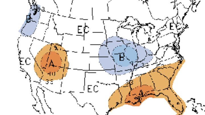
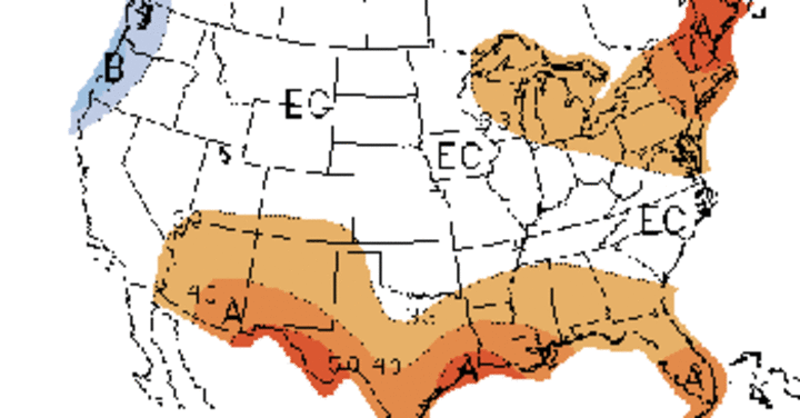
The latest 30-day outlook by the Climate Prediction Center for the month of August (Figure 1) indicates that an area covering eastern Nebraska and Kansas, Iowa, Illinois, Missouri, most of Indiana, southern Minnesota and Wisconsin, northern Kentucky, and southwestern Ohio has a tendency toward below normal temperatures. This tendency disappears in the August - October forecast (Figure 2).
If this forecast proves true, then the corn crop will fall even further behind and freeze vulnerability will increase. If average temperature departures are greater than 2 F below normal, September temperatures across the central and northern Corn Belt may need to resemble normal August temperatures to insure the crop escapes frost.
Precipitation
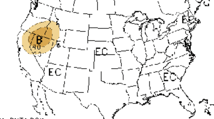
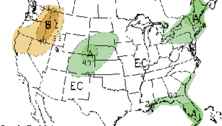
The latest 30-day outlook for the month of August doesn't indicate any significant tendency across the Corn Belt, with all areas indicated as having equal chances of above normal, normal, or below normal precipitation (Figure 3). However, the 90-day outlook for August-October indicates that an area from the desert southwest northeast through Colorado and into Wyoming and western Nebraska has a tendency toward above normal moisture (Figure 4). No tendency was indicated for the rest of the Corn Belt.
The southwestern monsoon season has begun earlier than normal this year and has been stronger than normal. Looking at the 90-day outlook map, it appears that the forecast expects the monsoon moisture feed to continue into September. If this is the case, the monsoon season would last much longer than normal.
If this occurs, western Nebraska could see additional relief from its prolonged drought. Wetter than normal surface conditions going into the winter freeze would reduce wind erosion and increase the percentage of snow that would be available for runoff in the mountain regions next spring.
Jet Stream Pattern
The average jet stream position during the past three weeks places the mean storm track across the Dakotas eastward through the mid-Atlantic states. Nebraska has been on the northern fringe of the upper air high pressure situated over the south-central Rockies. This high pressure has meandered eastward on occasion, resulting in brief periods of above normal temperatures across the central and eastern Corn Belt. Intense heat has been confined to the southern High Plains region.
Upper air lows have moved along the periphery of the upper air ridge about once a week, bringing heavy moisture to the Dakotas eastward into the Great Lakes region. As these lows move eastward, the upper air ridge is pushed back toward the southwest, allowing for low intensification over the Great Lakes. When these lows intensify, cooler than normal temperatures are funneling as far southward as Kentucky and Tennessee.
Although these cold outbreaks are short-lived, they present an ominous sign toward the potential for more significant cold air as we approach the end of August. In fact, if this pattern continues through August, the upper Midwest, including Minnesota, Wisconsin, and northern Iowa, is likely to have an earlier than normal freeze.
Cold air is already beginning to pool in the extreme northern Hudson Bay region, with low temperatures flirting with the freezing mark. If this trend continues and extends southward, it will be an even stronger indicator of an early freeze.
Al Dutcher
State Climatologist


