August 10, 2012

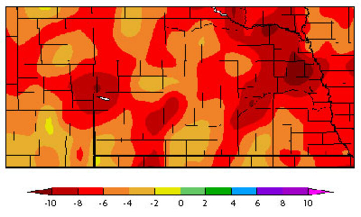
Figure 1. Departure from normal precipitation (in inches) from October 1, 2011 to August 9, 2012. (Source: High Plains Regional Climate Center)
All maps link to larger versions.


|
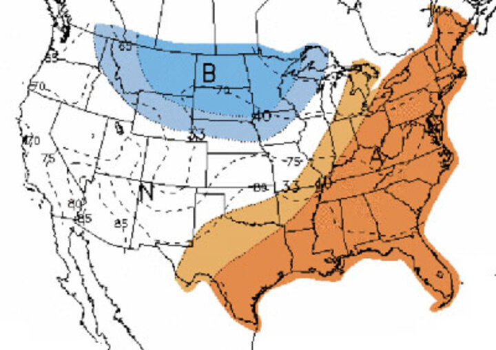
Short to medium range models are coming into agreement that a significant upper air trough will develop over the northern Rockies eastward through the northern Plains. If these models are accurate, this upper air trough will push southward during the second half of next week and high temperatures may drop into the 70s for eastern Nebraska by next weekend. Western Nebraska may not get as cool, but could see low to mid 80s.
The weather models push the trough southward beginning next Wednesday and initiate rain and thunderstorms over northern Nebraska during the second half of the day. The associated surface front is projected to slowly sag south and not completely clear the state until late Friday. This will provide about a 48-hour window for widespread precipitation across the state. Current precipitation forecasts indicate the potential for 0.50-1.50 inches of moisture, with locally heavier amounts if severe weather develops.
The rain will be too late for dryland corn, but should provide valuable moisture to dryland soybeans for pod set and fill. The moisture would also be welcome for wheat producers as the fall planting window is rapidly approaching. After a quick warm-up August 20-22, the weather models indicate another significant trough will work into the central Plains and generate the potential for several more days of rain and thunderstorm activity.
Even if all of the precipitation currently predicted does occur, it will take some time for drought impacts to ease. Precipitation deficits since last October are running 6-10 inches below normal for most of the state. In order to cut these deficits in half by the end of September, we would need to see 6.5 to 9.5 inches of moisture. Normal moisture from now through the end of September averages between 3.50 inches for western Nebraska to 4.50 inches for southeast Nebraska.
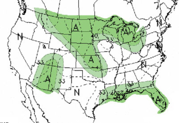
The crucial 30-day and 90-day outlooks issued by the Climate Prediction Center (CPC) next Thursday should give some insight on whether the short-term moisture prospects are temporary or the start of a sustained weather trend for Nebraska. I will be looking to see if the CPC verifies an El Nino wet fall pattern that appears in Nebraska climate records. Even a forecast for normal temperatures and precipitation conditions would be a vast improvement over their persistently dry and hot weather we’ve had the past four months.
Al Dutcher
Extension State Climatologist
