July 12, 2012
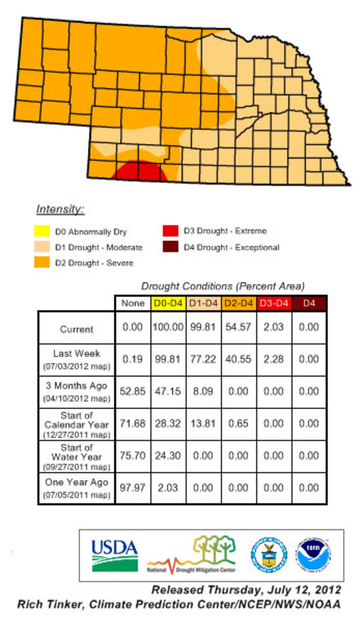
U.S. Drought Monitor Depiction for Nebraska

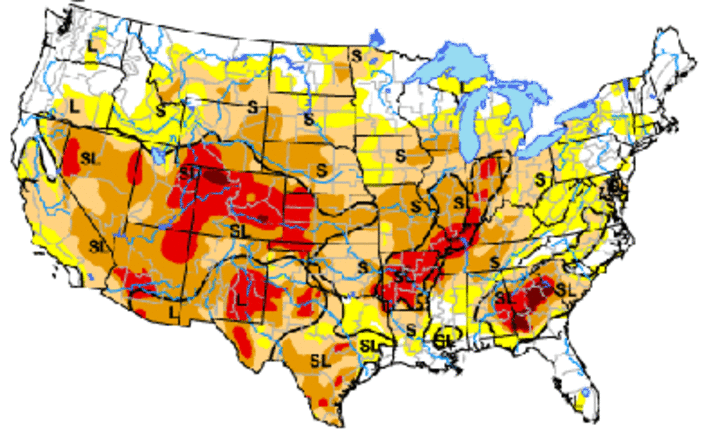
U.S. Drought Monitor for July 10, 2012

National Drought Monitor for July 10, 2012 expands drought areas further north this week. The Drought Monitor focuses on broad-scale conditions; local conditions may vary. See color code above for map. For more details about the drought depictions, see droughtmonitor.unl.edu. (Source: Rich Tinker, MOAA/NWS/NCEP/CPC) |
Today’s U.S. Drought Monitor, which incorporates rainfall data through 7 a.m. July 10, now depicts drought conditions for the entire state of Nebraska. Exceptional heat and abysmal precipitation during the past few weeks has led to a rapid degradation of crop conditions across the state. Moderate drought conditions are currently depicted for eastern Nebraska with severe drought covering much of western Nebraska.
It is important to note that very small pockets of heavy rainfall have been reported during the past week across the southwest, south central, southeast, and Panhandle regions of Nebraska. However, it is virtually impossible to indicate such small areas (sub-county) on a national scale map. It should also be noted that the conditions depicted for any given area are an assessment of the average conditions and crops could be worse or better than indicated.
Because of the rapid deterioration of crop conditions across the state, the U.S. Drought Monitor may also be “behind the curve” in reference to depicting the impacts of soil moisture depletion on crop health and reproduction problems. Most notably, the U.S. Drought Monitor is primarily a precipitation-based assessment and the impacts of above normal temperatures and crop water use may not be adequately represented in the most current assessment.
With corn pollination in progress across the state, temperatures and precipitation tendencies the next two weeks will likely have a significant impact on yield potential. Approximately 50% of the corn crop was in the silk stage last week when temperatures were consistently in the upper 90s or above. The brief cool down early this week was welcome, but it appears that the heat will return this weekend into the first half of next week.
Temperatures should once again move into the upper 90s, with 100+ temperatures probable for extreme southern Nebraska. Corn that has already pollinated likely will be susceptible to tip-back in areas that have missed out on recent precipitation. For crops just coming into pollination, the expected heat could impact pollination for a sizeable portion of the state’s corn crop.
Unfortunately, weather models are not offering any hint of significant moisture during the next week, with only widely scattered thunderstorms possible as moisture moves around the periphery of the high pressure ridge that will be building back into the central Plains this weekend. Any precipitation that does materialize will likely be localized and similar in coverage to events experienced during the past week.
Medium range models (14 days) continue to advertise above normal temperatures and below normal moisture for Nebraska and the western Corn Belt. The models do hint that monsoon moisture may work its way into the western Corn Belt, but they are not depicting any major frontal boundaries to initiate widespread precipitation. In short, precipitation development will be due to surface heating, which means isolated coverage at best.
Al Dutcher
Extension State Climatologist
