If this winter resembles the past couple of months, we are likely in store for a wild roller coaster ride. So far we have seen the second coldest October on record since 1896 and the snowiest on record for a large swath of western Nebraska. November will likely rank as one of the 10 driest and 15th warmest. This December is currently ranked as the 8th coldest on record and another major snow storm away from being one of the top 20 wettest.
1- and 3-Month Precipitation and Temperature Probabilities A = Above normal chance 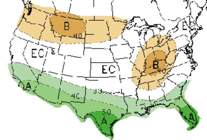
1-month precipitation probability outlook 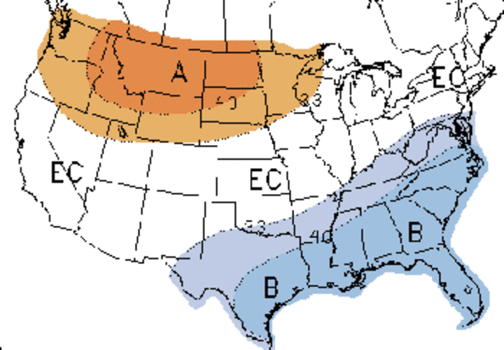
1-month temperature probability outlook 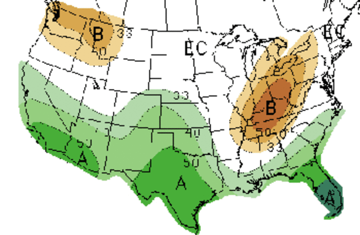
3-month precipitation probability outlook 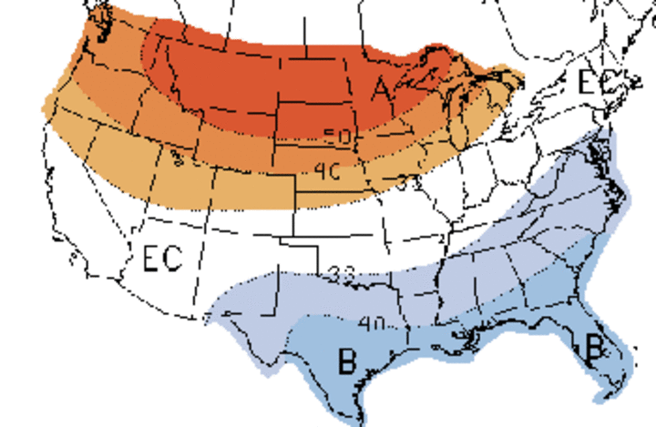
3-month temperature probability outlook |
Average temperatures were so cold in October across the northern Panhandle and Sandhills that they fell below November average temperature readings. A review of climate records indicates that the last time this happened on a wide scale was 1917, so it was an exceptional rare event. This is even more impressive when you consider October average temperatures are normally 13-15ºF greater than November average temperatures.
I know most press publications have been hinting that this winter's average temperature is expected to be above normal because of the ongoing El Nino event. When you lump all of the events together, the central and northern Plains usually lie between the northern and southern jet streams. Thus, most storms stay south or north of the state, and arctic air remains bottled up in Canada.
If you read my fall analysis of this year’s El Nino, you will recall that I looked at years when we moved out of La Nina conditions and into El Nino conditions. In comparison, national forecasts tend to lump all of the El Nino events together and thus forecasted a warm winter with no defined precipitation trend for Nebraska.
My analysis indicated below normal temperatures for December, with the strongest tendency across eastern Nebraska. The same statistics pointed to a moderate tendency for below normal moisture across the western two-thirds of the state and above normal moisture across the eastern third of Nebraska.
It appears that the temperature forecast will likely be proven true, but the precipitation forecast will be wrong over much of the western two-thirds of the state. This goes to show the impact that a massive snow storm can have on monthly precipitation forecasts in winter. It now looks like we’ll see warmer than normal temperatures across the eastern two-thirds of the state, with below normal temperatures across the western one-third of Nebraska. Wetter than normal conditions are predicted for the eastern third, with drier than normal conditions predicted for the western two-thirds of the state. February trends indicate warmer and drier than normal conditions across the western and eastern thirds of the state, with colder and wetter conditions over the central third.
Only time will tell whether the forecasted conditions will verify, but short-term models are pointing toward a continuation of this below normal trend through the end of the month. In addition, recent model runs are beginning to merge on a stormy solution during the last full week of the month. Several models indicate that this stormy period may rival conditions experienced with last week’s storm.
Even the Climate Prediction Center changed their December above-normal temperature forecast to below normal, acknowledging that the northern jet was likely to continue funneling significant cold air into the lower 48 states for much of the month. If the snow pack isn=t reduced significantly across eastern Nebraska by late December, January will likely have below normal average temperatures.
There is a long winter ahead and it is impossible say what the impact of storm systems that haven=t even materialized will have on our spring weather. The one thing to watch for is the amount of snow pack we accumulate before significant melting occurs. Another major snow storm coupled with below normal temperatures will definitely lay the foundation for flooding when thawing occurs. There could be several inches of moisture in the melting snow on top of frozen ground.
Al Dutcher
Extension State Climatologist
