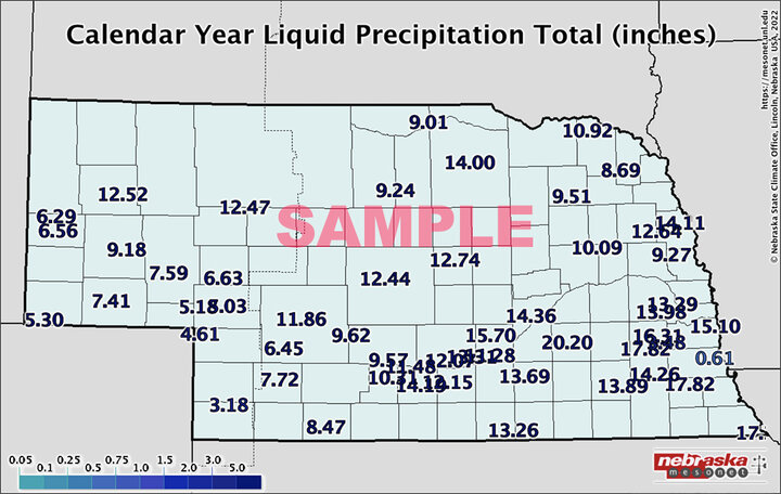
The following liquid precipitation maps and data include information from weather stations throughout Nebraska, as provided by the Nebraska Mesonet and Nebraska State Climate Office, and throughout the seven-state High Plains Region, including Nebraska, Kansas, South Dakota, North Dakota, most of Iowa, and parts of Wyoming and Colorado, as provided by the High Plains Regional Climate Center. Visit these source websites for additional and historical weather data.
Note Regarding Winter Data: These maps include winter measurements of liquid precipitation, but not snow events. To view data for winter precipitation/snow events, check
- NERain: https://nednr.nebraska.gov/nerain/
- Closest National Weather Service (NWS) office
Jump below to precipitation data for individual Nebraska sites. The locations listed in this table are more specific than the table used prior to April 20, 2017. We have included the former location names (AKA=also known as) for your convenience in locating previous sites.
Liquid Precipitation Maps
Nebraska Mesonet provides daily, weekly and annual liquid precipitation data for Nebraska — go to Nebraska Mesonet to view precipitation total maps using the dropdown menu.

- 7-Day: Precipitation | Percent of Normal Precipitation | Departure from Normal Precipitation (inches)
- 30-Day: Precipitation | Percent of Normal Precipitation | Departure from Normal Precipitation (inches)
- 60-Day:Precipitation | Percent of Normal Precipitation | Departure from Normal Precipitation (inches)
- 90-Day: Precipitation | Percent of Normal Precipitation | Departure from Normal Precipitation (inches)
- 180-Day: Precipitation | Percent of Normal Precipitation | Departure from Normal Precipitation (inches)


