
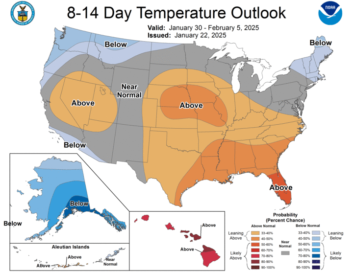
Temperature Rollercoaster
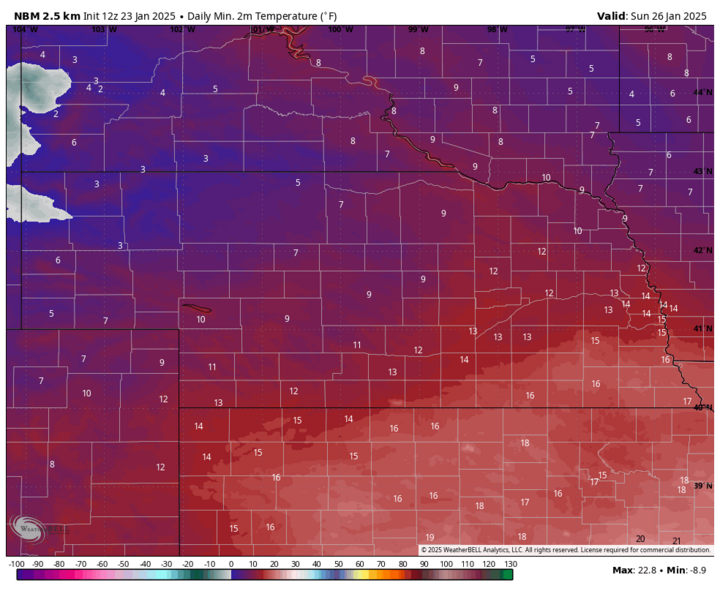
Mild weather is on the way for all of us, but we have a bit of a rollercoaster ride to get through first. Another cold front moved through the state Wednesday and brought seasonally cold temperatures to the state Thursday. Temperatures will be warmer Friday, particularly in south-central and eastern Nebraska, where highs in the lower and mid-20s will be replaced by highs in the upper 30s to mid-40s with compressional warming ahead of another front. This will bring down high temperatures to the upper 20s in western Nebraska, with warmer temperatures as you head east. Some light snow is also possible on Friday night across the southern Panhandle, but accumulations are expected to be under an inch. After a cold start on Sunday, temperatures will climb back to seasonal to seasonally mild levels in the mid-30s for central and eastern Nebraska, with upper 20s to lower 30s holding on in the Panhandle.
Mild Week Ahead
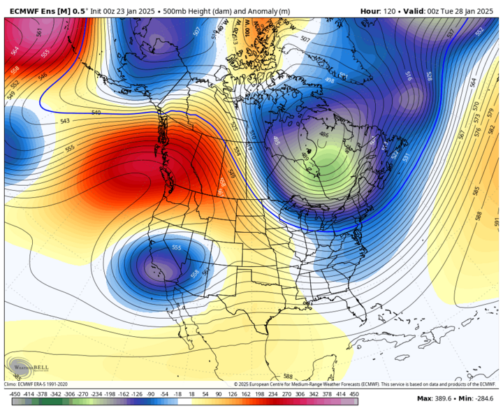
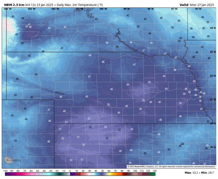
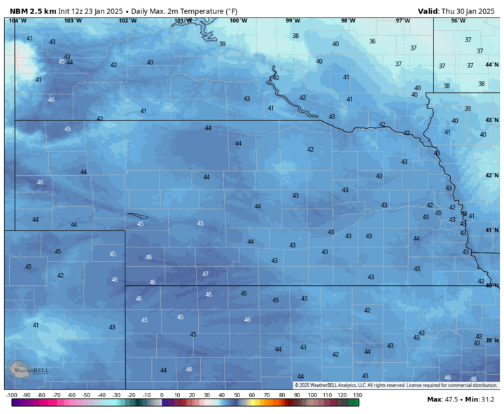
The upper air pattern that brought the bitter cold to the region earlier this week consisted of a strong ridge over Alaska with a corresponding trough in the central U.S. In other words, we had direct access to arctic air. The pattern next week will feature troughing over Hudson Bay with ridging to the west and a slow-moving trough across the southwestern U.S. With upper-level ridging in place most of next week, we will see much milder temperatures statewide for several days. Current forecast is for everyone to be at least in the mid-40s from Monday, Jan. 27 through Thursday, Jan. 30 with slightly cooler temperatures toward next weekend.
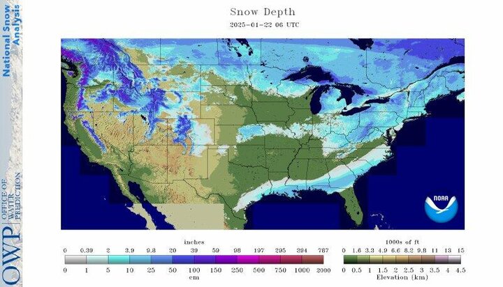
With the lack of snow cover for all but far southeast Nebraska and some extra warming from downsloping westerly winds, I suspect that high temperatures will be a bit warmer than currently projected. Good chance that the I-80 corridor south cracks 50 for a few days and there is a chance for everyone to get in on the 50s between next Monday and Wednesday.
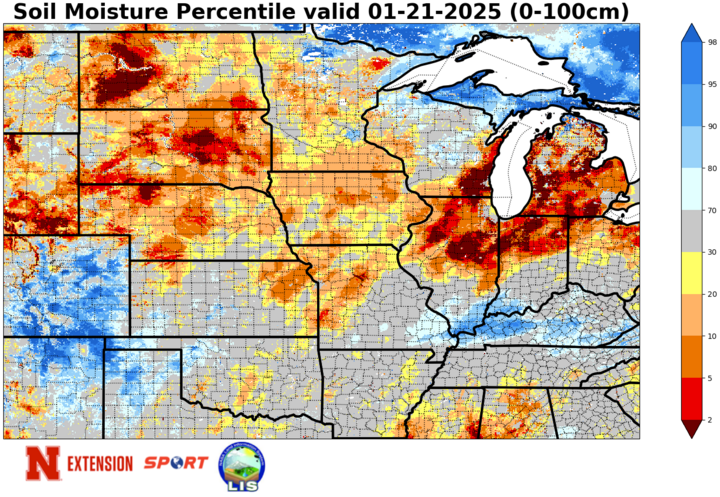
There will be a bit of a breeze each day but probably not strong enough to cause major fire danger concerns. Caution should be taken though, as most of the state has not any appreciable moisture this month and most of southwestern Nebraska has not had any meaningful moisture since before Thanksgiving.
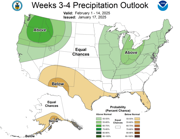
Moisture Possible Late Next Week?
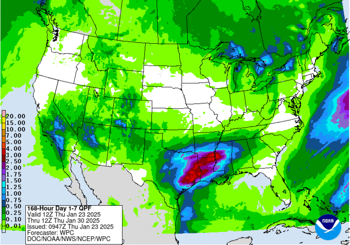
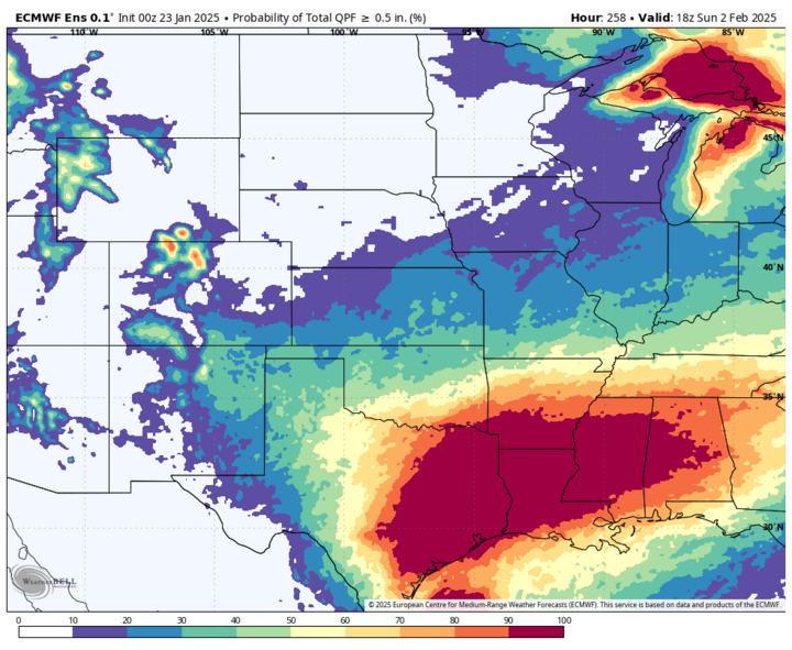
The slow-moving trough over southern California and the southwest U.S. early next week will bear watching. Most of the models have been showing it taking a southern route, which would do nothing other than perhaps increasing cloud cover to the southern part of the state. But the ECWMF's AI model has started showing more pronounced upper-level ridging in the eastern U.S., which would help drive that trough more to the northeast. If that ends up happening, there will be chances for rain or a rain to snow mix in eastern Nebraska next Friday afternoon and night, Jan. 31.
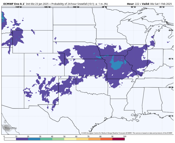
This possibility is starting to get picked up in the Ensemble too. The latest run shows a slight chance of a half inch or more of precipitation across the southeastern quadrant of the state and a slight chance of an inch of snow. Think it will be clearer by early next week, if we are likely to see some precipitation in places like Auburn, Wahoo or Gretna. There is not going to be a significant amount of cold air to work with, but the northwest side of an upper-level low can often have enough dynamic cooling to support snow after starting as rain. Something to watch out for.
If this system ends up staying on the southern route, there is no real chance for precipitation next week for the state.
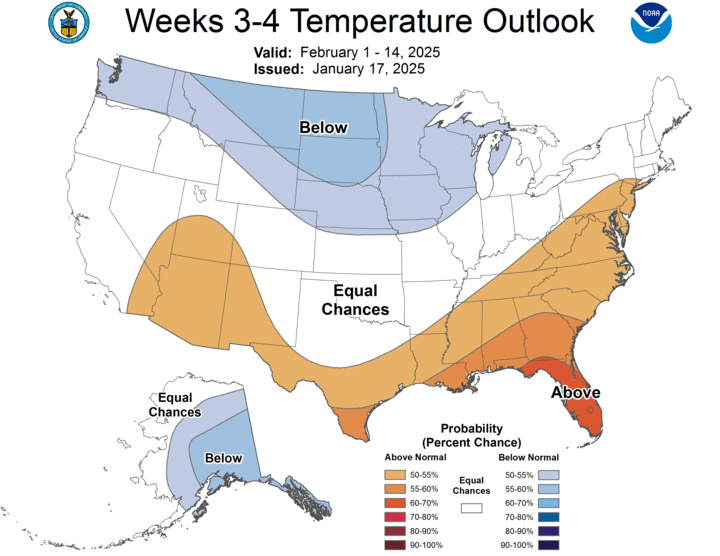
Colder Weather Returning in Early February
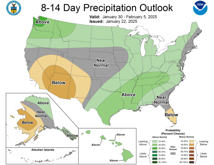
The CPC shows a good chance of below-normal temperatures for the north-central U.S. in the first half of February, and there is some level of agreement in the main models with colder temperatures returning after Feb. 2. The questions are how cold will it be, and will it be a 7-10 day stretch of quite cold temperatures or more of a rollercoaster.
There also is some signal that we will see increased chances for snow in the first week of February. It's too early to give an official prognosis on what will happen, but I do recommend being prepared for colder temperatures to return, at least for a little bit after Groundhog's Day.
Cold Temperatures Earlier This Week
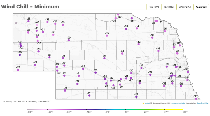
Earlier in the week, very highly amplified flow combined with some polar vortex stretching led to very cold temperatures from last Saturday to Tuesday morning. Coldest temperatures occurred on Monday when some sites in the northern Panhandle and far northeast Nebraska did not get to 0 for a high and most of the rest of the state had afternoon temperatures struggling to get above numbers associated with the age of toddlers or young children. Temperatures quickly dropped below 0 on Monday evening and most locations in the state got colder than 10 below for air temperatures, with isolated locations getting down to -20.
Wind chill values were also cold enough for 2-hour delays on Tuesday morning, with -30 to -35 common in the northern half of Nebraska and -20 to -30 below in the southern half of Nebraska. Coldest wind chill award goes to the Mesonet site west of Hay Springs, which registered a wind chill of -45 in the early morning hours on Tuesday.

Drought Update
The latest map showed no change from last week, but last week's map did show increased drought coverage between North Platte and McCook and between Sidney and Big Springs. Most of the state has had a very dry January thus far and since Dec. 1, only the southeast climate division is not in the bottom quartile for precipitation. Additional degradation will be possible in parts of western Nebraska in the next several weeks if it remains this dry. There will also be increased risk of late winter and early spring wildfires this season if moisture doesn't materialize.
Temperature and Precipitation Roundup
Below are the temperature and precipitation extremes around the state for the week ending Jan. 18, 2025:
- Maximum Daily High Temperature: 59°F, Big Springs 6 SSE Mesonet
- Minimum Daily High Temperature: 12°F, Ainsworth
- Minimum Daily Low Temperature: -10°F, Fordyce 4 N Mesonet
- Maximum Daily Low Temperature: 33°F, Nebraska City
- Maximum Weekly Precipitation: 0.20-inch, Plainsview Ranch
- Maximum Weekly Snowfall: 2.4 inches, Chadron 3 SW
