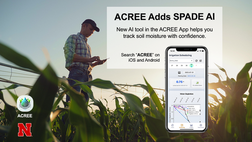
The development of large language models (LLMs), particularly ChatGPT (OpenAI, Inc., San Francisco, California), has significantly advanced artificial intelligence (AI) across every aspect of our lives. In the last update of the ACREE app, we introduced an irrigation scheduling function for producers across Nebraska. Now, we are adding a pilot AI feature to our app through a collaborative effort between the University of Nebraska-Lincoln (UNL) and Georgia Institute of Technology (GaTech). This AI feature is designed to help producers better understand soil moisture sensor readings.
How It Works
This feature is based on SPADE (Soil moisture Pattern and Anomaly DEtection), an integrated framework that leverages LLMs to detect irrigation patterns and anomalies. SPADE (Lee et al., 2025) utilizes ChatGPT-4.1 and can identify water events (irrigation or rainfall), estimate net water gains in inches, detect and classify anomalies, and generate structured, interpretable reports.
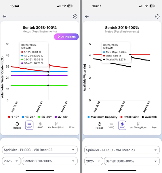
Commercial soil moisture sensors are typically probe-shaped and report volumetric soil moisture content at 4-inch increments up to 3 or 4 feet in depth. Producers often see 9 or 12 lines of volumetric water content readings, which are sometimes averaged at every foot of soil, as shown in Figure 1. While sensor readings can be integrated into a single line, this often requires sensor- and site-specific calibration and needs micro-adjustment to match actual field conditions (Figure 1). This process can be confusing, especially for new soil moisture probe users.
The AI feature in the ACREE app leverages the power of LLMs to better explain soil moisture data and extract useful information for irrigation decisions. Currently, this function processes the past seven days of 1-foot soil moisture data through the LLM. The system detects anomalies in the data, such as missing data or extreme values, and then identifies valid water events.
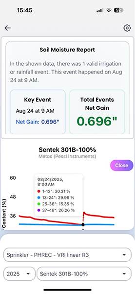
For example, the system shows the timing of water events — in this case, an irrigation event that occurred on Aug. 24, when irrigation passed the soil moisture probe around 8-9 a.m. Soil moisture at 1 foot increased from 30.3% to 36.6%, representing a moisture gain of (36.6% - 30.3%) × 12 inches = 0.75-inch. SPADE successfully detected this irrigation event and estimated a soil moisture gain of 0.69-inch (Figure 2). Note that possible moisture gains from 2-, 3-, and 4-foot soil depths were not processed by SPADE, so the results reflect only changes at the 1-foot soil depth.
Important Disclaimer and Availability
Please note this is a beta test, and AI can make mistakes. The feature can be enabled for current ACREE users who have soil moisture sensors installed in their fields. New users should contact Dr. Xin Qiao for more details on availability. SPADE with ChatGPT 5 will be available in a future release.
Acknowledgement
We thank our funding partners, including the National Science Foundation (Award Number 2420405) and USDA NIFA (Award Number 2024-67021-41534), for their support that made this project possible.
References
- Lee, Y. et al., Leveraging Large Language Model for Soil Moisture Pattern and Anomaly Detection in Time-Series Data. Submitted to Computer and Electronics in Agriculture in July 2025.
