Drought Covers a Majority of the State
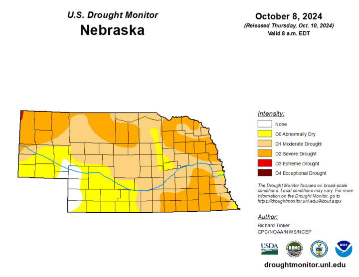
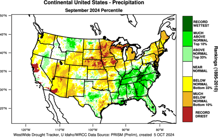
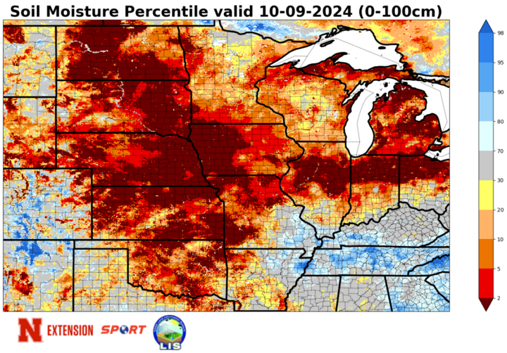
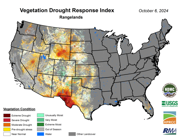
The latest U.S. Drought Monitor shows that nearly 75% of the state is in drought and a third of the state is in severe drought (D2) or worse. A total of 46 counties are now at least partially covered by severe drought (D2). Furthermore, a small section of Sioux County is now in extreme drought (D3). Preliminary numbers suggest that several locations in Nebraska had their driest September on record and only isolated locations were not in the bottom 10th percentile according to Oregon State's PRISM dataset. Some locations in northeast Nebraska have not had a single drop of rain in over 40 days.
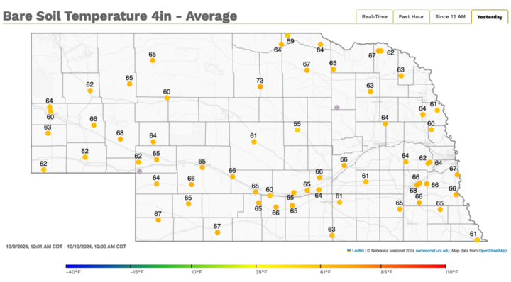
The lack of precipitation combined with high temperatures consistently 10-20°F above seasonal averages has led to rapid drought development and intensification for a majority of the state. The reason for both the lack of precipitation and warm temperatures has been the persistent ridging over the north-central U.S. since the latter part of August. The prolonged acute dryness has taken a real toll on soil moisture, which is now in the 5th percentile or worse across almost all of Nebraska and a majority of the landscape across the central U.S. Fire danger will continue to remain very high any days where we have breezier conditions combined with low relative humidity. We are also entering into a critical period for the 2025 winter wheat crop. Emergence of winter wheat is well below normal given the amount planted, which is a reflection of the lack of moisture to get the crop going. Pastures aren't in fine shape either and ponds are drying up.
Some of this likely has a tie to the transition out of El Nino into neutral and near La Nina conditions in the central and eastern equatorial Pacific. But some of this is also a direct sign of our changing climate. The jet stream remaining up in Canada deeper into climatological fall is tied to the weakening temperature gradient between the higher latitudes and middle latitudes where we reside. This does not mean every fall season will start out this warm and dry. But it would be reasonable to assume that more early fall seasons in the future may look like this: persistently warm and dry for extended periods.
Freshest Frost on the Pumpkin
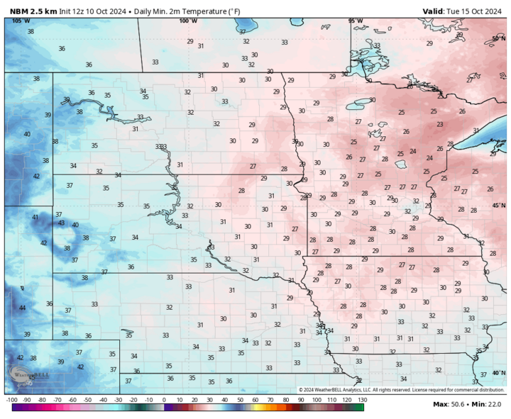
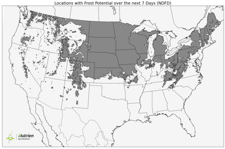
A stronger cold front will move through the state between Saturday afternoon, Oct. 12 and early Sunday, Oct. 13, bringing much cooler temperatures to the region for Sunday and Monday, Oct. 14. No rain chances of course. But there will be enhanced fire risk in the western half of the state on Saturday and in the eastern half of the state on Sunday, as wind speeds will be higher and relative humidity levels will be low. Winds calm down Sunday night and temperatures will drop quickly. Sub-freezing temperatures are likely in the western half of the state and across portions of northeast Nebraska on Monday morning. Temperatures will rebound back into the 60s on Monday afternoon but will drop off again quickly after sunset. Temperatures will likely drop below freezing across most of the state on Tuesday morning, Oct. 15. The dryness of the landscape combined with calm winds will enhance radiational cooling so I expect lows to be a bit colder than what are currently forecast, especially in eastern Nebraska. The growing season is likely to be officially over for a majority of the state by this time next week.

Warm Weather Returns
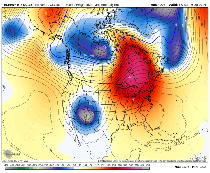
The cooler spell will be brief as high temperatures should be back in the 70s by Tuesday in western Nebraska and statewide by Wednesday, Oct. 16. There is a good chance temperatures will exceed 80°F across most of the state on Thursday, Oct. 17 and across the eastern half of the state next Friday, Oct. 18. I would say it's reasonable to assume that we are done with the 90s for the remainder of the calendar year. But we may not be done with temperatures occasionally hitting the low 80s until after Election Day, unless there is a prolonged and major shift to the trough, ridge pattern across the Northern Hemisphere before Halloween. Watch what happens south of Alaska in the next few weeks. If ridging starts becoming prominent there, then troughs getting deeper into the western U.S. and then ejecting out into the Plains would become a more frequent possibility. It also would mean an end to days on end of much above-average temperatures.
Rain Chances in 10 days
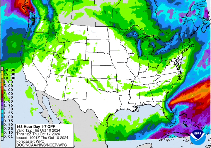
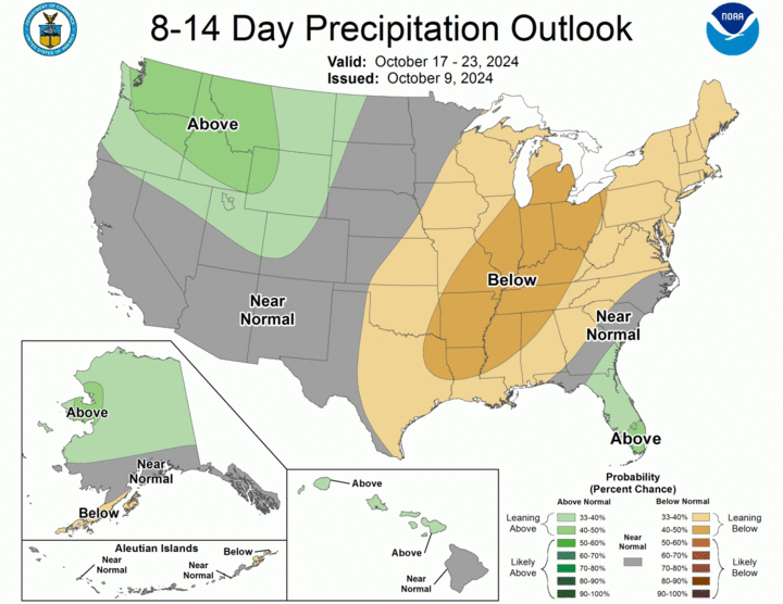
Speaking of troughs getting into the southwestern U.S., that is starting to look more likely by the end of next week according to the ECMWF AI model. It's still more than a week out but there have been multiple model runs showing a modestly potent storm system moving out into the central U.S. about 10 days from now. With high pressure off the mid-Atlantic, this would be a favorable setup to have two things needed for robust precipitation: atmospheric dynamics and moisture flow. We have not had either one of these things of late. To be clear, if either of these is weak next weekend, we are not looking at significant, widespread moisture falling across the central U.S. There is simply no local source of moisture to tap into to help generate more precipitation in this part of the country if moisture return from the Gulf is insufficient. But if both the dynamics and moisture flow ahead of said storm are sufficient, then a broad area of the state (and central U.S.) could be in store for over an inch of moisture the weekend after this one. It should not be underestimated how critical that moisture will be for the 2025 winter wheat crop, cover crops, and younger grasses/trees. In the meantime, harvest delays due to rain won't be an issue for another week at least.
Temperature and Precipitation Summary
This document contain the maximum/minimum temperature, average temperature, number of days with maximum temperatures ≥95F, minimum temperatures ≥70F, degree days, and total precipitation for each Mesonet station over the period from Sept. 29-Oct. 5.
Below are the temperature and precipitation extremes around the state over the past week:
- Maximum Daily High Temperature: 100°F, Offutt AFB
- Minimum Daily High Temperature: 62°F, Plainsview Ranch
- Minimum Daily Low Temperature: 18°F, Harrison 20 SSE
- Maximum Daily Low Temperature: 58°F, Falls City Brenner Field
- Maximum Weekly Precipitation: 0.01-inch, Omaha 7.8 WNW
- Minimum Weekly Precipitation: 0.00-inch, Everyone else
