Wet End to the Week
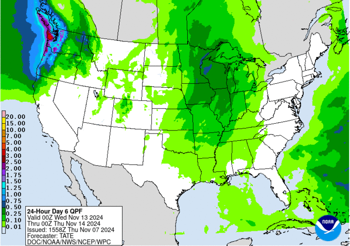
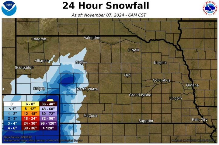
An upper-level low will make its slow trek from the southwestern U.S. to the Western Corn Belt in the next three days. This will bring beneficial rainfall to the entire state. The southern Panhandle and southwest Nebraska also stand a chance to see some snow mixed in with the rain at times. Significant accumulations are not expected in Nebraska, though a slight track east would potentially put western Chase and Dundy counties at risk of getting additional snowfall.
Precipitation will be likely in the southwestern part of the state this afternoon, though North Platte is likely to be its northernmost extent over the next 24 hours. Precipitation will start to overspread more of western Nebraska by tomorrow afternoon and will gradually move north and east on Friday night into Saturday morning. Precipitation over an inch is quite likely for places McCook and Benkleman and probable for Kearney and Holdrege. A half to three quarters of an inch seems a good bet for Scottsbluff, Ord, Columbus, Lincoln and Nebraska City. Lighter amounts are likely for the northwest and northeast corners of the state.

Pleasant Weather
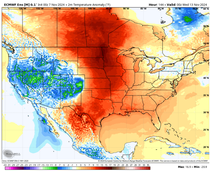
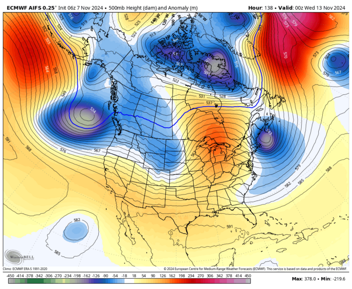
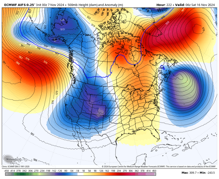
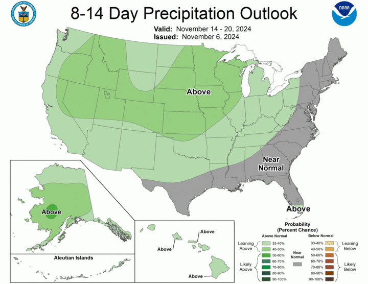
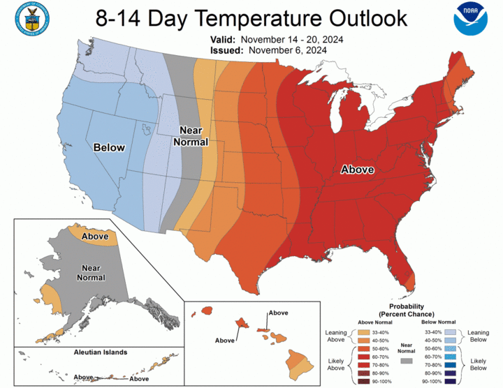
The upper-level low will exit by Sunday morning and skies will clear from southwest to northeast. Most places should be sunny by Sunday afternoon and early next week looks quite nice for mid-November: Ample sunshine and mild afternoon temperatures in the upper 50s to lower 60s. A weaker cold front moves through mid-week, which will bring a chance for showers to eastern Nebraska on Tuesday night and a more seasonal temperatures for Wednesday. By the end of the week, another storm system will be moving from the southwestern U.S. into the High Plains. Exact details are still a little sketchy at this point, but additional beneficial precipitation may be possible next weekend across the entire state.
Related
September 2024 Officially Driest September on Record in Nebraska
Drought Relief
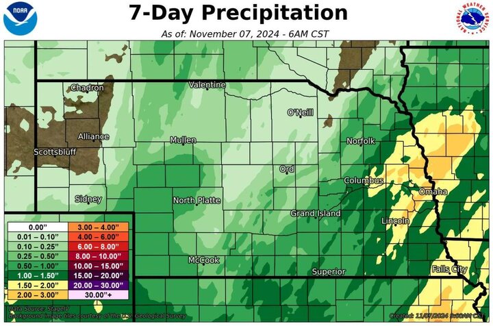
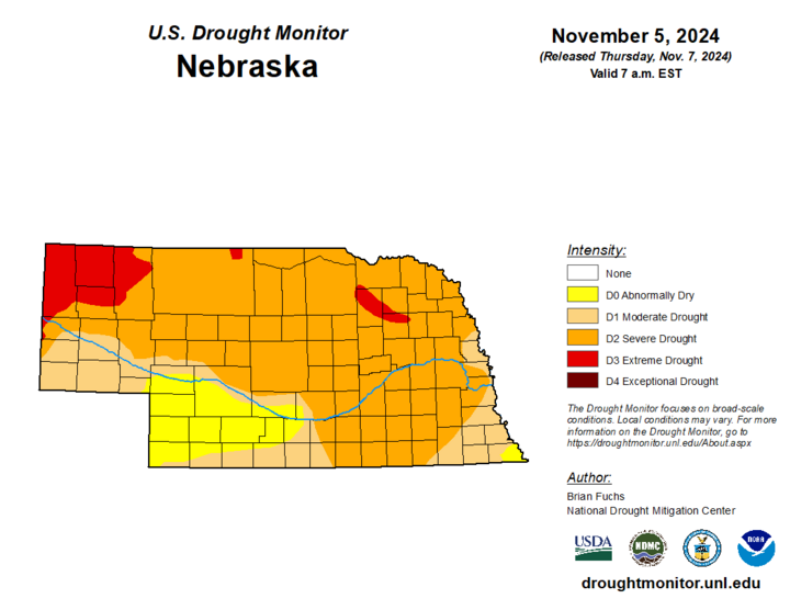
Rainfall last weekend and Monday evening was significant across much of eastern Nebraska, with some locations picking up over three-inch total. Thus, we actually have some drought improvements to speak about for the first time in weeks. 1-category improvements were noted in the southeast corner of the state, most of Washington County, and a small portion of Burt County. No degradation was noted this week and that makes it the first time since early July that there was no degradation to report.
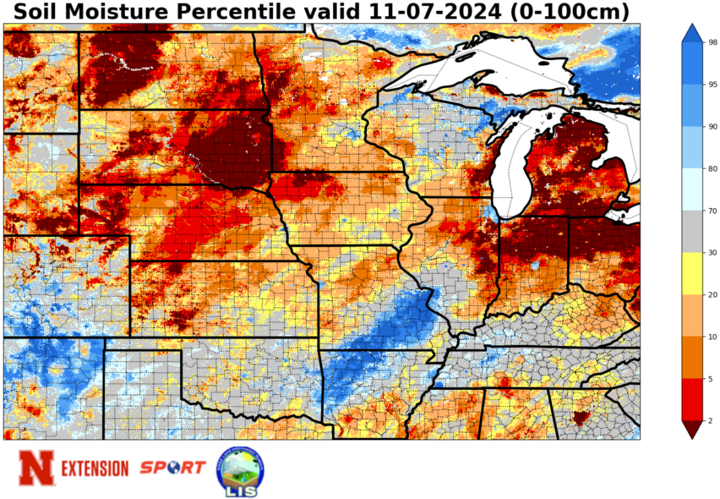
Soil moisture improved marginally over the last week in much of central Nebraska and improved markedly across much of eastern Nebraska, with many areas of southeastern Nebraska inching closer to the near-normal range according to SPoRT LIS. Still a long way to go before anyone achieves a full profile of moisture. But the prognosis is good for additional soil moisture recovery in the next two weeks.
Soil Temperature Update
Colder temperatures have dropped four-inch soil temperatures down the lower 40s across the western third of the state. Soil temperatures generally in the mid 40s across central sections of Nebraska with upper 40s to low 50s being common in eastern Nebraska. Expect soil temperatures to remain around this level or possibly bump up slightly over the next week as air temperatures generally remain above average.
Temperature and Precipitation Roundup
This pdf contains the maximum/minimum temperature, average temperature, degree days, average four-inch soil temperature, and total precipitation for each Mesonet station over the period from Oct. 27-Nov. 2.
Below are the temperature and precipitation extremes around the state over the past week:
- Maximum Daily High Temperature: 72°F, Auburn 5 ESE
- Minimum Daily High Temperature: 34°F, Harrisburg 1 N Mesonet
- Minimum Daily Low Temperature: 13°F, Bushnell 15 S
- Maximum Daily Low Temperature: 57°F, Tecumseh 1 S
- Maximum Weekly Precipitation: 4.25 inches, Pawnee City 8.1 SW
- Maximum Snowfall: 6.0 inches, Lamar 3.4 S
