Dry Start to Weekend
A weak cold front will be moving through the state Friday afternoon, May 10 and will bring a slight chance of showers to the eastern side of the state. There will be a wind shift but don't expect temperatures to be noticeably cooler on Saturday, May 11. What you can expect is a very nice day with plenty of sunshine, lighter winds, pleasant humidity levels, and highs in the 70s statewide. For those who just moved here, consider this a notice that there are about three days in a year where this is the case, so don't waste the day inside if you don't have to!
Raining on Sunday?
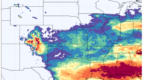
The second day of the weekend looks to be cloudier and possibly (or likely) somewhat wet across the southern portion of the state. The culprit is a slow-moving upper level low, which will move from the central Rockies into the Plains before heading toward the Great Lakes region. The current track would keep the bulk of the more significant precipitation in Kansas and Missouri. But if it ends up being a bit further north, then areas along and south of I-80 are more likely to pick up 0.5- to 1.0-inch between Sunday afternoon, May 12 and Monday evening, May 13. The ECMWF ensemble probability map shows that one inch of precipitation between Sunday and Monday is possible in the far southern and southeastern parts of the state, even with the current track. Precipitation is less likely from the upper level low in the Panhandle and northern third of the state, but scattered showers will be possible in those areas.


Mid-week Cold Front
By Wednesday, May 15, our attention turns to a cold front that will be making its way into the state from the northwest. This will not be a particularly drastic change in air temperature after its passage, but there will be enough of a moisture gradient and dynamics for showers and thunderstorms to develop across the state.
Amounts are uncertain at this point but everywhere in the state could pick up some moisture. A few recent model runs are more bullish on heavier precipitation across south-central and eastern sections of Nebraska. The WPC is not bullish on higher precipitation totals in the next week, but it's possible that is underestimating — perhaps significantly underestimating — totals in the eastern half of the state. Precipitation totals could certainly be in the 1.25-2.00 inches range in places like Geneva, Seward, Eagle and Auburn.


Planting Windows?
The possibility of over an inch of next rain in the first four days of next week is not necessarily the best news for those who were hoping for an extended planting window next week. But for those looking for an extended dry spell, both the ECMWF and GFS are projecting it being drier than average in the eight- to 14-day period. This is not in agreement with the CPC, which keeps it wetter than average (and this time of year, that means something) in the eight- to 14-day period.
Both the ECMWF and GFS are showing more ridging in the west and northwest flow aloft in the north-central U.S., which in mid-May is not a wet signal for us. If that does indeed verify, then we are likely going to have some drier stretches, though not necessarily 10 days with no rain at all. So, there is hope but sometimes models advertise false hope. Watching what happens in the north Pacific in the next five days will give clues as to what solution is more likely.
Warmer Weather
While there is some uncertainty on precipitation amounts, there is more consensus on temperatures being above average statewide next week, with warmer anomalies expected in western Nebraska. The CPC's eight- to 14-day outlook shows warmer temperatures are likely to persist into the third week of May. But there does not appear to be any significant, mid-summer type heat coming like we had around now in 2022.
Drought Monitor Changes
Precipitation last weekend and early this week was enough for more drought improvement in eastern Nebraska. Specifically, the larger area of severe drought (D2) that had been in place for what seems like eternity in places like Fillmore County was upgraded to moderate drought (D1). So, for the first time since the map from June 1, 2021, there is no severe drought anywhere in the state.
With additional improvements from D1 to D0 in parts of southeastern and northeastern Nebraska, under 10% of the state is in drought for the first time since June 8, 2021. But there was an area of degradation from nothing to abnormal dryness in Banner and Kimball counties, due to modestly drier-than-average conditions dating back to last fall. Soil moisture percentiles in that area are also generally below the 30th percentile and the rangeland specific pixels for VegDRI also are indicative of mild stress.

More Blue Counties than Red Counties in the Central U.S.
I am, of course, talking about soil moisture percentiles, not politics. "Thou shalt not discuss election projections on a state climate office page" is a good commandment to live by.
The latest soil moisture percentiles map from SPoRT LIS shows a lot of blue areas (representing the 70th percentile or higher) for 0-100 cm soil moisture across Nebraska and the central U.S. more broadly. This is a reflection of the active pattern that has brought significant, drought-busting (or improvement) rain for many areas. It also is leading to delays in planting, with Nebraska and other surrounding states behind the five-year and longer-term average for percent planted.


Freezes and Tornadoes
It's May in Nebraska, so it wouldn't be an update if I didn't get to simultaneously discuss sub-freezing temperatures and severe storms.
With the strong frontal passage late last week, temperatures got rather chilly last Saturday morning in western Nebraska. Temperatures fell below freezing pretty much everywhere in the Panhandle and dropped down all the way to 19°F at the Bushnell site. No snow was reported in the state last week for the first time in a while.
Changing gears a bit — there were severe storms in the state on Monday, with tornadoes reported in Lincoln, Custer, Webster and Gage counties. There were numerous hail reports in Furnas counties during the afternoon and then further east in Sarpy County on Monday evening.
NASS Crop Progress Update
As of the end of last week, 31% and 18% of corn and soybean had been planted, respectively — well below the five-year averages for both. Some corn has started emerging and is currently at the five-year average of 7%. Sorghum planting is also off to a slow start though not much behind recent years.
Winter wheat checked in at 67 % good-excellent against 4 % poor-very poor. Almost 70% of oats have emerged.
First pasture ratings of the season show 70% good to excellent against only 8% poor to very poor. That is a significant improvement over last year at this time.
Temperature and Precipitation Roundup
Click here to view the average temperature, growing degree days and total precipitation for each station that had no missing days over the period from April 28- May 4. Includes CoCoRaHS observer reports.


- Maximum High Temperature: 80°F, Cambridge
- Minimum High Temperature: 47°F, Chadron Municipal Airport
- Minimum Low Temperature: 19°F, Bushnell 15S
- Maximum Low Temperature: 57°F, Valley NWS
- Maximum Precipitation: 5.44 inches, Shubert 2SW
- Minimum Precipitation: 0.04-inch, Bushnell 15S
