Blame It on the Rain
Much of the state has received significant precipitation over the past week and the outlook calls for more. This in general is good news — we still are trying to eliminate or improve drought conditions in much of east-central and southeastern Nebraska. But it's not the best news for farmers trying to get crops in. So blaming it on the rain is appropriate in that sense. You're also more than welcome to blame me if this headline gets a terrible Milli Vanilli song stuck in your head.
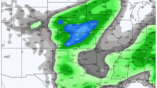
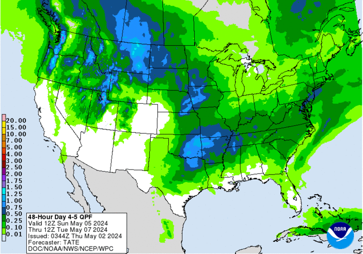
The next cold front will be moving into the state by afternoon on Friday, May 3, and rain and thunderstorms will develop between Ogallala and Valentine, spreading from west to east through Saturday morning, May 4. Good chance of getting woke up in the Lincoln, Sioux City and Omaha metro areas, unless you are a night owl. The severe threat is not zero, but there will be a chance for higher wind gusts and small hail. Total amounts of 0.5-1.25 inches are likely in central and eastern Nebraska, with lowest amounts in the western part of the Panhandle.
Good Marathon Weather Anticipated
Sunday morning, May 5 is the morning of the annual Lincoln Marathon and the weather looks good so far — mostly clear skies and temperatures in the upper 40s at the start of the race, with lighter winds. Wind speeds will increase during the morning as will temperatures, but only to seasonal levels in the 60s. Good luck to all of those who are participating!
More Severe Weather Coming
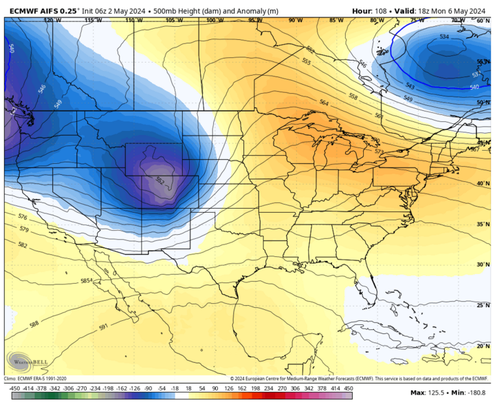
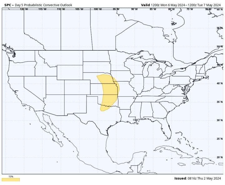
By Monday, May 6, another deep trough will be moving into the High Plains region and this will help set the stage for another potential round of severe storms across the eastern half of the state on Monday afternoon into Monday evening. The main surface low is projected to move into western South Dakota by Monday afternoon, putting the eastern half of the state squarely in the warm, moist sector. At this point, it appears reasonably likely that storms will blow up somewhere between Highways 281 and 81 on Monday afternoon and progress their way east and north.
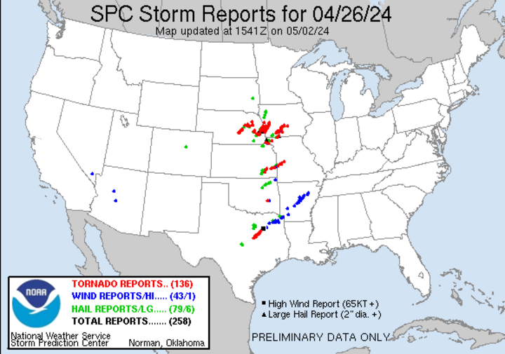
All modes of severe weather will be possible, including large hail and tornadoes. But it is premature to call for a major tornado outbreak and my best advice is to pay close attention to the forecast as we get closer to Monday and to pay heed to all watches and warnings issued. We are fortunate to have experienced and dedicated personnel at all six NWS offices (Cheyenne, Goodland, North Platte, Hastings, Omaha/Valley, and Sioux Falls) that cover Nebraska, and the work the Hastings and Omaha offices did on April 26 probably saved lives.
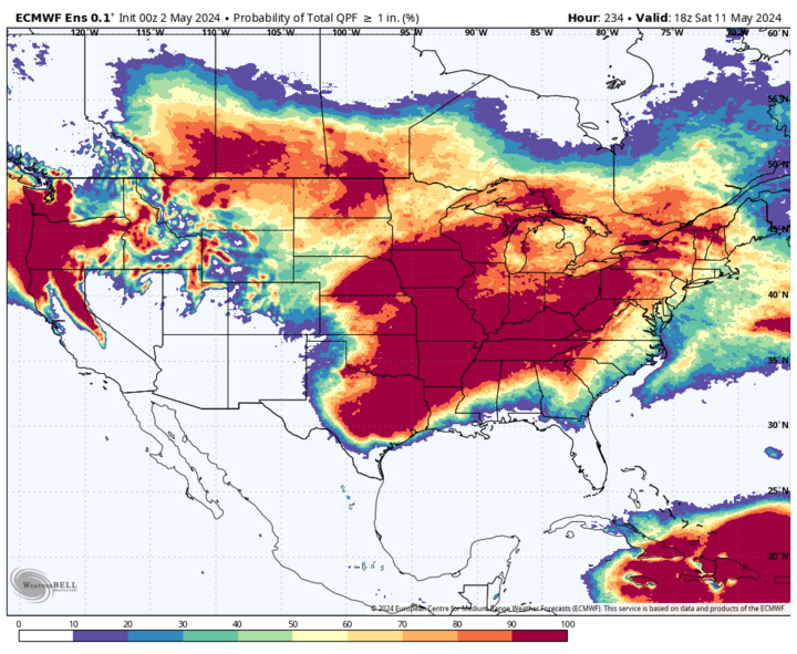
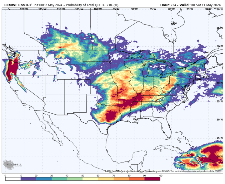
What does seem more certain is another 0.5-1.5 inches of rain is likely with this round of storms in the eastern third of the state. Between Friday night and Tuesday morning, May 7, some areas of eastern Nebraska could pick up an additional two to three inches of moisture.
Active Weather Pattern Easing?
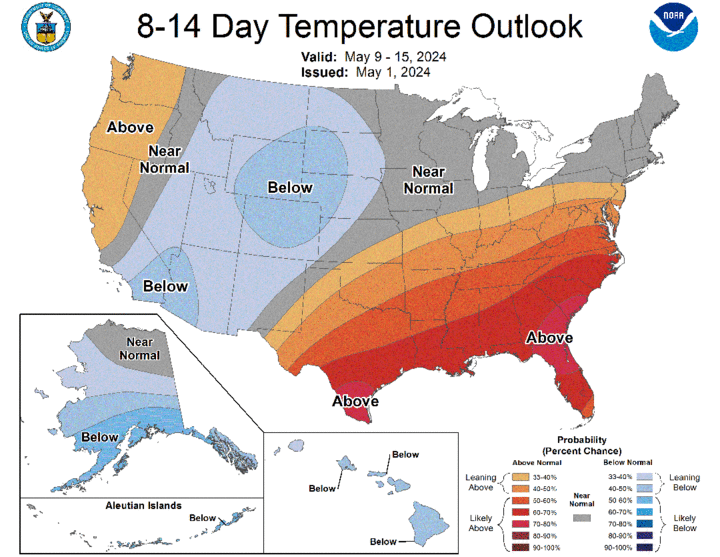
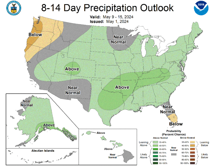
The good news for farmers itching to get back in the field is this may be the last of the "active wave train" for a little while and I'm not seeing any signal for widespread significant precipitation in the state after next Tuesday morning. But we are also going to be under the influence of troughing most of next week with the possibility that the main surface low gets charged rent in western North Dakota next week (i.e., stays around). Thus, there will likely be chances for precipitation at times, particularly in the northern and western parts of the state.
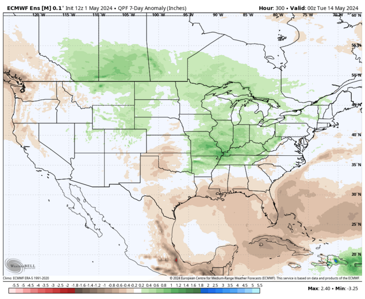
Regardless, the lack of signal for significant precipitation later next week is good for the prospect of getting back into the field. The CPC is currently showing above-average precipitation being favored statewide in the eight- to 14-day period, but the ECMWF is only favoring above average precipitation in the eight- to 14-day period in the Panhandle.
The Heat Miser is on Vacation
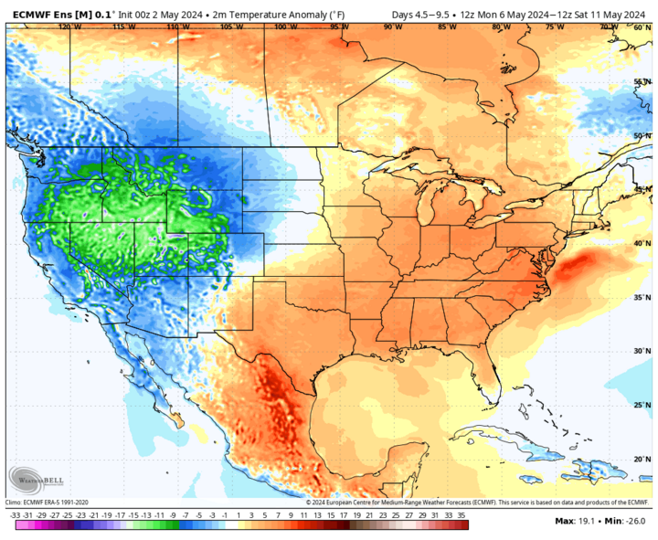
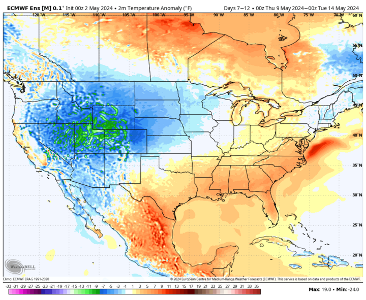
While it will be seasonally warm in the eastern half of Nebraska on Monday afternoon (mid-70s to low 80s) and will remain slightly above average in the eastern sixth through Wednesday, May 8, we are not expecting any very warm days and we are still at least 10 days away for any sustained warmer-than-average temperatures.
Temperatures will be cooler as you go west in the state next week, with highs in the 50s being common later next week in western and north-central sections of the state. Highs likely will be in the lower to mid-60s elsewhere.
Cloud cover may be more common than sun the back of half next week across much of the state. The good news is frost is very unlikely, as cloud cover will help prevent temperatures from crashing too much.
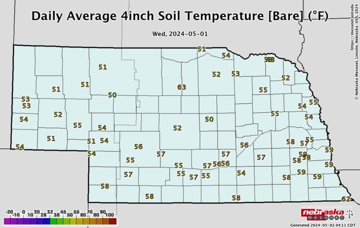
Recent Precipitation and Drought Update
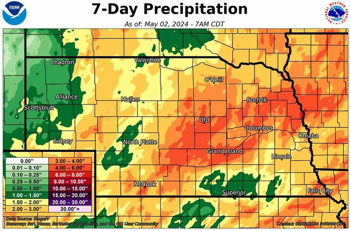
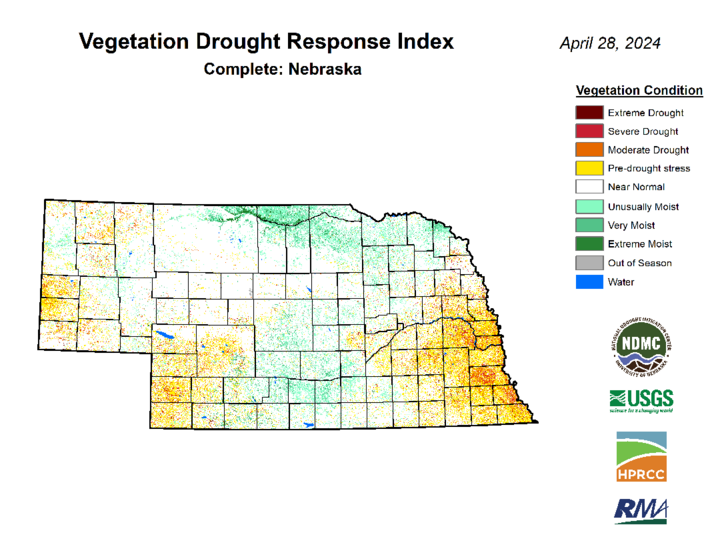
The entire state has received precipitation over the past week and many places have received over two inches in what has been the wettest spring week in the state in several years. There was also a broad area of central Nebraska from Dawson to Hamilton counties that picked up four to five inches, and large pockets of northeast Nebraska picked up three to four inches.
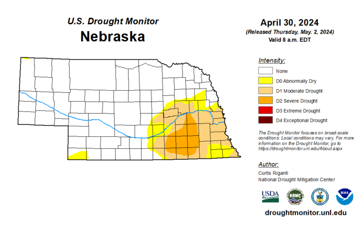
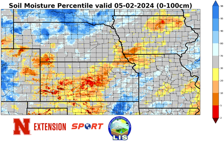
I was especially happy to see widespread two- to three-inch totals across much of southwestern Nebraska, as that area had been heading the wrong direction from a moisture perspective this spring. The rain meant improvements in soil moisture and led to additional drought improvements and removal in southwestern, central and northeast Nebraska. We are now down to around 17% of the state in drought (all eastern side) and less than 25% in any drought or abnormal dryness. That is a vast improvement over a year ago when we were at our drought nadir statewide.
NASS Crop Progress Update
As of the end of last week, 24% and 22% of soybean and corn had been planted, respectively — a little below the five-year averages for both. Not anticipating those numbers being too much higher on next week's update. Winter wheat checked in at 63% good-excellent against 7% poor-very poor. Over 80% of oats have been planted and 55% of oats have emerged. Should start getting pasture ratings next week.
Temperature and Precipitation Roundup
Click here to view the average temperature and total precipitation for each station that had no missing days over the last week. Includes CoCoRaHS observer reports. Below are the temperature and precipitation extremes around the state over the past week.
- Maximum High Temperature: 85°F, Falls City Brenner Field
- Minimum High Temperature: 41°F, Bushnell 15S
- Minimum Low Temperature: 28°F, Alliance Municipal Airport
- Maximum Low Temperature: 59°F, Falls City 4NE
- Maximum Precipitation: 5.13 inches, Lexington Jim Kelly Field
- Maximum Snowfall: 0.8 inches, Sidney 14.1 WSW
