Sunshine and the 80s
The next few days will feature plenty of sunshine and warm temperatures, especially Friday, May 17 when highs should easily exceed 80 statewide. Temperatures may even be every bit of 90 around North Platte, Valentine and Bloomfield on Friday. It will also be relatively breezy, especially in the afternoon. All in all, a good day for yard work, a picnic, or golf if you can play hooky from work. A weak front will move through the state on Saturday so temperatures will be 5-10°F cooler than tomorrow but still warm for mid-May. There is a slight chance of showers in central and eastern Nebraska with the frontal passage Saturday morning, but most places won't have more than a few clouds.
Rain on the Scarecrow, Mud on the Plow
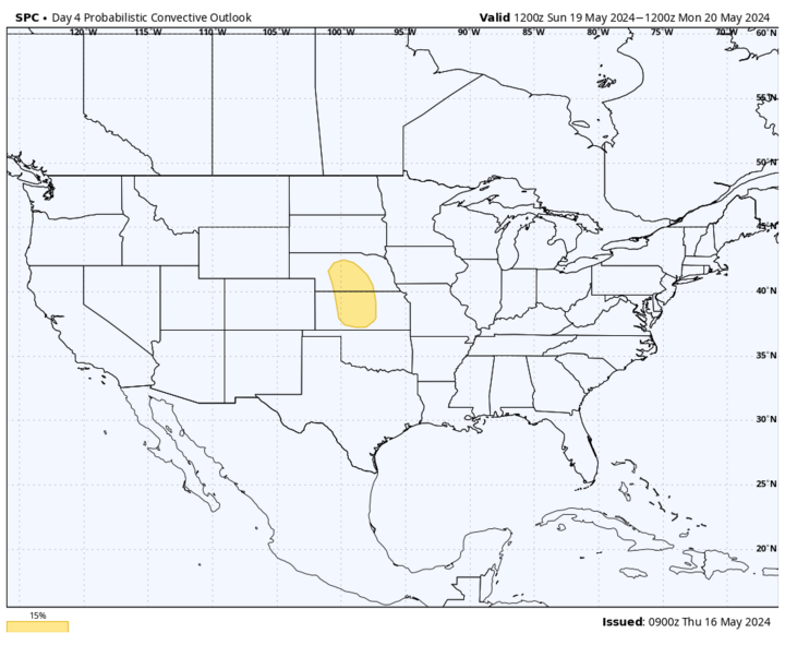
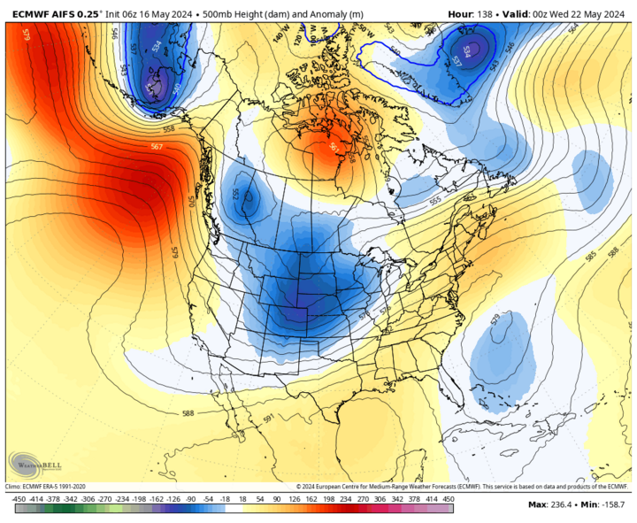
While chances of rain are quite low in the next few days, Sunday, May 19 starts the beginning of another active period of weather. The front that moves through early Saturday will stall southeast of us and start retreating back to the north by Sunday morning. This will keep warm temperatures around and will bring increasing low level moisture, with dewpoints getting into the 60-65 range east of Kearney. All this sets the stage for a fair amount of instability and with the front starting to move back to the east, central sections of Nebraska from Harlan County to Ord, should keep an eye on severe weather. The SPC already has this section of the state in the 15% risk category and all severe hazards are possible. These storms will move off to the east and northeast through Sunday night but the severe risk may be lower east of Highway 81. Heavier rainfall will be possible as well. The western third of the state is likely to miss out on this round but fear not, you have other chances coming.
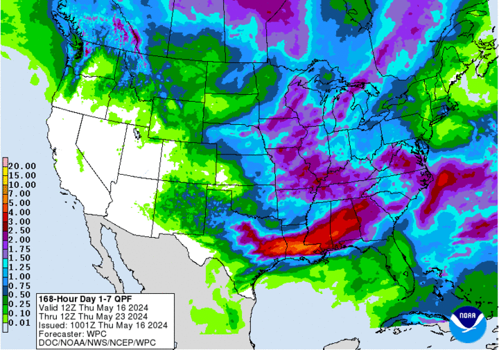
The front will not be in any danger of getting a speeding ticket as it will take until Tuesday morning, May 21 for the front to fully clear the state. Expect temperatures to be warmer the further east and southeast you go in the state during the day on Monday, as is often the case in May. In the meantime, a deeper trough will start working its way into the Plains on Monday and this will provide "fuel" for widespread showers and storms across the state from Monday late afternoon into Tuesday. A half inch or more is a good bet everywhere in the state save for the northern part of the Panhandle. Precipitation will clear the state by Tuesday morning and drier, cooler, and breezy conditions will be the rule by Tuesday afternoon statewide.
A modest break in precipitation will start Tuesday afternoon and go through Thursday night. We then turn attention to another system entering the state, which will bring a good chance of rain and thunderstorms statewide between Thursday night and Friday. Saturday probably will be dry but Mother Nature looks to treat the state to additional precipitation by Memorial Day and possibly again a few days later. Hope your lawnmowers are working well!
Bottom Line: We are Entering into Another Period of Very Active Weather
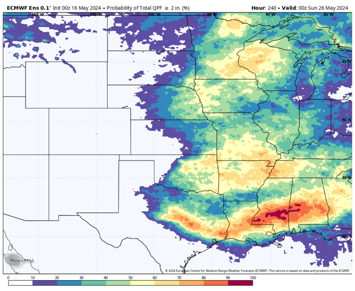
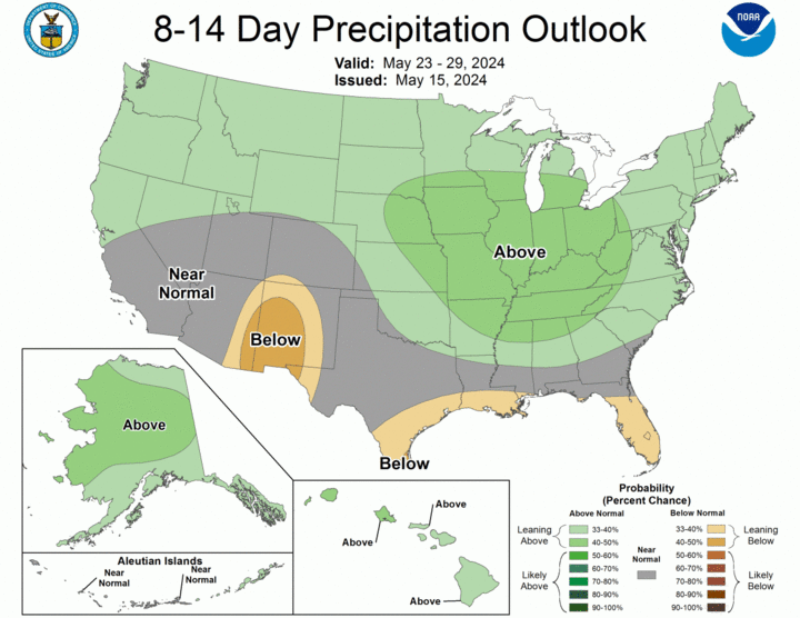
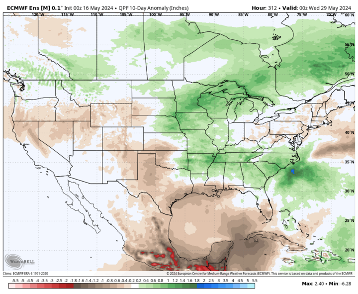
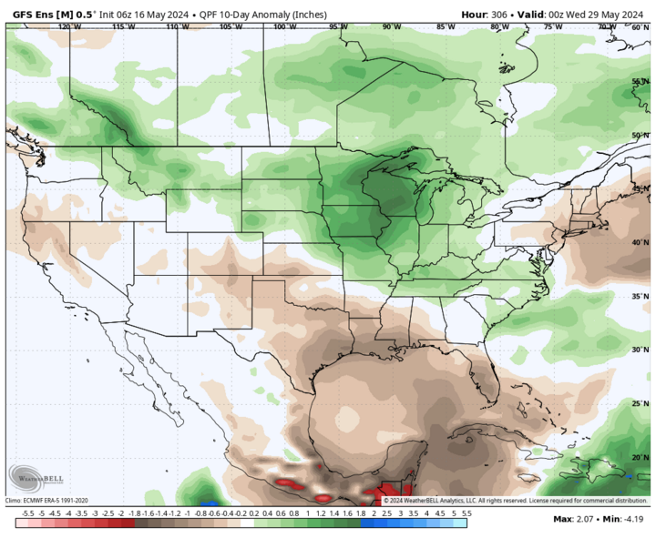
For farmers trying to get crops in the ground, there likely won't be more than 72 consecutive hours without precipitation between Sunday and the end of the month. The whole state looks to get an inch over the next 10 days (great news for the southern Panhandle and southwest Nebraska) and there is a strong probability of at least two inches in areas along and east of Highway 281. I feel pretty confident that some areas in east-central and northeast Nebraska will get four inches between now and next weekend, and some places could absolutely get half a foot over the next two weeks. The upside is this will lead to further drought relief. Pure speculation on my part, but it is possible that we may be able to declare the state drought free in early June if we have widespread four- to five-inch totals between now and the end of the month in places like Geneva, York, Seward and Lincoln.
Cooler Temperatures
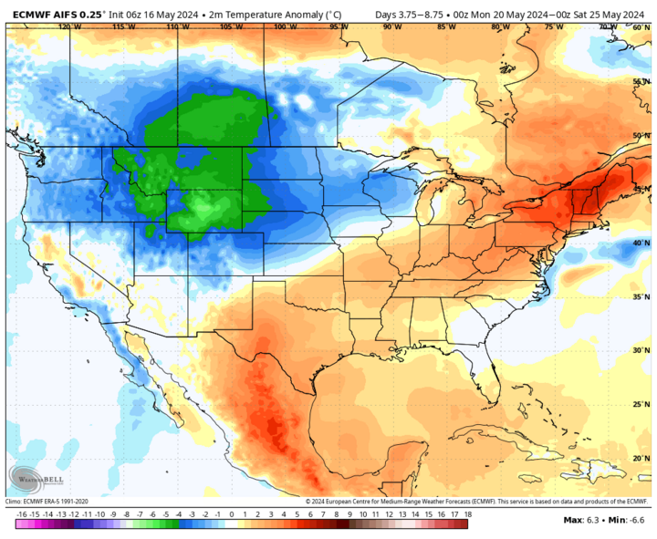
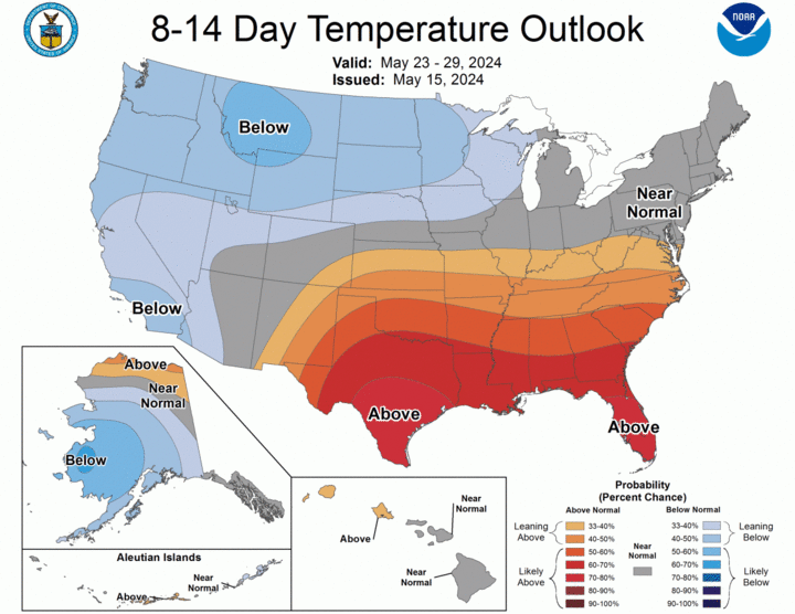
Temperatures are likely to be seasonally cool in western Nebraska on Monday and statewide on Tuesday. A brief rebound to more seasonal or slightly above-average temperatures looks likely Wednesday, May 22 and Thursday, May 23 before cooling off again at the end of the week. Coolest temperatures will be confined to the north-central area of the state, where highs may struggle to hit 60°F on Friday, May 24. Low temperatures likely to be in the 40s statewide on Saturday, May 25 and there will be a bit of frost risk in the highest elevations of the Panhandle on Friday morning if skies clear enough. Regardless, we're not looking at any record cold in the state over the next week — just pleasant temperatures in between storm systems. We'll have plenty of heat to deal with soon enough.
Drought Update
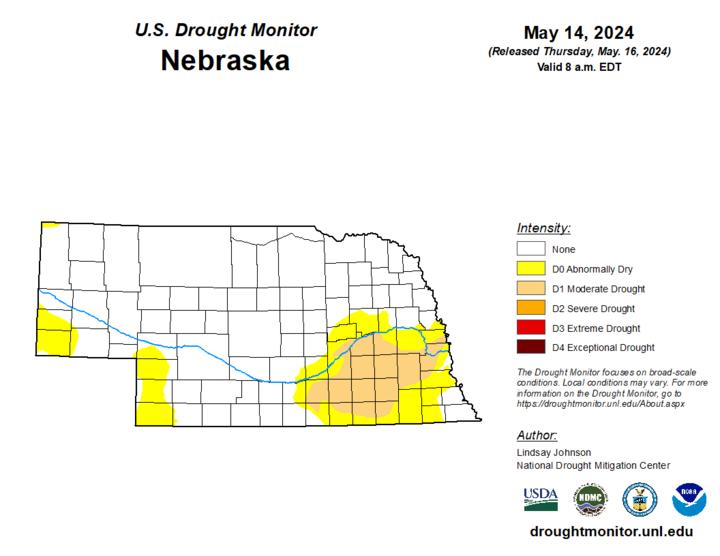
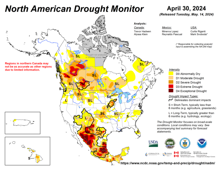
Drier-than-average conditions that have persisted in recent months across the southern Panhandle and far southwest corner of the state led to some introduction of abnormal dryness (D0) in Banner, Kimball, Dundy, Chase, Perkins and Keith counties. This is not technically drought but we do need the projected rainfall to come to fruition in these areas to prevent that area from going into it as we head into climatological summer. Robust precipitation led to removal of D0 in Howard and eastern Sherman counties and across the southeast corner of the state in Nemaha and Richardson counties. The area around Dawson and Shubert in Richardson County has been especially wet over the last month, with over 12 inches at a couple of the observer sites.
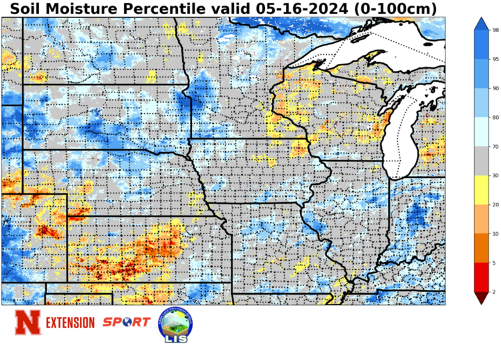
Soil moisture percentiles are generally in the near-normal to wet range across the state. Exceptions being the areas of western Nebraska that have recently gone into D0. Streamflow percentiles are still on the lower side in parts of eastern Nebraska, where moderate drought (D1) is present and across southwest Nebraska. But they are generally above the 50th percentile elsewhere — quite the change from a year ago.
NASS Crop Progress Update
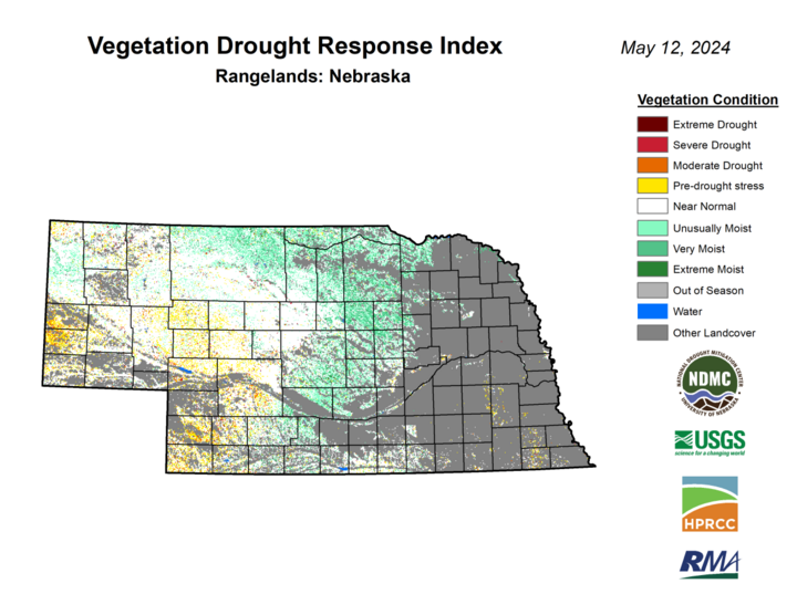
Fifty-five percent and 37% of corn and soybean, respectively, had been planted as of the end of last week. This is a significant increase from the week before but still below the five-year averages for both. Corn emergence came in at 18%, near close to the five-year average while soybean (9% emergence) was slightly above the five-year average. Sorghum planting is also off to a slow start with only 5% planted. Winter wheat checked in at 79% good-excellent against 3% poor-very poor, significantly higher than in recent years. Over 80% of oats have emerged. First pasture ratings of the season show 59% good to excellent against only 5% poor to very poor. That is also a significant improvement over last year at this time, though the good-excellent percentage did decline somewhat. VegDRI continues to depict very good pasture conditions in the northern and eastern Sandhills regions with near-average or slightly dry conditions to the southwest of Mullen.

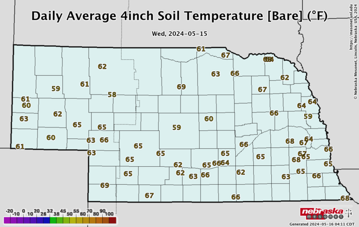
Temperature and Precipitation Roundup
Click here to view the average temperature, growing degree days and total precipitation for each station that had no missing days over the period from May 5-11. Includes CoCoRaHS observer reports. Below are the temperature and precipitation extremes around the state over the past week.
- Maximum Daily High Temperature: 87°F, Kilgore 1NE
- Minimum Daily High Temperature: 49°F, Agate 3E
- Minimum Daily Low Temperature: 25°F, Bushnell 15S
- Maximum Daily Low Temperature: 60°F, Falls City Brenner Field
- Maximum Precipitation: 2.86 inches, Dawson 2.5SE
- Minimum Precipitation: 0.00 inches, Multiple locations
