Storms Friday Night
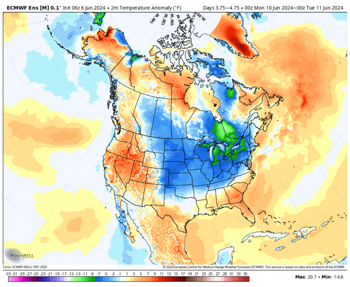
It is currently a beautiful day statewide (June 6) with clear skies and temperatures in the mid-70s to lower 80s. Expect similar conditions on Sunday and Monday in eastern Nebraska as well, as we will be on the east side of a western ridge with cooler air filtering in from the north.
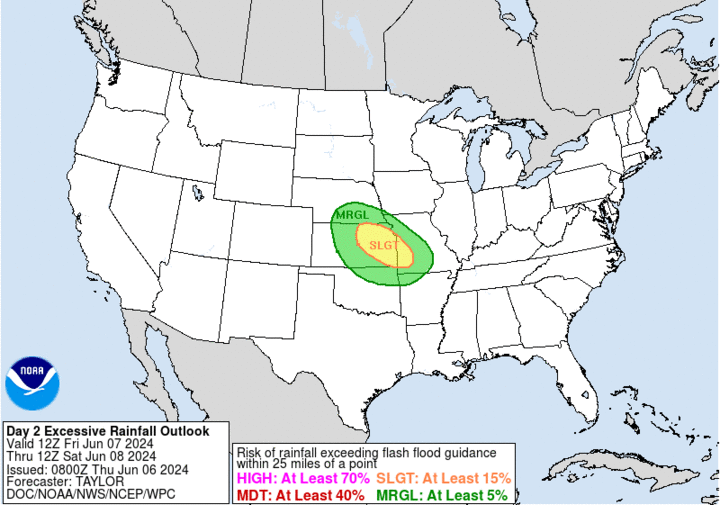
Friday, June 7 and Saturday, June 8 will feature some shortwave energy coming around the ridge. This will lead to chances for showers and storms late afternoon and evening in north-central Nebraska, and during the night for eastern and south-central Nebraska.
Some of the recent high-resolution models show a mesoscale convective system forming around Ainsworth and pushing southeast. This suggests there is at least a chance of severe weather Friday night in the Lincoln and Omaha metro areas, as well as the rest of southern and eastern Nebraska. The SPC has now upgraded much of the central and eastern sections of the state to a slight risk and wouldn't entirely shock me if parts of eastern Nebraska are upgraded further Friday.
Additional showers are possible Saturday afternoon along and south of the Platte but severe storms are not much of a threat. There also is going to be a chance of showers and storms on Sunday, June 9 in west-central areas of the state.
Additional Rain Chances Tuesday
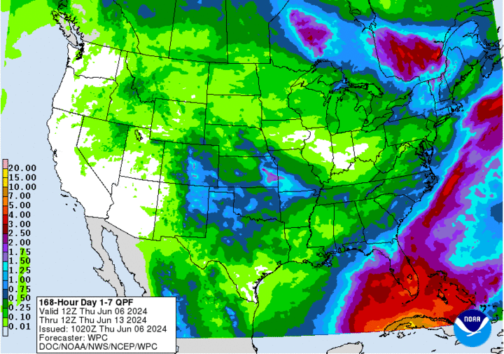
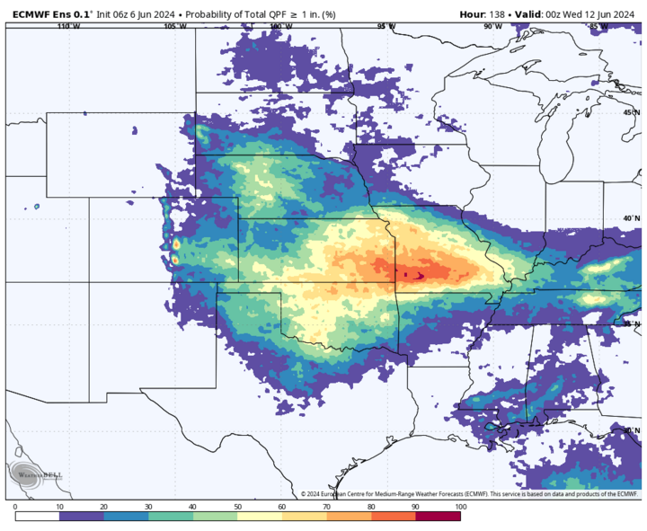
As the western ridge breaks down, a system will traverse the state bringing everyone some chance for rain. The main surface low will be well to our north and there doesn't appear to be a significant severe weather risk. Nevertheless, it seems possible that everyone will have a shot at some additional moisture on Tuesday, June 11, with the best chances occurring in western Nebraska, where it would be welcomed.
The Heat Is On
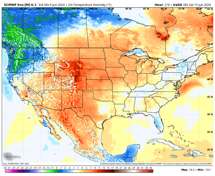
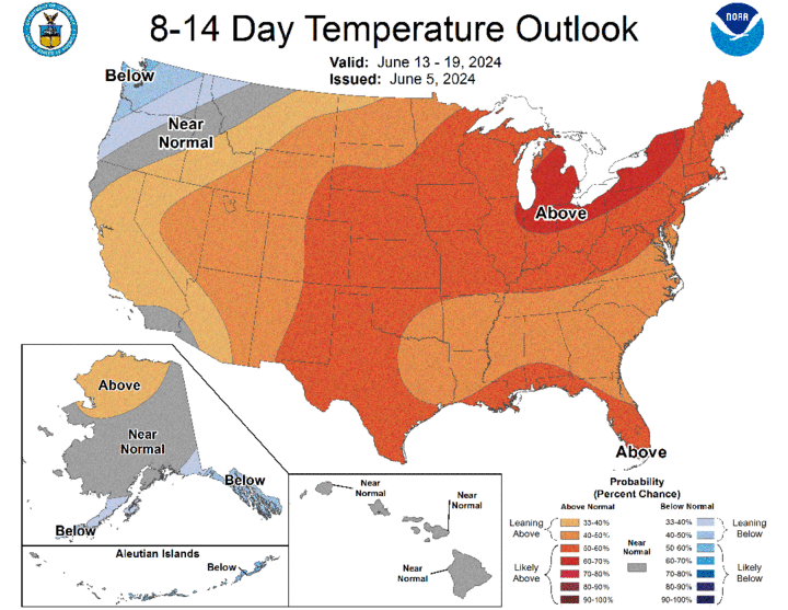
The ridging will shift to the central U.S. later in the week bringing increased 500-mb heights and warmer temperatures. Expect temperatures to jump up several degrees between Tuesday afternoon and Wednesday afternoon, June 12, with our first real heat of the summer likely for pretty much everyone in the state and larger region by the end of the work week. We're not looking at record temperatures, but most areas will be at least in the upper 80s if not into the lower and middle 90s from Thursday, June 13 to Saturday, June 15.
In the eastern sixth of the state, expect dewpoints to start creeping closer to the 70 mark, so it will feel closer to 100°F at times in the afternoons. There also may be a chance of storms in the Panhandle and north-central sections of the state in the evening hours on Friday and Saturday
Severe Weather the Following Week?
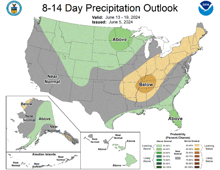
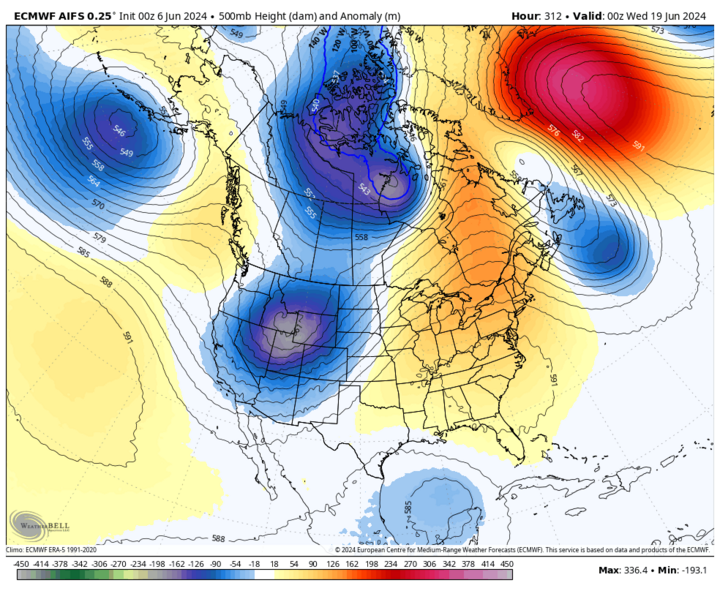
The warmer temperatures may stick around until after Father's Day, when our attention turns toward the possibility of another sharp trough coming into the western U.S. and making a turn into the northern Plains region. With ridging anchored off to the east, this would be a favorable setup for severe storms and heavy rains. Still a ways out but there is certainly some model consensus toward the ridging shifting east and the heat backing off the week after next. The CPC also has the entire state as seeing a good chance of above-average precipitation in the eight- to 14-day outlook.
Drought Improves
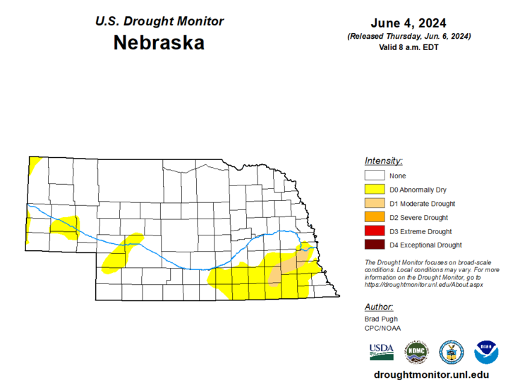
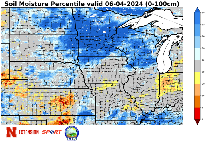
Significant precipitation occurred yet again in parts of eastern Nebraska the back half of last week (especially Thursday) and this led to additional improvements on the U.S. Drought Monitor. We are now down to less than 2% of the state in drought, with only an area from Wilber up to Louisville (including much of Lincoln) still in moderate drought. These are the only places in eastern Nebraska not to have seen an improvement in drought status since the early spring. Precipitation simply hasn't been sufficient enough yet to warrant full removal. But there are other areas of eastern Nebraska (Columbus to David City for example) that were deep in exceptional drought (D4) a year ago at this time and now are free and clear of drought and abnormal dryness.
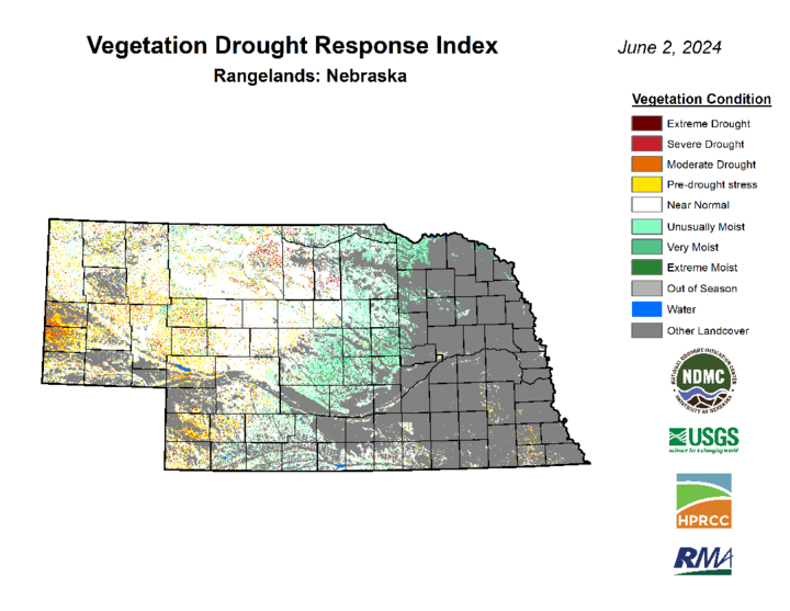
The area of the state that currently concerns me most is the area around Scottsbluff and southwest of Chadron. Been a pretty dry spring to this point and the signal of drought stress from VegDRI is concerning. Thankfully, it sounds like crops in that region are doing reasonably well at the moment. But we are entering a hotter time of year and the rain needs to pick up soon or things could go sideways quick.
NASS Crop Progress Update
Ninety-six percent and 90% of corn and soybean, respectively, had been planted as of the end of last week. Corn emergence came in at 79% and soybean emergence at 64%. Both are just slightly behind the five-year average but significantly ahead of a few weeks ago.
Sorghum planting has also accelerated in recent weeks with 52% planted. Winter wheat checked in at 68 percent good-excellent against 5% poor-very poor and checked in at 72% headed. This is above the five-year average and a 50-percentage point increase over two weeks ago. 95% of oats have emerged and are rated as 63% good to excellent and 4% poor-very poor.
Pasture ratings of the season show 70% good to excellent against 5% poor to very poor. That is a positive change over two weeks ago. VegDRI continues to depict very good pasture conditions in the northern and eastern Sandhills regions with near-average or slightly dry conditions to the southwest of Mullen.
Temperature and Precipitation Roundup
Click here to view the average temperature, growing degree days and total precipitation for each station that had no missing days over the period from May 26-June 1. Includes CoCoRaHS observer reports. Below are the temperature and precipitation extremes around the state over the past week.
- Maximum Daily High Temperature: 93°F, Scottsbluff W B Heilig Field
- Minimum Daily High Temperature: 65°F, Plainsview Ranch
- Minimum Daily Low Temperature: 36°F, Bushnell 15S
- Maximum Daily Low Temperature: 66°F, Falls City Brenner Field
- Maximum Weekly Precipitation: 6.28 inches, Platte Center 3.2 NNE
- Minimum Precipitation: 0.00 inches, Marsland 3.5 E
