Light Snow Then Mild
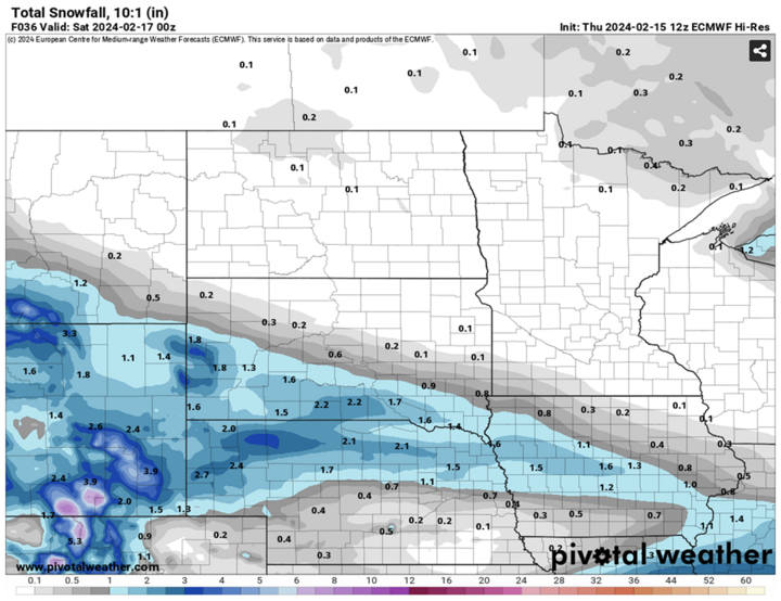
Another mild first half of the week is in store next week. But first we have a little snow and cold temperatures to deal with. No truly significant snow accumulations were expected anywhere in the state with this system. Nevertheless, the NWS offices in Sioux Falls, Omaha, North Platte and Cheyenne issued winter weather advisories in their respective Nebraska counties along and north of Highway 20, where two to four inches of snow seems a safe bet. Farther to the south, in places like Grand Island, Columbus, York, Lincoln and Omaha, accumulations were expected to generally remain at around an inch or less. Temperatures will be seasonally cold across the state Friday, Feb. 16, with most of western, northern and central Nebraska remaining in the 20s. Temperatures in the southeastern quadrant should get into the lower 30s. Easily the coldest weather in three weeks.
After a chilly start in the teens on Saturday, Feb. 17, temperatures look to moderate to near or slightly above seasonal normals for high temperatures. This should be sufficient to melt much of the remaining snow in areas that receive a few inches or less tonight. Temperatures warm even further Sunday, Feb. 18 back into the 50s for most, and northeast Nebraska likely in the 40s. Monday, Feb. 19 through Wednesday, Feb. 21 looks mild, especially Wednesday along and south of the Platte. Wouldn't surprise me to see temperatures make a good run at the mid to upper 60s in Lincoln, Nebraska City, and Falls City and 60-65°F seems reasonable in places like Norfolk, Tekamah and Niobrara. Overnight lows will also be very mild with some locations not dropping below freezing on Tuesday night.
Another Midweek Cold Front
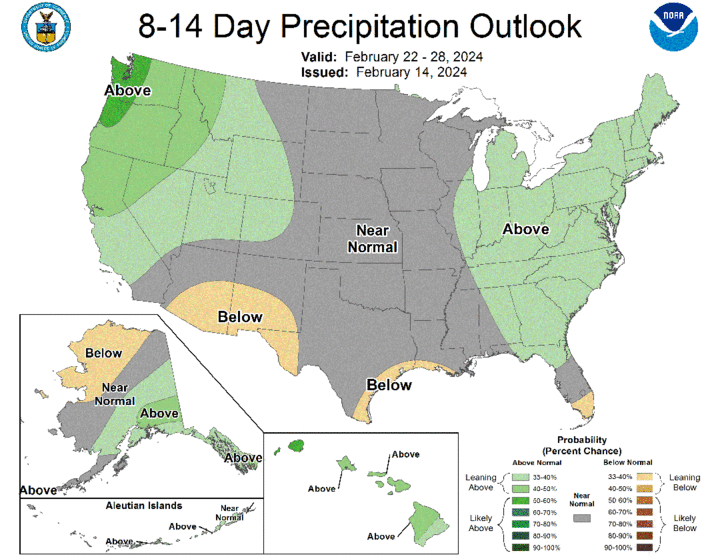
Upper-level ridging will temporarily break down later next week as a sharp trough moves into the eastern U.S. This means a cold front will move through sometime late Wednesday or early Thursday, Feb. 22 and back us down to more seasonal temperatures. Around the same time, another shortwave may be moving into the High Plains, which could mean additional rain in parts of west-central Nebraska around Ogallala and North Platte, and some snowfall in the western part of the Panhandle. Still a ways out but models have been showing the possibility of more than four inches in Kimball, Sidney and Bridgeport. So be prepared if you are traveling out in that area next Thursday. Last weekend's snow was a bit higher than what I was originally anticipating in that area, for what it's worth.
Mild Finish to February
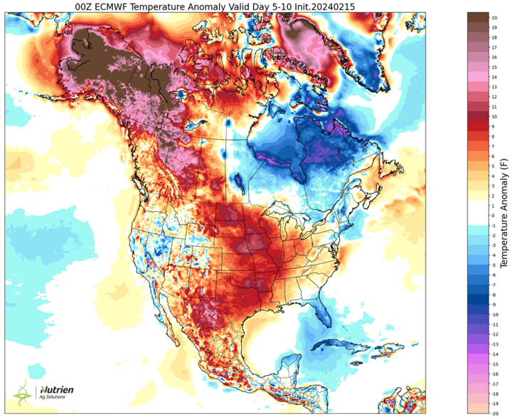
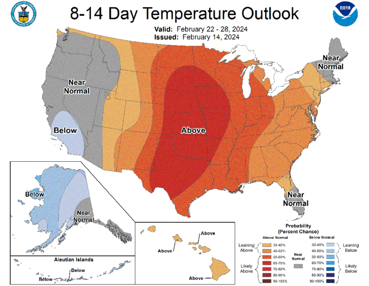
It has been a very mild February thus far in western and south-central Nebraska and near-record warm February in eastern Nebraska. Mild weather will resume late next week as upper-level ridging returns to the central Plains, while the Great Lakes region and eastern seaboard gets a taste of colder temperatures under deeper troughing. This mild weather looks to remain with us into the end of the month. Expect several more days above 50°F and a few in the 60s as we head toward March, when we may start seeing changes.

Precipitation and Drought Update
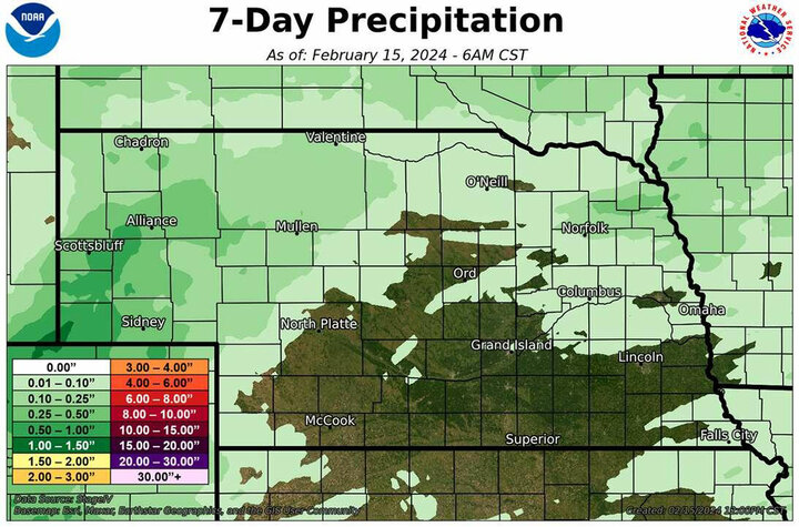
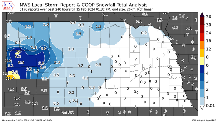
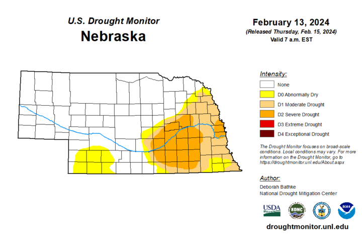
With last weekend's snow melting improving soil moisture in western Nebraska, there was some improvement on the U.S. Drought Monitor in western Chase and Perkins counties. Total snow amounts last weekend were in excess of six inches with liquid water equivalents of 0.25-0.50-inch in much of the Panhandle. Lighter amounts of snow and light rain fell over the western Sandhills last Saturday. Over the past 24 hours (as of Feb. 15), some parts of northeastern Nebraska also received light precipitation, including a little bit of light snow north of Hartington. Everywhere else in the state had no measurable precipitation over the past week.
