Roller Coaster Temperatures
It is a chilly day in eastern Nebraska and a bit on the cool side in western Nebraska, except for the southwest Panhandle where it's currently in the 50s. But temperatures will start rebounding tomorrow as ridging moves back into the region. This weekend looks quite mild with temperatures likely exceeding 50F statewide and likely getting near 60 in the counties along the Kansas border on both Saturday and Sunday. There will be a bit of breeze from the southwest in the afternoons, especially in the western half of the state. But it still should be light enough to make it pleasant for outdoor work for those needing to finish taking care of leaves or putting up Christmas lights.
A series of troughs will be moving into the north central U.S. in the first half of next week. Temperatures start dropping again on Monday back into the mid-30s to low 40s statewide, with coldest temperatures in the western third of the state. Tuesday and Wednesday will feature some moderation in western Nebraska but cooling further in the eastern third of the state. Highs likely will be subfreezing in northeast Nebraska on Wednesday and may be subfreezing as far south as Seward and Nebraska City. Ridging will start moving back into the central U.S. by Thursday, which will bring mild temperatures in the 50s to the Panhandle and southwestern Nebraska and should allow for temperatures in the 40s into central and southeastern Nebraska. The northeast corner of the state, which has easily been the coldest spot in Nebraska of late, will likely remain in the 30s for one more day. Temperatures are likely to be in the 45-50°F range statewide by next weekend — pretty mild for mid-December.
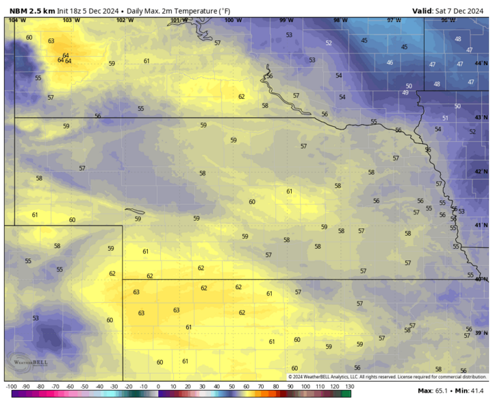
Figure 1. Projected high temperatures on Saturday.
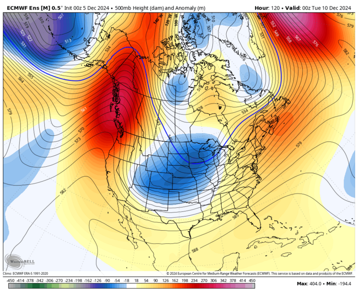
Figure 2. Projected 500-mb heights Monday evening.
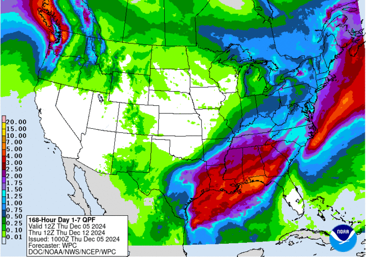
Figure 3. Projected seven-day precipitation.
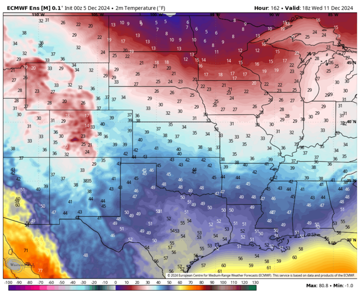
Figure 4. Forecast temperatures midday Wednesday, Dec. 11.
Dry
Even though we will have a few cold frontal passages coming through the state in the first half of the week, there isn't going to be enough moisture to work with to generate much in the way of precipitation. A brief period of light showers or snow showers can't be ruled out on Sunday evening into Monday morning or on Tuesday night in eastern Nebraska. But chances are quite slim. A pattern shift may be coming the week after next that would increase our chances of getting moisture back into our part of the country. Models have been hinting at moisture coming back around Dec. 17-18, but details are still fuzzy at best so projections of amounts and type of precipitation are purely speculative at this point.
Regardless, we will be in need of moisture by then as most places in the state have not had much, if any, moisture in the last two weeks. A bit of snow fell last weekend in northeast Nebraska around Norfolk and Wayne. But only isolated spots picked up more than two inches and no one in the state has picked up more than a tenth of inch of moisture since Nov. 20. So any moisture that falls later this month will be welcome.
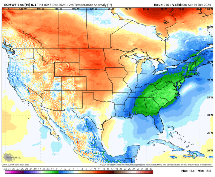
Figure 5. Projected temperature anomalies next weekend.
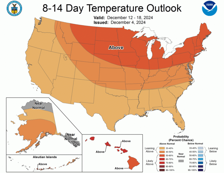
Figure 6. CPC eight- to 14-day temperature outlook.
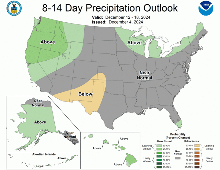
Figure 7. CPC eight- to 14-day precipitation outlook.
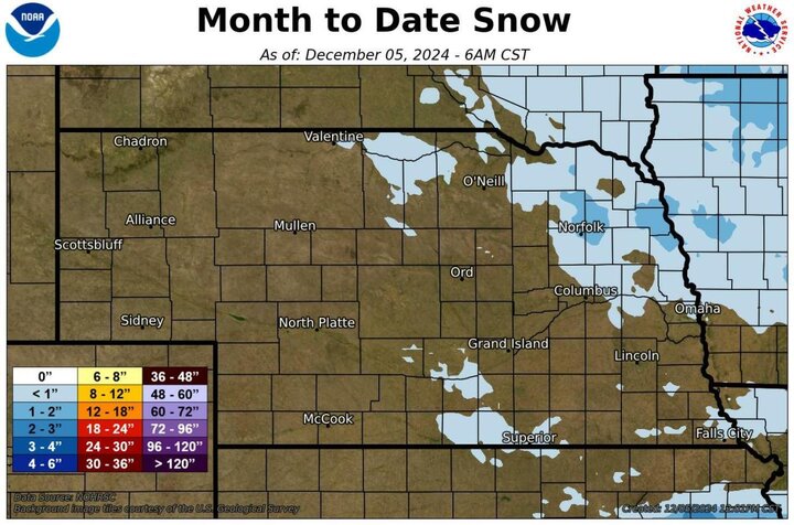
Figure 8. Recent snowfall.
Drought Update
No changes were noted on the Drought Monitor this week. Roughly 85% of the state is in drought with severe and extreme levels of drought respectively covering 44% and 8% of the state. Only parts of southwest Nebraska are free and clear of drought and abnormal dryness. These numbers are improvement compared to six weeks ago but moisture will be needed soon to prevent some areas of north-central and western Nebraska from slipping into a worse category. Soil moisture percentiles from SPoRT LIS show most of the soils in the state are at best near-average for the time of year with most locations falling between the 10th and 30th percentile. Another soaking rain before soils fully freeze would be welcome, especially for the northern and western third of the state, which missed out on the best moisture in the first half of November. This, of course, is the least likely area to get that kind of moisture this time of year — at least in its most useful form (rain). Bottom line: our soil moisture is in much better shape than it was in late October, but we aren't close to being fully recharged or being out of the woods for going into next spring too dry.
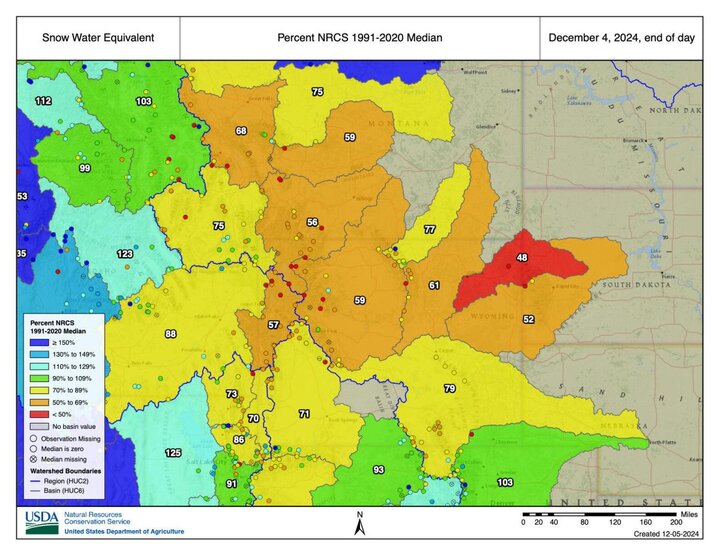
Figure 9. Snow water equivalent in the western U.S.
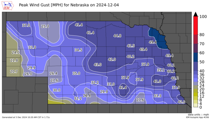
Figure 10. Wind gusts on Wednesday, Dec. 4.
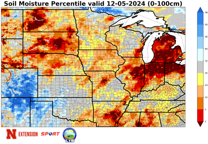
Figure 11. Latest soil moisture percentiles from SPoRT LIS.
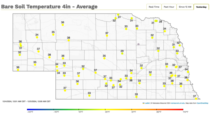
Figure 12. Four-inch bare soil temperatures.
Temperature and Precipitation Roundup
Below are the temperature and precipitation extremes around the state over the past week:
- Maximum Daily High Temperature: 68°F, Enders 10 SW Mesonet
- Minimum Daily High Temperature: 16°F, Fordyce 4 N Mesonet
- Minimum Daily Low Temperature: -1°F, Kilgore 4 NE
- Maximum Daily Low Temperature: 27°F, McCook Municipal Airport
- Maximum Weekly Precipitation: 0.07 inches, Pierce
- Maximum Weekly Snowfall: 2.1 inches, Bloomfield
