Relief is spelled R-A-I-N
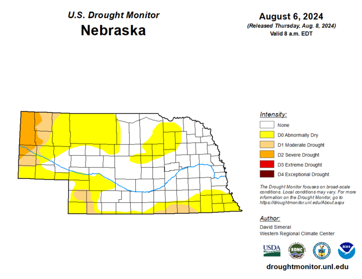
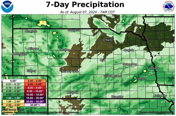
OK, I promise I passed spelling in second grade. But there is good news: Precipitation is likely over much of western and central sections of Nebraska in the next 36 hours as a cold front and an associated shortwave in the atmosphere moves through the state. Best forcing from said shortwave will be over the western section of the state, with severe thunderstorms possible later today from North Platte and points south. Thunderstorms are developing along the Front Range and will move into the Panhandle and Sandhills in the next several hours (though it's possible the northern Panhandle may miss out on the best moisture) and continue to move east-southeast overnight. Robust precipitation looks likely (possibly over an inch) in areas south of Highway 20 and west of Highway 281 through tomorrow morning. This is welcome news for the Sandhills, where it has been quite dry over the past 30-40 days. It will be especially welcome news in the Panhandle and southwestern sections where drought has developed over the past few months.
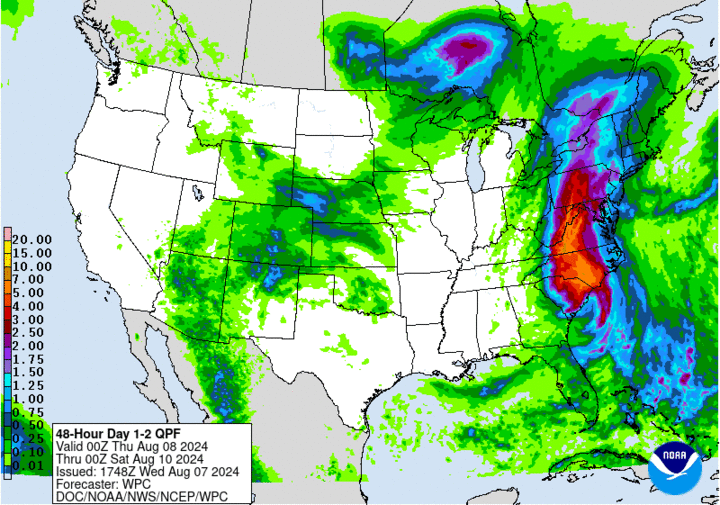
Instability profiles in the eastern side of the state tonight are more marginal so amounts are likely to be under a half inch as the storm complex loses its punch, with some areas of east-central Nebraska possibly not picking up much at all. Additional showers are possible across the state tomorrow but generally on the lighter side. But any rain is welcome after the heat earlier this week, especially along the Kansas border where temperatures were over 100°F for multiple days earlier this week. Additional precipitation is likely across southwestern and south-central Nebraska on Friday, Aug. 9 and is possible across much of the state on Sunday, Aug. 11 as another shortwave moves through the region.
Chili and Cinnamon Rolls Weather
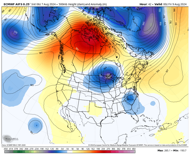
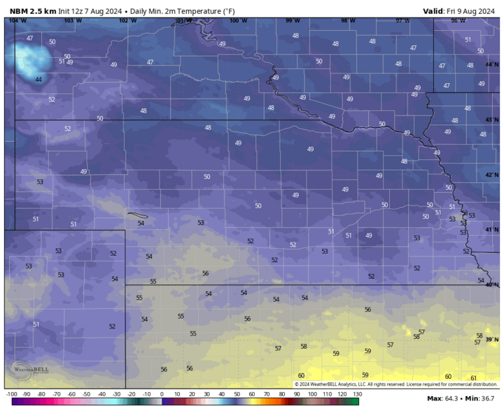
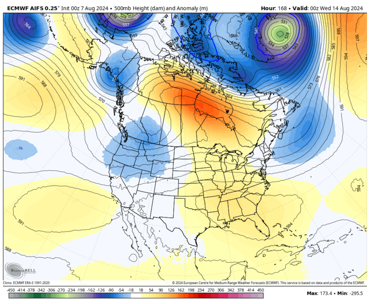
The upper air pattern to close out the week will feature strong ridging over northwestern Canada and a sharp trough south of Hudson Bay. This pattern will help "drive" cool air into the region, which will persist through the weekend. With clouds and showers possible during the daytime hours, much of west-central and central Nebraska may struggle to hit 70°F tomorrow. Additional chances of showers and cloud cover should hold temperatures down yet again on Friday in southwestern and south-central Nebraska. The rest of the state should see more sun on Friday but with dewpoints in the mid-50s, temperatures in the 70s and a light breeze, it should be a very pleasant day to be outside. Saturday, Aug. 10 also looks quite pleasant with temperatures in the 70s, lower humidity and lighter winds.
Warmer and Stormier Next Week
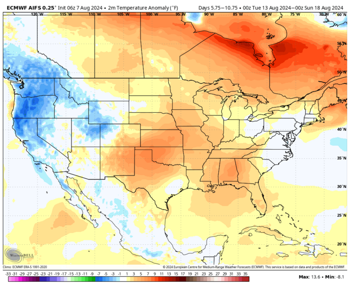
Next week will feature a stronger mid-level ridge in place from Texas to Mississippi, broad area of surface high pressure off the east coast, and various shortwaves moving through our region on the north side of the ridge. This will lead to more seasonal temperatures from Tuesday, Aug. 13 to Saturday, Aug. 17, with highs 84-88 common in east-central and northeast Nebraska and 88-94 elsewhere. It will also be more humid and dewpoints may approach 80 at times in areas east of Highway 77 the second half of next week. The wild card on temperatures will be thunderstorms, which will be likely at times next week. If clouds linger for half a day after storms, temperatures will need to be adjusted downward. Right now, it appears there will be a good chance for storms across the state on Monday night into Tuesday morning.
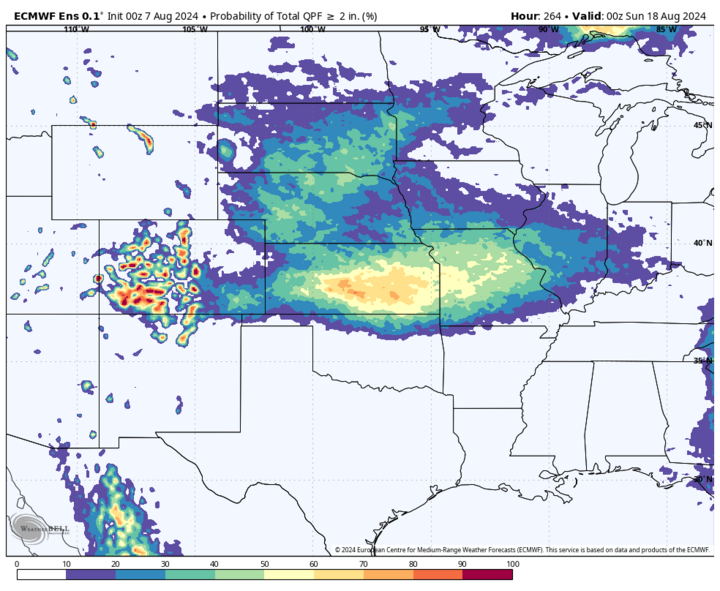
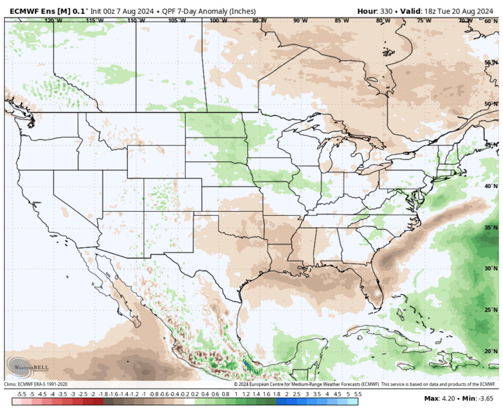
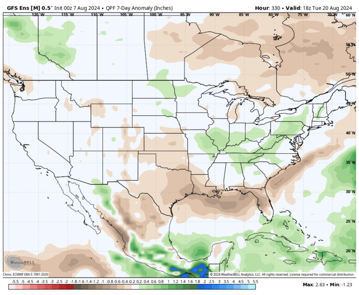
With the expected pattern in place, the setup will be favorable for additional chances of evening and overnight storms across the eastern half of the state for much of next week. ECMWF ensemble does indicate a reasonable probability for 2 inches of moisture falling over the next 10 days, and there is some chance that rainfall amounts could be higher than that for much of central and eastern Nebraska. Severe weather can't be ruled out next week either. Flooding isn't welcome but several rounds of rain would be very beneficial in helping "finish" up the corn and soybean crops.
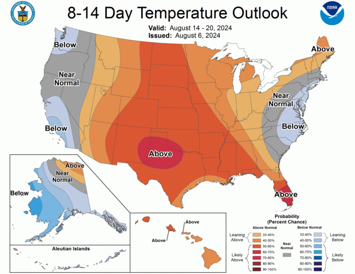
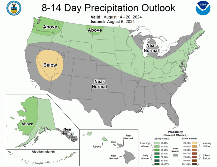
Looking beyond next week, the CPC and ECMWF are in agreement with warmer temperatures persisting and rain chances for much of the state continuing into the week of Aug. 19. Might need to keep an eye on 100-plus temperatures returning to western Nebraska by then as well.
Ag Update
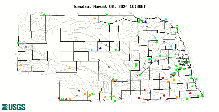
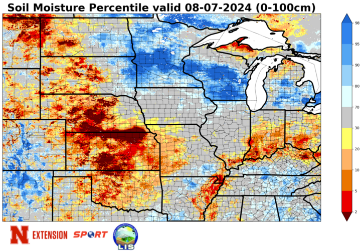
The latest NASS Crop Progress Report for the state's crops can be viewed here. With drier weather the rule over the past 30 days and heat the last two weeks, soil moisture percentiles across southern and west-central Nebraska have taken a nosedive that the 2024 Chicago White Sox could be proud of. Only a small pocket of northeast Nebraska is above the 70th percentile for soil moisture (according to SPoRT LIS) and much of the state is now below the 20th percentile. Much of the area in southern Nebraska along the Kansas border is now under the 5th percentile and low streamflow percentiles are also reflecting the sharp change to dry and hot over the past month from Beaver City to Fairbury with drier soils showing up as far north as the I-80 corridor.
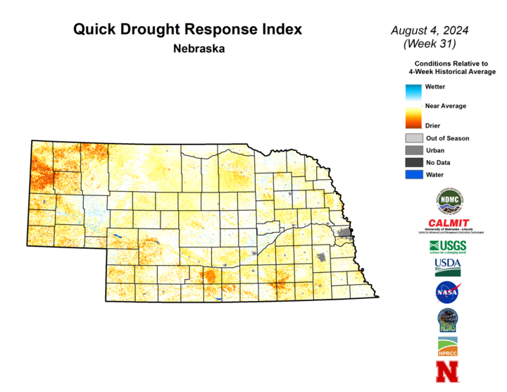
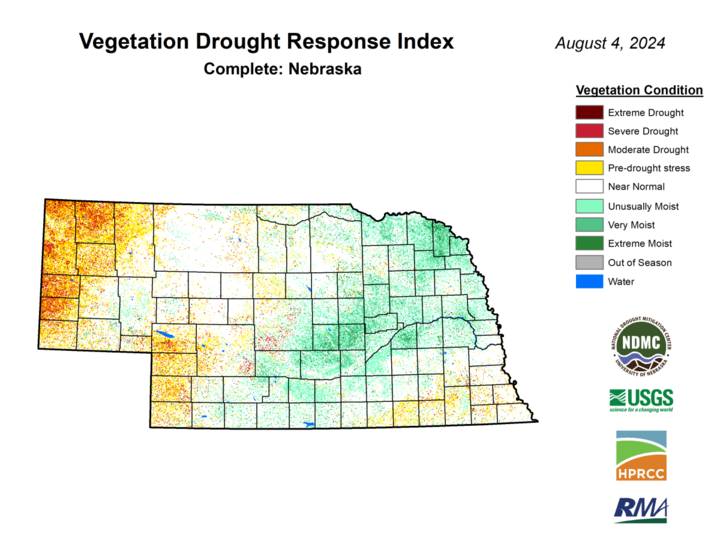
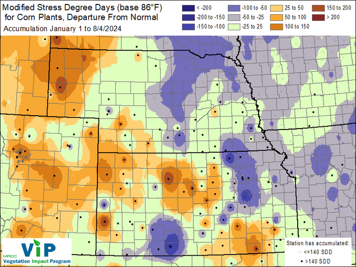
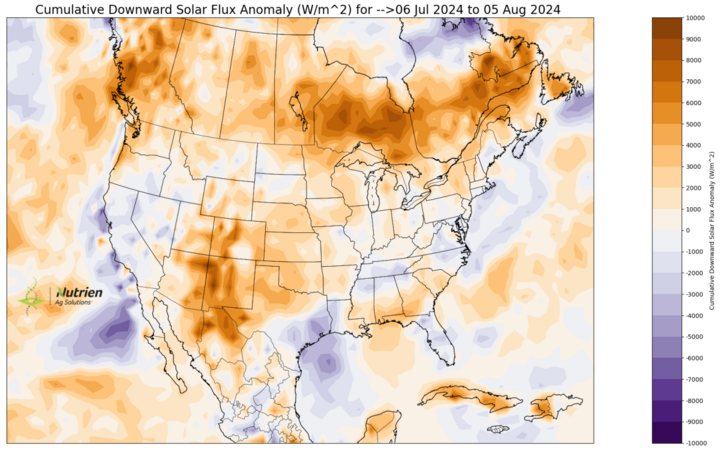
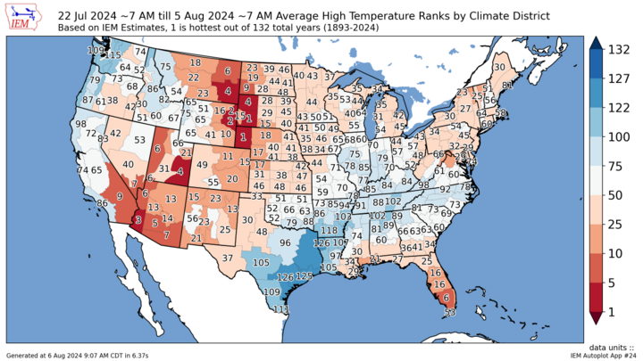
This decline in soil moisture and heat has taken a toll on pastures and rainfed crops and this water stress is starting to show up on VegDRI in areas like Hebron and Thedford. QuickDRI shows drier than average conditions across the vast majority of the state. In the Panhandle, the last two weeks featured the warmest average high temperatures on record (for the common period of July 23-Aug. 5) and pasture/range conditions are increasingly severe. VegDRI is doing a very good job of picking on this stress. The soil moisture percentiles are not doing a good job, but there is a possibility that the modeled leaf area index is simply too low to simulate plants taking up water in areas with the most severe stress. Just a hypothesis. Precipitation from AHPS also has not been perfect in that area either and what has fallen may not be infiltrating much due to hard pan soil conditions.
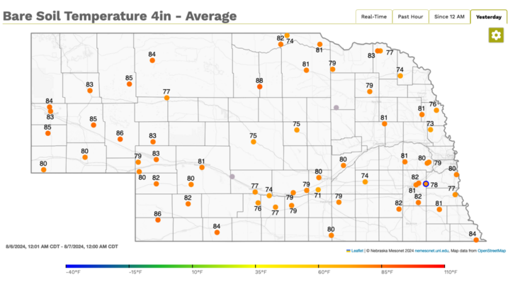
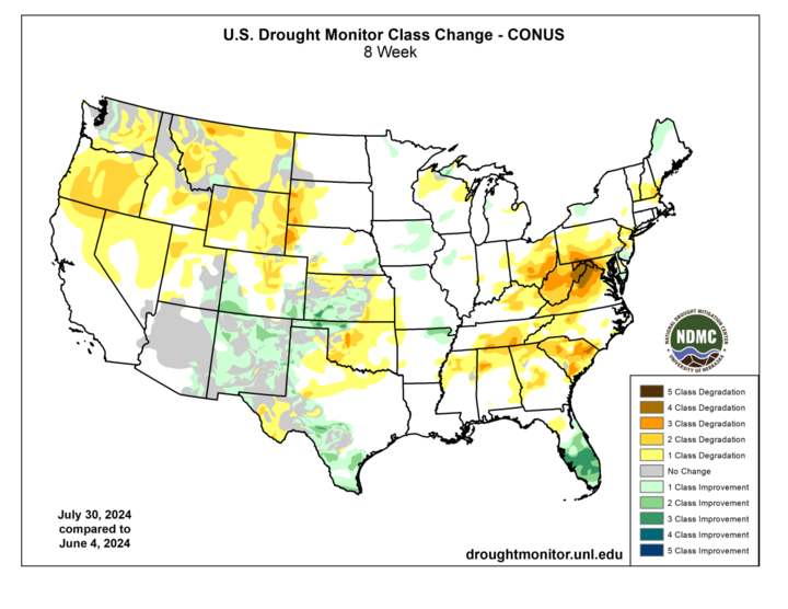
Regardless, this summer has featured a fairly intense flash drought in the Panhandle and above-average rainfall will be essential in the next several days to prevent conditions from deteriorating further. The latest U.S. Drought Monitor will be released Aug. 8 but additional degradation in that area is likely. Same story along the Kansas border. Four-inch soil temperatures are mostly in the 80s but those will be coming down in the coming days.
Temperature and Precipitation Summaries
Provided are pdfs of the maximum/minimum temperature, average temperature, number of days with maximum temperatures ≥95F, minimum temperatures ≥70F, degree days, and total precipitation for each Mesonet station over the period from July 28-August 3; a temperature summary for ASOS and COOP sites (July 28-Aug 3), a precipitation summary for ASOS, COOP, and CoCoRaHS sites (July 28-Aug 3). Also includes CoCoRaHS observer reports.
Below are the temperature and precipitation extremes around the state over the past week:
- Maximum Daily High Temperature: 106°F, Chadron
- Minimum Daily High Temperature: 71°F, Aurora
- Minimum Daily Low Temperature: 44°F, Harrison
- Maximum Daily Low Temperature: 78°F, Crete
- Maximum Weekly Precipitation: 2.53 inches, Bennington
- Minimum Precipitation: 0.00, Multiple Locations
