Showers and Thunderstorms
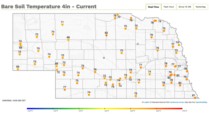
A quick look at satellite imagery reveals a strong area of low pressure at the surface in southeast Manitoba and a broad area of clouds along the cold front, which extends from North Dakota through the Nebraska Panhandle and down to New Mexico. Ahead of it, showers and thunderstorms are occurring across central Nebraska. Further east where skies are still mostly sunny, one more very warm day is in store. Portions of southeast Nebraska likely will top out in the mid-90s on Thursday, Aug. 29, perhaps even the upper 90s between Lincoln and Johnson. The western third of the state will see afternoon temperatures mostly in the 70s.
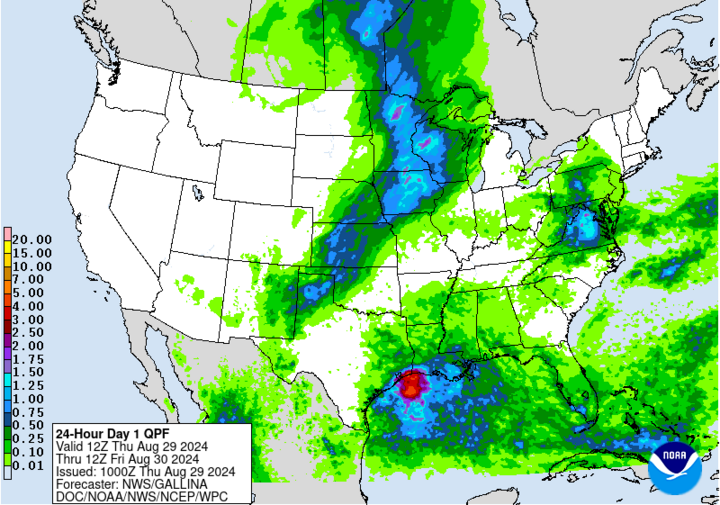
Showers and thunderstorms will continue the march to the east through the remainder of the afternoon and into the overnight hours (Aug. 29). Almost everyone east of North Platte should get a quarter of an inch and most of eastern Nebraska has a reasonable shot at picking up a half inch or more. Some areas in southeast Nebraska could certainly pick up over an inch, which would be very welcome. Light rain may still be present in far southeast Nebraska early tomorrow and clouds will gradually clear from northwest to southeast during the day tomorrow. Temperatures will be much cooler across the eastern half of the state Friday, Aug. 30, with some locations not making it out of the 70s. Areas with more sun are likely to get into the lower 80s.
Kickoff Temperatures
After a cooler start, temperatures will be above average Saturday afternoon, Aug. 31 across the state, with highs in the lower 90s in north-central Nebraska and 85-90 elsewhere. Temperatures in Lincoln will likely be around 86 degrees for the kickoff on Saturday with temperatures peaking in the upper 80s during the game. Winds are likely to be light from the south and full sunshine is expected. The good news is dewpoints will be lower (55-60), so humidity won't be a significant factor.
Football score forecast:
Speaking of the game, here are our predictions for the score:
Eric's prediction: Nebraska 45 UTEP 14
Camille's prediction: Nebraska 32 UTEP 20

September — Never Was a Cloudy Day?
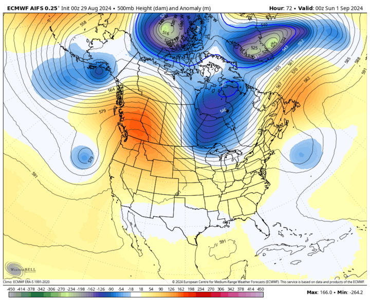
By late Saturday, a sharp trough will be centered over western Ontario. As this moves to the southeast, it will help drive another cold front into the area Saturday night into Sunday morning, Sept. 1, which will bring even cooler air to most of the state for Sunday. In contrast to today's front, the Saturday evening cold front should come through dry and the first few days of September look bone dry and about as cloud free as suggested in the 1978 Earth, Wind and Fire song.
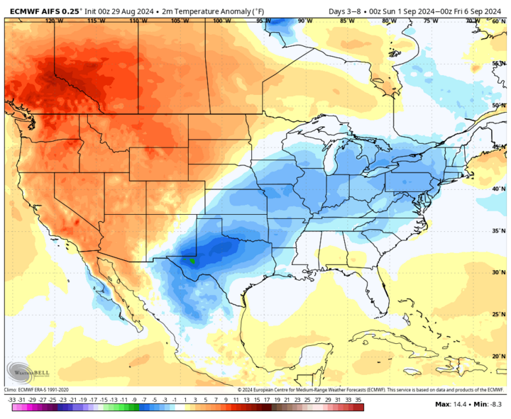
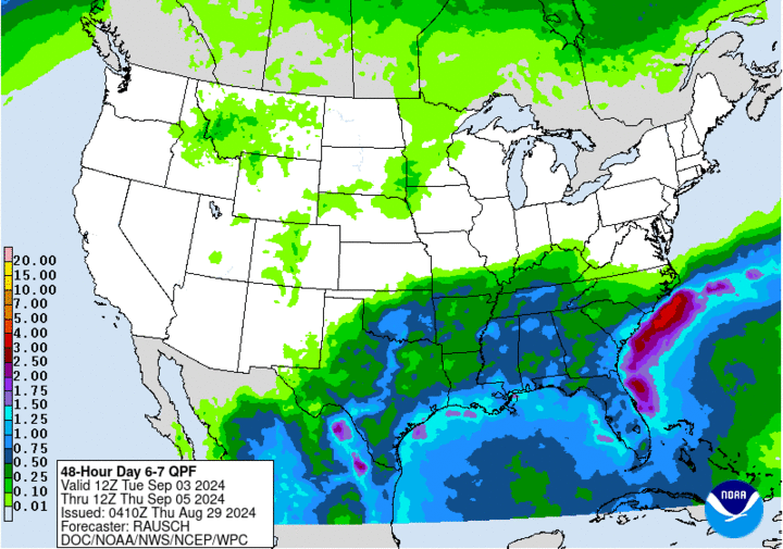
Cooler weather will hang around the eastern half of the state for the first half of the week but with western Nebraska in closer proximity to western ridging, that area will likely spend most of the week in the 80s and lower 90s. The WPC is quite bearish on precipitation for Nebraska and the entire north-central section of the U.S. next week. But there does appear to be a chance of at least one shortwave traversing the Northern Plains into the western Corn Belt later in the week that could help generate an area of showers and thunderstorms in central and eastern Nebraska. If moisture return is better than currently expected, then it's possible for some areas to pick up a half inch between Wednesday night, Sept. 4 and Friday, Sept. 6. Conditions currently look dry and pleasant for the football game next Saturday, Sept. 7 against Colorado.
Dry and Warm Favored in Extended Forecast
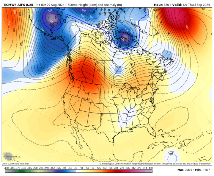
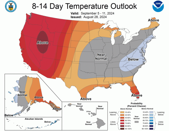
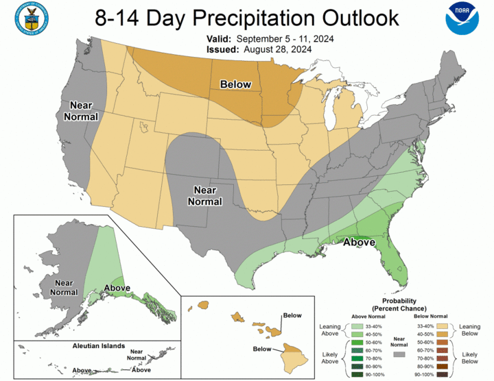
Models are fairly consistent in showing ridging persisting across the western U.S. and Canada going into the second week of September. This will likely keep much of the north-central section of the U.S. on the drier side and there is a possibility that a large area of the Corn Belt (including eastern Nebraska) will have minimal precipitation in the first half of September. Temperatures are likely to be above average statewide the second week of September as well, with some days likely running 10-15°F above average in the northern half of the state. The 90s aren't over with us yet and a quick look at the ECMWF weeklies suggest we are in for another September with temperatures running well above the 20th Century average and dry to very dry.
Drought Update
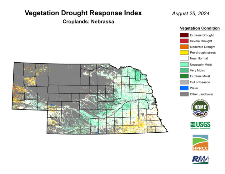
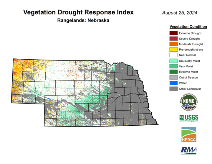
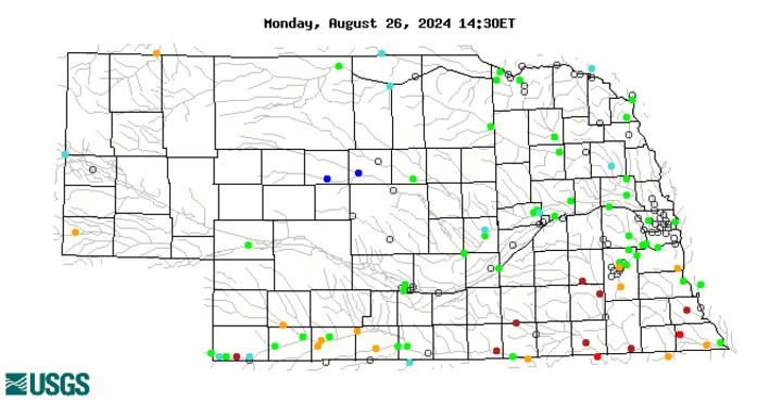
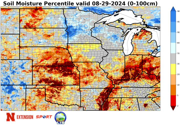
There is good news and bad news to report. The good news is the southern half of the Panhandle and the southwestern quadrant of Nebraska have seen additional improvements on the U.S. Drought Monitor after significant precipitation fell the middle of last week. Most of that area has had a wet August and indicators like soil moisture percentiles and VegDRI have shown improvements since late July.
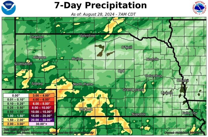
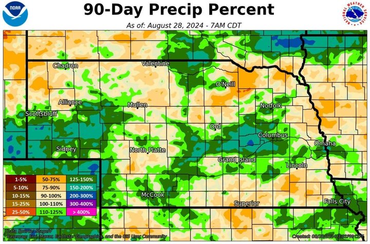
Elsewhere, the news is not so good. Most of the state has had a drier than average month with many areas in eastern and central Nebraska running 2-plus inch precipitation deficits so far this month.
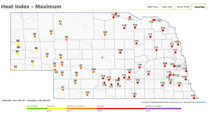
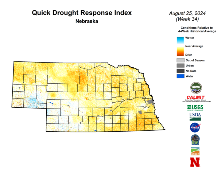
This was a bit less of an issue earlier in August when it was cooler, but the recent spell of heat has put additional stress on crops and accelerating the corn to an earlier maturity, especially in areas shy of moisture. The latest QuickDRI map shows a large area of the state has having a short-term dry signal, with more acute short-term dryness in southeast Nebraska and the northern part of the Panhandle. The rain over the next 24 hours will be especially critical for some areas of eastern Nebraska to still have a shot at higher rainfed soybean yields.
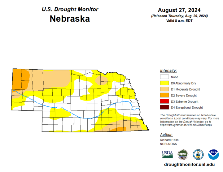
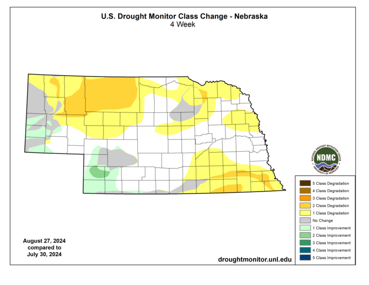
Over the past four weeks, we have seen a large chunk of the state with a 1-category degradation, and some places in north-central, northeast, and southeast sections of Nebraska have seen a 2-category degradation to moderate or severe drought. Roughly a quarter of the state is now in drought and there is legitimate concern that percentage could double over the next month if September is as warm and dry as what it appears it could be. This warm, dry signal is also apparent for a large section of the central U.S., including most of the Corn Belt.
Temperature and Precipitation Summaries
The following links contain the maximum/minimum temperature, average temperature, number of days with maximum temperatures ≥95F, minimum temperatures ≥70F, degree days, and total precipitation for each Mesonet station over the period from Aug. 18-24; a temperature summary for ASOS and COOP sites (Aug 18-24), a precipitation summary for ASOS, COOP, and CoCoRaHS sites (Aug 18- 24). Also includes Includes CoCoRaHS observer reports.
Below are the temperature and precipitation extremes around the state over the past week:
- Maximum Daily High Temperature: 107°F, Springview
- Minimum Daily High Temperature: 74°F, Elgin
- Minimum Daily Low Temperature: 41°F, Harrison
- Maximum Daily Low Temperature: 77°F, Hebron
- Maximum Weekly Precipitation: 2.26 inches, Naponee
- Minimum Weekly Precipitation: 0.00 inches, multiple locations
