Hot and Dry
I’m on travel currently, so this update will be shorter and without as many figures. The next few days will feature a bit of a reprieve from the heat as the ridge shifts westward and puts us under northwest flow aloft. This will bring down temperatures into the 80s and lower 90s, and in the eastern half of the state, it will bring lower humidity levels. With the lower humidity levels, temperatures will be able to drop more at night than they have been the last several days. Expect overnight lows the next few days to be in the 60s in eastern and south-central sections of the state, and the 50s elsewhere. This is good news for crops that need a break and for anyone out of power after yesterday's storms.
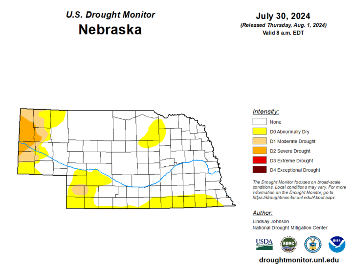
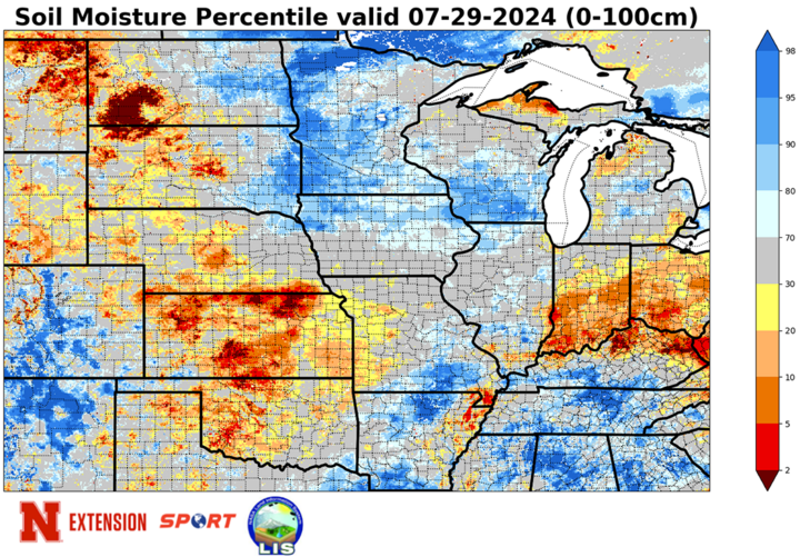
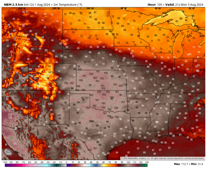
The heat will be back by the end of the weekend, with temperatures getting into the 90s statewide, and temperatures over 100 possible in parts of western and southern Nebraska. Heat will peak Monday with temperatures over 95 common and lower 100s likely closer to the Kansas border. Some precipitation will be possible in western Nebraska this weekend, but not everyone will pick up beneficial moisture. Remainder of the state should remain dry through at least Monday night, which will not help areas that are seeing drought conditions worsen or have been abnormally dry in recent weeks.

A Change Would Do Us Good
To paraphrase a Sheryl Crow song from the ‘90s, we will need a change next week to put the kibosh on a larger section of the state going into drought or abnormal dryness on the U.S. Drought Monitor as we head deeper into August.
Thankfully, it appears that a big change is indeed coming next week in the form of cooler temperatures — perhaps much cooler temperatures — and increased chances for widespread precipitation. A front should pass through the state by Tuesday, Aug. 6, which will start the downward trend in temperatures. Some storms will be possible from in central and eastern Nebraska later on Monday into Tuesday, but chances are better to our north and east.
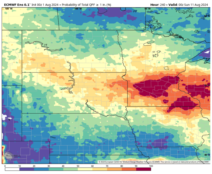
Later in the week, there will be additional shortwave energy coming into the Northern Plains and Western Corn Belt at regular intervals. Translation: Starting on Wednesday, Aug. 7, there will be good chances of showers and thunderstorms almost every day through the first part of the week after next. Chances for 1-plus inches of moisture next week are the best they have been for the state since early July, and over the next 10 days, there is a reasonable chance of 2-3 inches across central and eastern Nebraska. Hopefully, the rain comes without the 70-100 mph winds that blasted areas in eastern Nebraska Thursday afternoon. Right now, the SPC does not have our area in a severe risk but pay attention to the forecast.
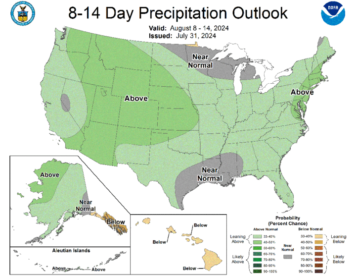
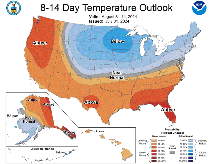
By next weekend, the flow will be highly amplified, with strong ridging over northwestern Canada and deep troughing over the north-central U.S. This will lead to an extended period of cooler weather across the middle of the U.S. and there will be likely be days with highs below 80 between Aug. 7 and Thursday, Aug. 15. The CPC shows cooler and wetter than average favored in the eight- to 14-day outlook and the global models are getting more bullish on precipitation across the state, particularly in the eastern half of the state. So, it is increasingly likely that the heat will be on an extended leave of absence starting early next week — good news for all of us.
