Record Warm and Wet
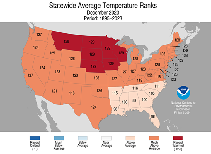
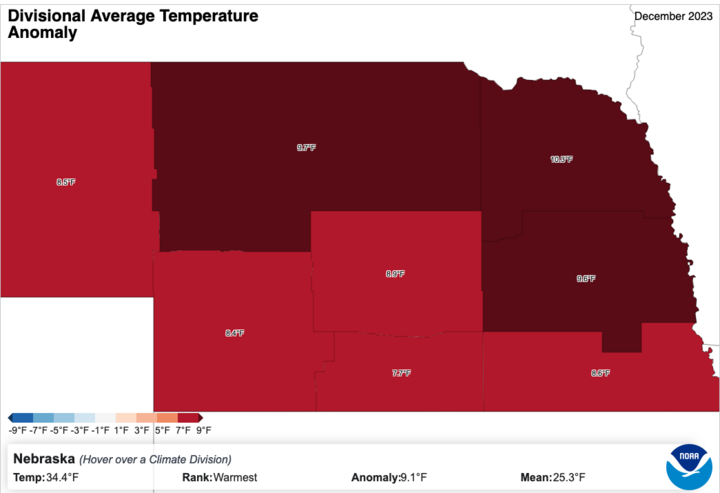
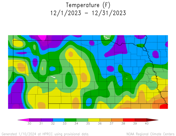
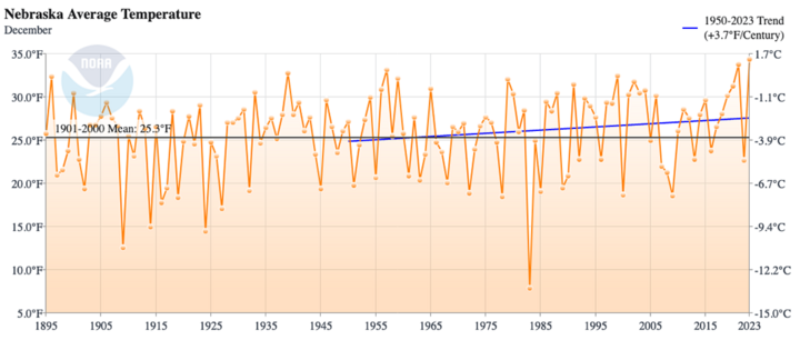
The statewide average temperature of 34.4°F made December 2023 the warmest December on record in Nebraska, beating the 33.8°F we set two short years ago (2021). Most other north-central states also had a record warm December, as did a majority of the climate divisions in the state. Anomalies were strongest in northeast Nebraska, where temperatures were a record 10.3°F above the 20th Century average, and all climate divisions were at least 7.5°F above average. The mild temperatures were strongly tied to the peaking El Nino.
For the majority of the month, the polar jet stream remained well to our north and there wasn't much truly cold air to speak of unless you went well into Canada or Alaska. (How times have since changed!) The mild temperatures in December 2023 were also part of a trend toward milder Decembers — almost like having a second November in many recent years.
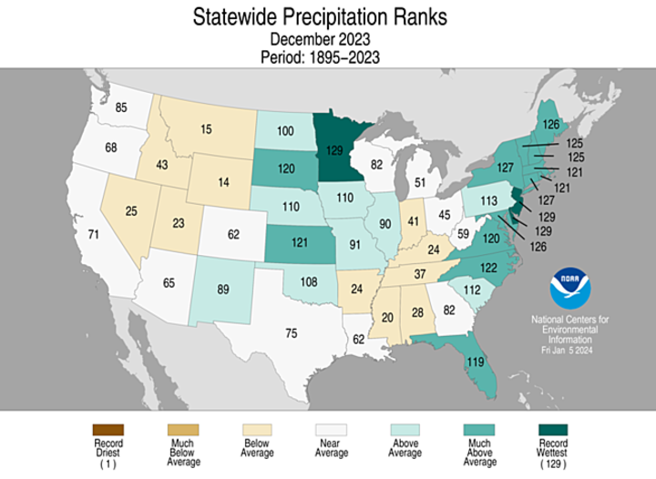
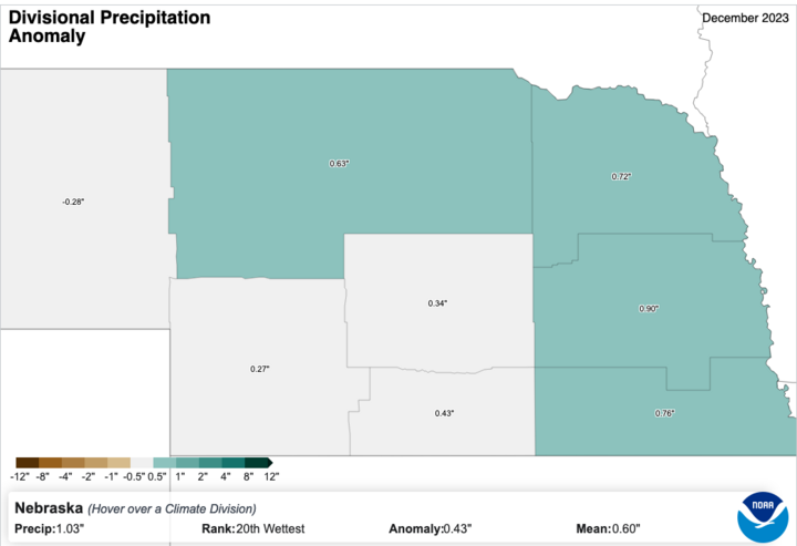
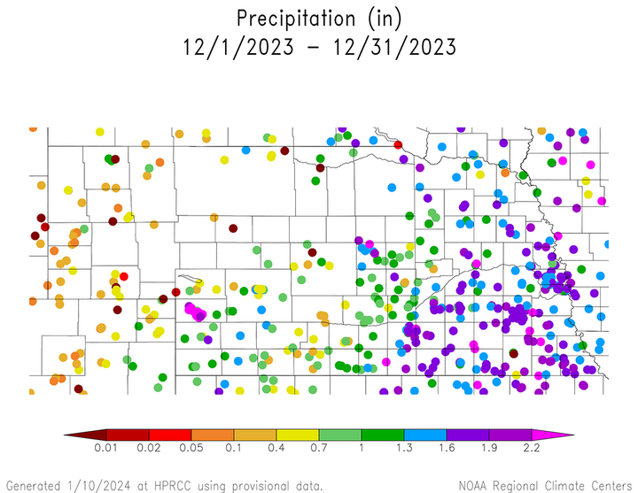
Precipitation in the second half of the month did push the statewide average to 1.03 inches, good for 20th wettest December and a continuation of a trend toward wetter Decembers. Only the Panhandle was drier than average in December.
In the first half of the month, sunshine was generally plentiful, temperatures were pleasant and precipitation was infrequent. That began to change around the middle of the month as we entered a more active pattern settled in with southwest flow, which culminated in a major storm around Christmas that affected the entire state. In that storm, a significant portion of the state picked up beneficial moisture in the form of rain and snow. Much of eastern and parts of central Nebraska picked up over an inch of liquid water equivalent and isolated areas picked up close to two inches. With the unusually warm temperatures in December, the ground remained unfrozen, which meant that a lot of the rain went into the ground and helped soil moisture. Snowfall with the Christmas storm was highest in northwest Nebraska near Chadron and there were pockets of northeast, north-central and southwest Nebraska that picked up eight to 12 inches.
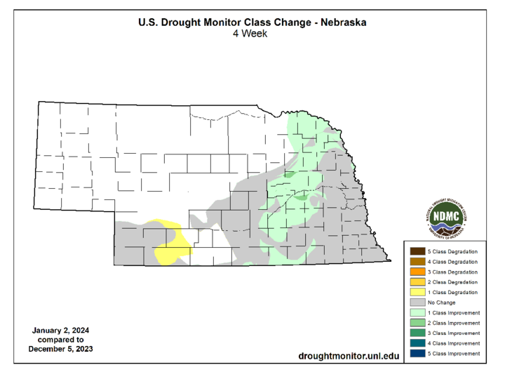
The beneficial moisture in eastern Nebraska also led to some improvement on the U.S. Drought Monitor, with much of the exceptional drought being upgraded to extreme drought after the Christmas storm. Additional drought improvement was noted in northeast Nebraska, but a small pocket of southwest Nebraska near McCook was downgraded to abnormally dry during the month of December.
