Just the Numbers
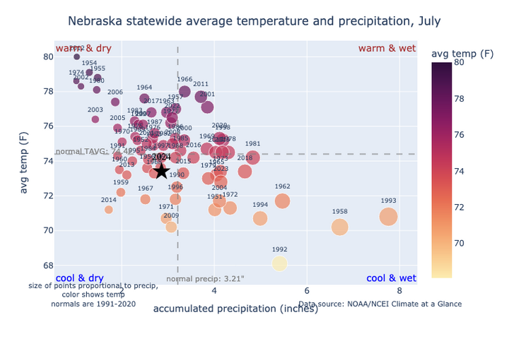
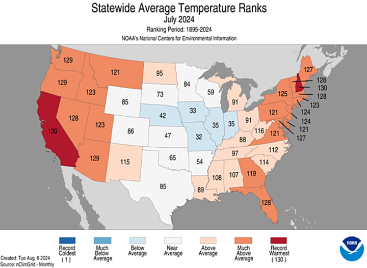
The statewide average temperature of 73.4°F and average precipitation of 2.86 inches were both slightly below the 20th Century average. It is the first month with a statewide below-average monthly temperature since January and it's the first month with below-average precipitation statewide since March. It was the second consecutive July with below-average temperatures, but it was well shy of the coolest July on record of 68.1°F set back in 1992.
Wet for Some, but Dry for others
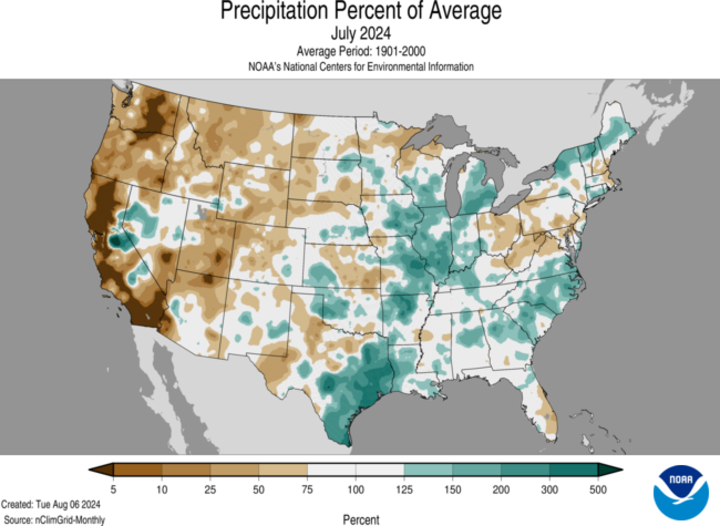
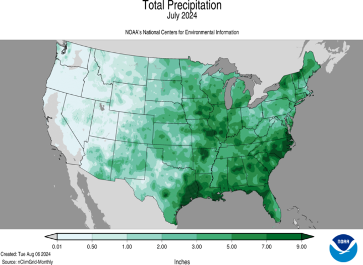
While precipitation statewide was below average, precipitation was (as is often the case) not evenly distributed. The I-80 corridor from Lexington to Omaha was generally above average, with parts of east-central Nebraska finishing well above average. But most of that precipitation fell in the first week of the month, with areas between Seward and Omaha experiencing some flooding after several inches of rain in the overnight hours between July 1-2.
After the first week of the month, precipitation was infrequent across the state with many areas having at least one 10-day stretch with no measurable precipitation. In the western and north-central sections of the state, precipitation was more marginal in early July and spotty thereafter. The southern fringe of the state also picked up less rainfall the first week of the month and had less from a thunderstorm complex that marched through areas of central and eastern Nebraska on July 31. For much of the western Panhandle, it was a continuation of below-average precipitation that started in the spring and with significant heat late in the month, drought intensified as a result.
Severe Storms
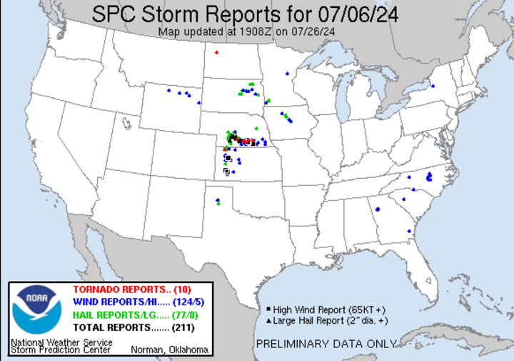
While the rain in early July was mostly welcome, the afternoon and evening of July 6 was rather destructive in parts of central Nebraska. Large hail caused severe damage to crops in Dawson, Gosper, Phelps, Buffalo and Kearney counties and pockets of other areas in the southern third of the state. Several tornadoes were also reported that afternoon and evening.
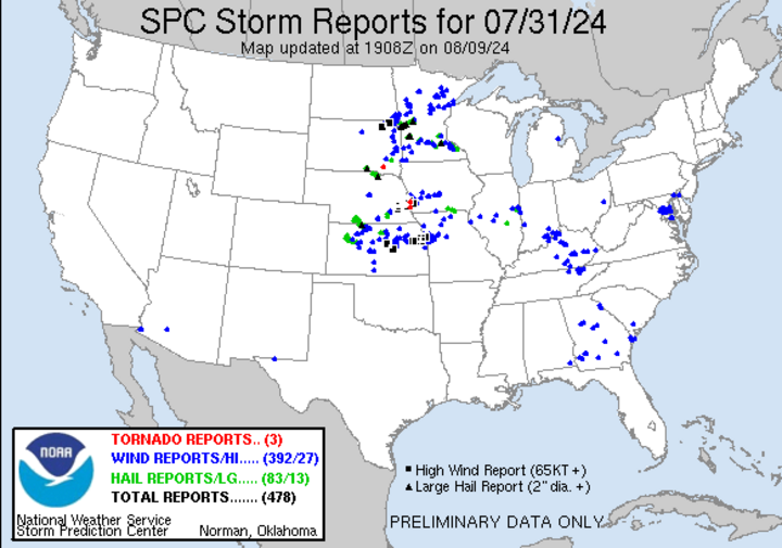
The afternoon of July 31 brought severe thunderstorms from south-central Nebraska to Omaha, with significant straightline wind damage in both the Lincoln and Omaha metro areas. Winds gusted to 83 mph at the Lincoln airport and to 92 mph at Omaha's Eppley airport. For the Omaha Public Power District, it was the largest power outage on record, breaking the record set in July 2021.
Extremes and Mesonet Summaries
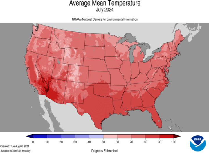
This link contains Nebraska Mesonet station summaries, temperature/HDD/CDD, and precipitation summaries for stations around the state. Includes CoCoRaHS observer reports in the precipitation summary. Below are the temperature and precipitation extremes around the state in July.
- Maximum Daily High Temperature: 106°F, Chadron Municipal Airport
- Minimum Daily High Temperature: 66°F, Crofton
- Minimum Daily Low Temperature: 36°F, Harrison 20 SSE
- Maximum Daily Low Temperature: 78°F, Falls City 4NE
- Maximum Monthly Precipitation: 9.47 inches, Davey 1.2 NNW
- Minimum Monthly Precipitation: 0.20 inches, Orchard 9 NNE
