The amount of available climate data useful for modern agriculture continues to grow, and software applications are now putting it in reach for producers. A recently released app called CliGrow, developed by the High Plains Regional Climate Center, helps producers estimate crop maturity using a field’s historical climate data.
For locations in the lower 48 states, CliGrow shows the 30-year average for growing degree days, a measure of temperature useful to estimate a range when a crop may gain maturity in a new growing season.
“Our primary objective is to provide value-added services to climate data,” with CliGrow the latest example, said Warren Pettee, an applications programmer who developed the CliGrow software as part of his work with the High Plains Regional Climate Center, housed in the University of Nebraska–Lincoln’s School of Natural Resources.
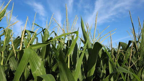
Producers can access CliGrow online and plug in specific field locations. Estimates are available for 10 crops — corn, soybeans, wheat, sugar beets, dry beans, sorghum, alfalfa, potatoes, sunflower and grass — with more to be added.
The software creates a graph showing the 30-year average for growing degree days, as well as historical data on the first and last frost for a given location. Pettee said producers can save a link to the graph and revisit the field’s up-to-date estimate at any time.
The center has posted a YouTube video explaining the CliGrow functions for producers.
The university has long-standing institutional partnerships on the climate front. The School of Natural Resources provides a home for the High Plains center, as well as the National Drought Mitigation Center and Nebraska State Climate Office.
Staff at the High Plains center had long aimed to create a service such as CliGrow as the amount of available climate data increased and the center developed new ag-focused software projects and refined them, Pettee said.
“There’s always been this dream of having nationwide applications where you can click anywhere and get information about the location you click on,” he said.
Climate center staff note that many factors can affect a crop’s maturity in a given season, but temperature is a major one, making CliGrow a useful tool, Pettee said.
The National Oceanic and Atmospheric Administration funds the High Plains Regional Climate Center, one of six such centers covering the United States. The six-state region for the High Plains center includes Nebraska, Wyoming, Colorado, Kansas, North Dakota and South Dakota.
In addition to applied climate research in cooperation with Nebraska U, the High Plains center provides climate-related services that include customized access to data; summary maps incorporating real-time data; monthly, seasonal and annual summaries of climate conditions and impacts; drought monitoring information; and agriculture-related tools for water resource management.
The regional climate center program is intended to strengthen local and regional connections, Pettee said, serving as “the boots on the ground to work with people to figure out ways we can use climate data to help inform decisions.”
