Astronauts, space and rockets may be the first things that come to mind when thinking about NASA, but in reality, Earth is the planet that NASA studies most. NASA’s focus on collecting data to improve life on Earth brought a team from NASA’s Earth Sciences division to Nebraska farms as part of their “Space for Ag” tour.
The tour on Aug. 22-23 took the team to farms in Mead, Giltner and Lexington, Nebraska to learn about the challenges facing farmers today. All of the farmers on the tour routinely evaluate new technologies and tools on their own operations by partnering with the Nebraska On-Farm Research Network, making them ideal candidates to share with NASA about what technologies they wished were available.
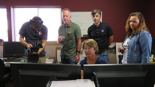
The tour also included a roundtable discussion with guests in attendance representing the Nebraska Corn Board, Nebraska Corn Growers Association, neighboring farmers and local extension. By putting all these Nebraskans together with NASA, great conversation was had to help direct the NASA team in ways they can further support the needs of the agriculture industry.
Extension Educator Laura Thompson chats with RFD-TV about NASA's visit to Nebraska farms.How in the World?
NASA has a long relationship with agriculture. Several tools that are familiar to producers are collected from Landsat-9, one of NASA’s longest running satellite missions in partnership with the U.S. Geological Survey. This data is used in the U.S. Drought Monitor and WASDE report.
While many of NASA’s tools focus on a global or regional scale, they are also working on developing tools that have impact on local decision-making. These tools are all freely available to the public.
The NASA scientists on the tour were interested in learning from farmers about how they currently make management decisions, what technologies they use and what tools they wished they had.
“A big part of this trip for us is listening and learning,” said Forrest Melton, one of the NASA scientists on the trip.


Knuths’ Operation
Kerry and Angela Knuth, owners of Knuth Farms, welcomed NASA’s Earth Science Division onto their fifth-generation family farm. The Knuths embrace innovation in order to successfully manage 2,300 acres of corn, soybeans and wheat, along with non-GMO and organic crops.
The farm is working towards increased efficiency by leveraging their precision agriculture technologies, testing remote sensing techniques with the On-Farm Research Network, and through simple trial and error. The Knuths routinely check satellite imagery of their fields to look for problem areas or spot differences between fields. But, they noted, there is a lot of room for improvement by better combining the imagery with other key sources of data on the farm to support their decision-making.

Hunnicutts’ Operation
This sentiment was echoed by Brandon and Zach Hunnicutt of Giltner, Nebraska. Like the Knuths, the Hunnicutts already have access to satellite data and use other technologies such as soil moisture probes. However, they noted that the technologies they are using sometimes produce as many questions as answers.
For example, the Hunnicutts have placed soil moisture probes in specific locations within their fields to help them make informed management decisions. But the Hunnicutts wonder if the information is really representative for the whole field.
That’s where tools from NASA might enter the equation.
Satellite imagery collected on a frequent basis is being used in tools like OpenET. This tool provides frequent evapotranspiration data on an individual field basis, helping producers optimize water use and make data-driven decisions about irrigation. By coupling tools like OpenET with the moisture probe data they are already collecting, the Hunnicutts may be able to further optimize their water use and efficiency.
Baties’ Operation
The final stop on the tour took the team to the Don and Barb Batie farm near Lexington, Nebraska. The Baties welcomed NASA to their farm, sharing their perspective on how the agricultural industry has changed during their farming career.
Like the Knuths and Hunnicutts, the Baties are engaged in finding new solutions and efficiencies for their operation by partnering with Nebraska Extension. The Baties have conducted 17 on-farm research studies in the past five years, investigating tools like crop model-based decision support systems to integrate crop management, weather and soil information for variable-rate, in-season nitrogen management.
Technology has played a key role in allowing the Baties to evaluate new tools and products.

“The studies we do would not be possible without technologies like yield mapping and variable-rate equipment allowing us to use prescriptions to put in studies,” Don said.
They have also worked to utilize their past geo-spatial yield history in conjunction with satellite imagery to make better informed management decisions.
Accurate and Fast Prediction is Key
NASA’s Earth Sciences Division Director Karen St. Germain asked the farmers on each tour stop, “What information do you wish you had?” Collectively, the Knuth family agreed that as they move towards sustainable agriculture practices, they need better imagery to help apply fertilizer.
“We need something that will work quicker and more accurately than biomass samples,” Angela Knuth said.
To become more sustainable and save money, farmers want to decrease fertilizer waste. Right now, the Knuth family is very comfortable using remote sensing to see where they are overwatering. Applying fertilizers with remote sensing is something that becomes a little more uncertain. This might be something that with satellite imaging, NASA could help with.
Don Batie expressed challenges that the other farmers on the tour mentioned, noting that ideally, each morning he would be able to sit down with his tablet or phone and see new satellite images of all his fields, along with a dashboard of analytics showing metrics related to water status, nitrogen status or other stressors in his fields. He also emphasized the importance of timeliness. In order for him to be able to act on the information, he would like to see imagery and analytics within one or two days of the image being acquired.
Angela Knuth echoed the desire for more information to support decisions, saying, “we are looking for tools and information that will help us make informed decisions and not simply tell us what to do.”
What’s in Store?
“NASA can develop tools, but we really don’t know how they will work at the ground level,” St. Germain said. “Overall, we want to make new partnerships.”
That’s why the opportunity to hear directly from farmers was so important. The conversations that happened in the field allowed farmers to provide input that may help NASA refine their existing tools and inform what tools get developed in the future. By involving farmers in the conversation and better understanding their needs, NASA will be able to better design and develop capabilities that are truly “out of this world.”
