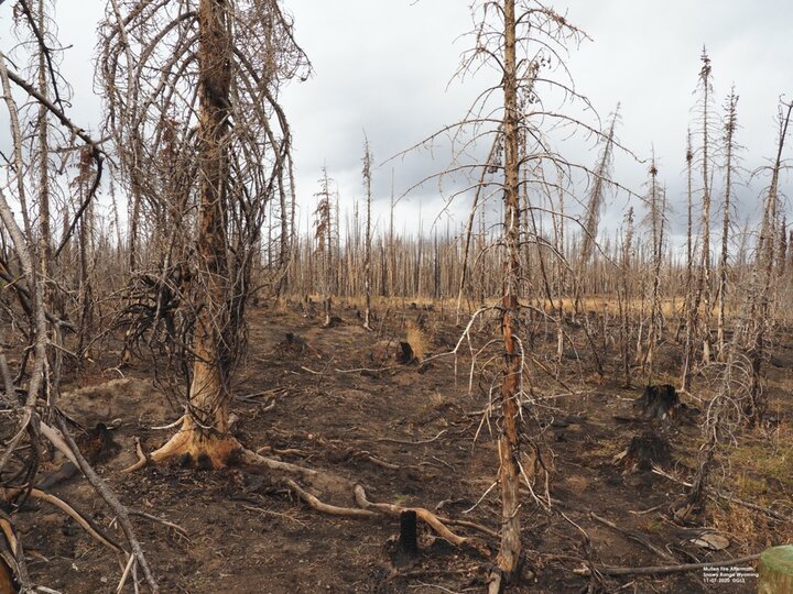
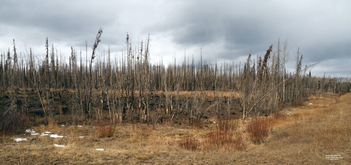
The wild fires that took place late this summer and early fall, located in Colorado and Wyoming, are almost completely controlled, but they still might affect agriculture throughout Nebraska during the next growing season and for years to come.
Why? Both of these fires, as a whole or in part, affect the Upper North Platte River watershed. The Cameron Peak fire was located west of Fort Collins, CO, and the Mullen fire was located west of Laramie, WY. The causes of the fires are unknown at this time.
Part of the Cameron Peak fire area takes in a portion of the headwaters of the Laramie River, which is a major tributary to the North Platte River. The remainder of the fire area is part of the South Platte River watershed. This fire started Aug. 13, 2020, and encompasses approximately 208,913 acres or 326 square miles. It was 92% contained as of Nov. 9. The fire is located in the Arapaho and Roosevelt National Forests.
The entirety of the Mullen fire affects the headwaters of the North Platte River watershed. This fire started Sept. 17, 2020, and encompasses approximately 176,878 acres or 276 square miles. It was 97% contained as of Nov. 9. The fire is located in the Medicine Bow and Routt National Forests.

Most of Nebraska was affected by the smoke from these fires, some days were worse than others. In the southern Panhandle, the air quality was very poor and visibility was limited to 5 miles or less on some days. Winds as high as 70 mph helped spread the fire in the rugged terrain already plagued by drought conditions and significant timber beetle kill from several years ago.
The fire crossed over into Colorado on Sept. 26. Burn scars from previous fires helped slow the fire’s progress and on Oct. 24 and 25, up to a foot of snow in the area helped significantly to reduce the fire spread. The fire boundary map would include approximately 40 percent of the southern portion of the Medicine Bow Range mountains, between Wyoming Highway 230 on the south and Wyoming Highway 130 on the north. All Forest Service roads within the fire area remained closed as of Nov. 9.

Just because there are a large number of acres indicated, not all of these acres are affected. The entire area is not burned to a char. The fire was spotty leaving some areas not affected and others mostly burned up. But there is still a large amount of beetle kill timber across the region and the potential for more wild fires is there.
The Potential Effect of the Fires on Nebraska
The Upper North Platte River watershed headwaters is located in north-central Colorado, close to Walden, CO. The Sierra Madre mountain range is on the west side of the headwaters and the Snowy Range mountain range is on the east side. Snowmelt from both of these mountain ranges together contribute approximately 75 percent of the water flow in the North Platte River. The North Platte River contributes a significant amount of water for irrigation, recreation, wild life habitat and municipal use across the states of Nebraska and Wyoming.
The fires’ effect on water supplies in the coming years will depend on the amount of snow fall and snowpack received in the watershed during the winter and early spring. There may be slightly higher incidences of sediment runoff in isolated areas where there is little or no ground cover due to the fire. Any sediment will be contained in the seven reservoirs and regulatory dams located in Wyoming on the North Platte River. Faster snowmelt runoff in the spring could occur due to an increase in the amount of sunlight hitting the slopes and warmer spring temperatures. Faster runoff would fill the reservoirs quicker, but if the U.S. Bureau of Reclamation who manages the reservoirs does not initially have sufficient reservoir storage space, they would have to release or move water through the system and could result in some low-land flooding along the river. But all of this is just a wait-and-see and will depend on what happens next spring.
Additional Information
For more information on these fires, visit https://inciweb.nwcg.gov/incident/maps/7208/
For information on the North Platte River and the irrigation projects in Nebraska and Wyoming, visit the slideshare presentation on the University of Nebraska Panhandle Research, Extension and Education Center website.
