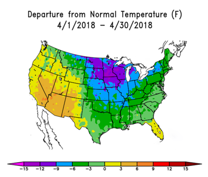
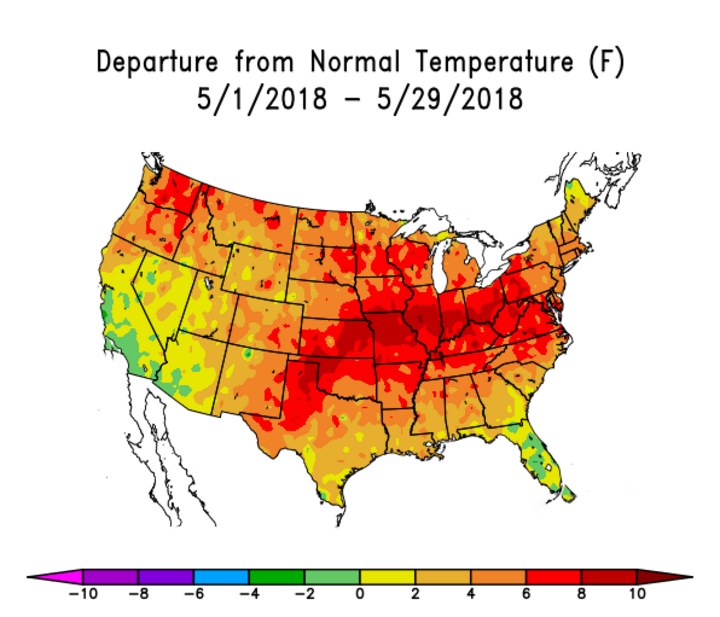
What a spring this has been in Nebraska. After the second coldest April on record dating back to 1895, May statewide temperatures are poised to rank in the top 10 warmest on record. May average temperatures haven’t been this warm since 2012. In addition, precipitation has been significantly below normal the past 90 days across most of east central, south central, and southeast Nebraska and concern is building for a potential worsening of drought conditions this summer.
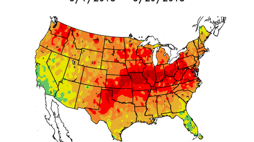
Al Dutcher gives his weekly forecast on Market Journal.The latest U.S. Drought Monitor is beginning to reflect the seriousness of the dry weather impacting the central Plains. Moderate drought conditions have spread northward out of Kansas and now encompass portions of southeast Nebraska. The most concentrated area of drought lies from Nuckolls through Saline counties.
Our saving grace from more widespread drought has been the copious precipitation that has fallen north of the I-80 corridor in central and western Nebraska. Additionally, the slow start to our warm season row crops means crop-water demand is averaging a third to half of potential evapotranspiration (ET). Therefore, it is still possible to make up for the accumulated precipitation deficits incurred this spring, but time is rapidly running out before daily crop water demand exceeds normal daily precipitation.
Randy Pryor, extension educator in Saline County, reported that their ET gauge dropped 2.6 inches in 8 days, or an estimated 2.3 inches in one week. These high ET values reflect the intensity of recent record-setting heat. They also underscore our concern for potential crop stress if this heat continues and the southern third of the state continues to miss precipitation events.
Forecast
In the short term, numerical models indicate that the battle between the Hudson Bay upper air low and southern-southwestern U.S. high pressure will continue into the foreseeable future. The central Plains appear to be on the southern periphery of this battle zone and will likely see several convective episodes over the next two weeks. Unfortunately, each push of cool Canadian air is quickly replaced by heat surging northward from the southern Plains.
The first episode is expected this Friday evening (April 1) through Saturday morning as a strong cold front pushes through the state. Heavy rainfall and localized damaging hail is expected with 1-2 inches of rain along the I-80 corridor of central and eastern Nebraska. After a brief cool down this weekend, heat begins to build early next week with a return to high temperatures over 90°F. Isolated to scattered thunderstorms are possible Monday through Wednesday as energy moves around the periphery of the northward-building high pressure ridge out of the southern Plains.
Considerable uncertainty exists for next Friday through the following week as another upper air low moves across the Northern Plains and brings another brief cool down as early as June 11 and as late as June 13. This would currently represent the second most significant chance for widespread moisture statewide after the event projected for this Friday and Saturday.
Unfortunately, medium range and long range models don’t offer any strong moisture signals for the Central Plains. The latest two-four week forecast issued by the Climate Prediction Center on May 25 centered on the final two weeks of June, suggesting above normal temperatures for the southern two-thirds of the country, including Nebraska. There is no clear temperature signal for July and August in the CPC extended outlooks, although above normal temperatures are depicted for the southern half and western third of the U.S.
What is clear is that the snowpack across the southern half of the Rockies disappeared rapidly during May. The combination of a poor snow year and above normal May temperatures led to this quick demise and may be responsible for intensifying the heat across the Southern Plains. Snow survey data from the Natural Resource and Conservation Service indicates snow levels below 10,000 feet are minimal from southern Colorado through central Wyoming.
Drought Concerns Loom for Nebraska
This will likely support the CPC temperature outlook for this summer across the southern and western U.S. It also increases the likelihood that the heat that has developed across southwestern and south central U.S. will build northward. Therefore, I will likely recommend at the state Climate Assessment and Response Committee meeting June 4 that a drought alert be issued for Nebraska.
