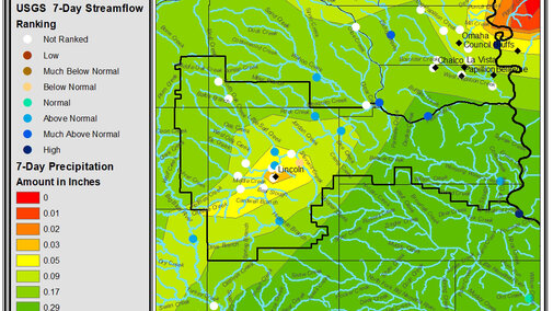
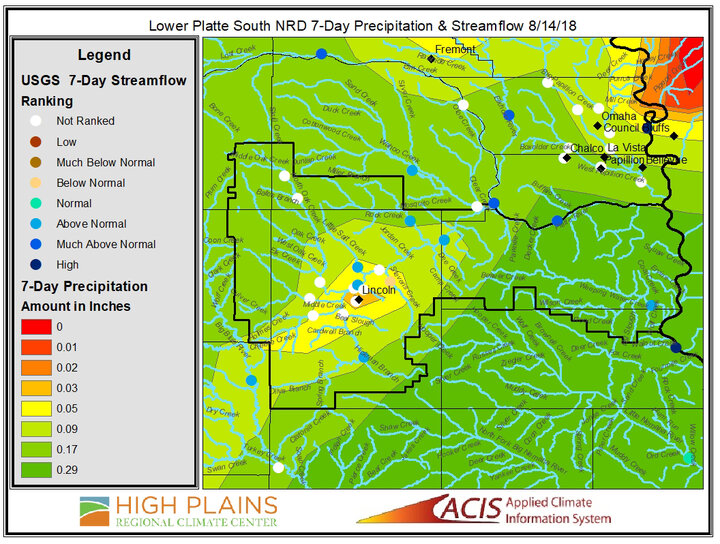
Calling all GIS users! If you use GIS to help with your farm management decisions, you may be interested in learning about the new shapefiles being offered by the High Plains Regional Climate Center (HPRCC). If you know of the HPRCC, chances are, you are familiar with their best known product – the rainbow-colored precipitation and temperature maps called ACIS Climate Summary Maps (Figure 1). These maps have been produced for 15 years, with few changes, and are featured in the CropWatch Weather section.
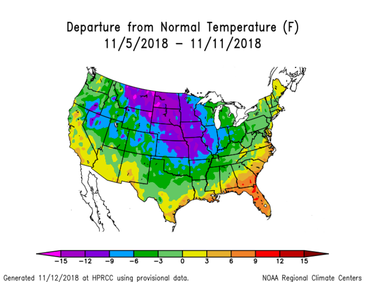
Now we have added a major new feature allowing you to download individual shapefiles for over 500 map options (Figure 2)! To get started, you can access the HPRCC GIS Portal at https://hprcc.unl.edu/gis/. A tutorial can guide you through the steps for various options.
For more information, please contact: Natalie Umphlett, HPRCC regional climatologist, numphlett2@unl.edu
The HPRCC is a part of the School of Natural Resources at the University of Nebraska-Lincoln. This project was funded by the National Integrated Drought Information System (NIDIS).
