Widespread and sometimes localized heavy rainfall the past two weeks has led to a reduced drought signature in the Nebraska portion of this week's U.S. Drought Monitor. Precipitation totals of 4-9 inches were common across the Sandhills east of Mullen and south of the Niobrara River valley. Further south, rainfall reports of 2-5 inches in the past week were common along and north of the I-80 corridor from Kearney to the Iowa border.

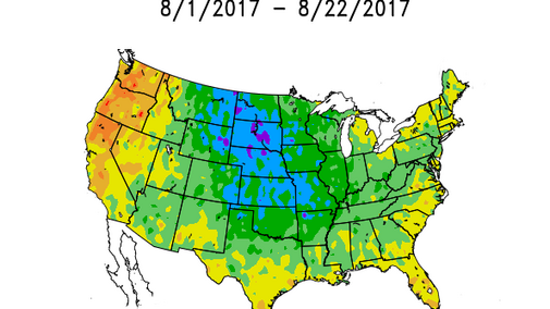
Most of the current drought area is in extreme northeastern Nebraska westward through Valentine and north of the Niobrara River. Two additional small pockets of moderate drought are in the southwest corner of the state and in Cheyenne and Kimball counties in the Panhandle (Figure 1). The lingering drought based on precipitation reports is in the 90-120 day time frame, as shorter term indicators are now normal to wet statewide.
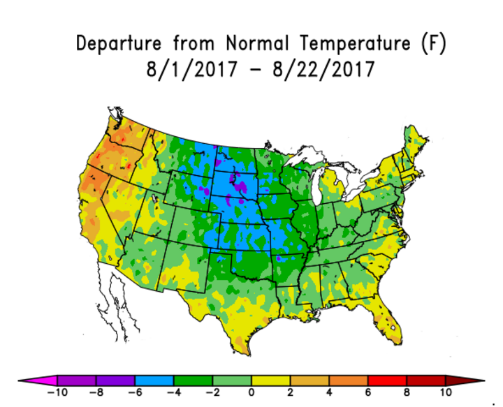
Coupled with the recent moisture, unusually cold conditions have developed during August and are widespread across most of the Corn Belt (Figure 2). The most significant departures are found in the western Corn Belt with temperatures averaging 4-6 degrees below normal since the beginning of August. A few pockets of temperatures 6-8 degrees below normal are located across the Dakotas. Departures of 2-4 degrees below normal extend across the central and western half of the eastern Corn Belt.
These cool conditions with recent rains should be beneficial for corn grain-fill and soybean pod-fill. They won’t undo any pollination issues, but will reign in further crop deterioration related to moisture shortfalls. The big question that remains to be answered is whether the corn crop can reach black layer without frost damage.
Short-term models all agree that these cool conditions will continue through the end of August in the western Corn Belt. Average temperatures are not expected to be as persistently cold, with departures easing into the range of 1-3 degrees below normal. The Great Lakes region and bordering states are likely to experience temperatures 2-6 degrees below normal.
Precipitation chances appear to be greatest this weekend for Nebraska, followed by a drier pattern through September 2. A brief period of above-normal temperatures is projected for the first two to three days of September before another cold front pulls cool Canadian air into the western Corn Belt. If this materializes, another round of moderate to heavy rainfall is likely September 4-6.
Models for September 7-9 indicate another brief warm-up before another strong cold front pushes south out of the Alberta Prairie Province region. Although this is the end of the model period and is always suspect for accuracy, my concern is that the models are aggressive with these cold air pushes into the U.S. and frost/freeze development will have to be watched closely.
These are not the conditions necessary for late-planted and replanted corn from the northern half of Nebraska east through Ohio to finish the growing season. Even with normal temperatures in September, many of my colleagues have indicated that a freeze before the end of September would impact these late-maturing crops.
A repeat of last September’s above-normal temperatures would certainly alleviate these concerns. Unfortunately, I see no such hint of consistent above-normal temperatures developing through the first third of September. There is likely going to be a lot of angst developing in regards to temperature trends as we officially close out August and begin to think about the fall harvest.
Impact from Hurricane Harvey
I will also remind our readers that we are now in the heart of hurricane season and Hurricane Harvey is expected to impact the northwestern Gulf of Mexico region this weekend with up to 30 inches of moisture along the Texas coast through next Tuesday. The latest model output slowly moves Harvey into the southern Mississippi Region by Aug. 30, then lifts the system through the eastern Corn Belt and merges it with the Great Lakes upper air trough. If this occurs, numerical models indicate exceptionally cold air will be pulled down from northern Canada on the backside of this upper air trough, possibly bringing freezing temperatures into the northern Mississippi Valley region as far south as central Minnesota and central Wisconsin. Because of the slow movement of this system, there is considerable uncertainty as to the current model projections.
If this model proves true, the trend of below normal temperatues for eastern Nebraska would likely continue through the first 10 days of September. With precipitation in these systems to be well above normal over the next month, harvest conditions — particularly in the eastern Corn Belt — could be a bit challenging, to say the least.
