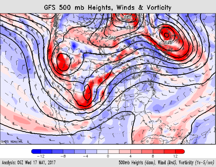
A very active weather pattern is currently impacting the central United States as a broad upper air trough over the western third of the country ejects northeastward toward the Great Lakes region. Severe thunderstorms developed during the afternoon of May 16 from Texas northward through Nebraska and dropped an extensive area of 1-3 inches from west central through eastern Nebraska.
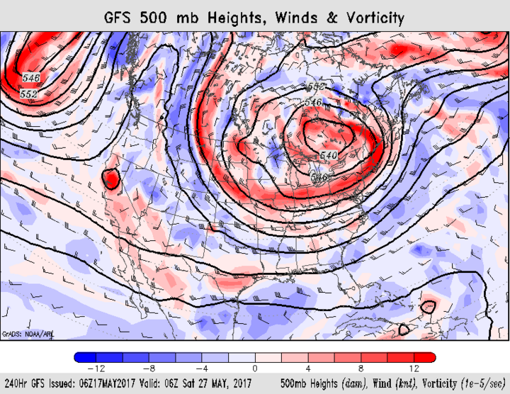
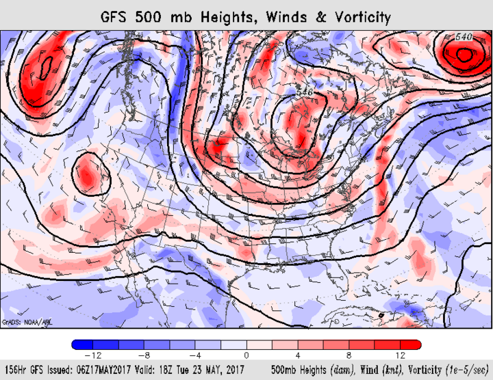
The first part of the upper air low responsible for this recent wave of precipitation is moved through Nebraska Wednesday with the main upper air low ejecting out of the western U.S. Thursday evening and pulling northeast on Saturday. The most recent weather models indicate that another round of heavy rainfall is likely for the eastern half of the state, but widespread severe weather is projected to be focused on eastern Kansas.


As this upper air trough stalls over the Great Lakes, unseasonably cold air will filter southward. Current model runs place the coldest air over northern Minnesota, Wisconsin, and Michigan. Nebraska will likely be on the western fringe of this upper air trough and precipitation will develop under a northwest flow regime. This upper air trough is projected to broaden and remain in place before weakening and moving east around May 28.
If this trough broadens further than is currently projected, cold air could impact northeast Nebraska. At this time no frost/freeze events look likely for us, but lows dropping into the upper 30s and highs in the 50s are possible mid next week. If the models are overly aggressive with this trough, temperatures will likely be 10-15 degrees warmer.
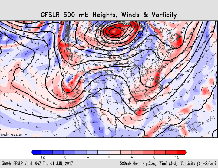
Looking at Figures 1-4, readers can see the projected movement of the western U.S. trough into its Great Lakes position, along with its eventual demise in May late. Any time we are in a northwest flow aloft, weather models have a much more difficult time handling individual waves moving on the backside of the upper air low.
The amount of precipitation also becomes more difficult to forecast as the source of moisture is more dependent on surface conditions because the flow of Gulf of Mexico moisture into the central United States is cut off. If weather models have a good handle on our projected pattern, showers and thunderstorms will be possible from Monday through Wednesday and Friday-Saturday statewide.
As we end the month, models hint at active weather for the western half of the state as another upper air low enters the western U.S. and begins to eject energy into the northern High Plains. The eastern half of the state looks to remain dry as surface high pressure blocks the eastern movement of this trough until we enter June.
Impacts for Farmers
Planting, spraying, and haying may be difficult at best next week. The first problem will be getting a sufficient period of drying after this week’s heavy rainfall, before additional moisture arrives early next week. Second is the forecast for considerably cooler weather the first half of next week in eastern Nebraska. Third is the uncertainty of whether additional precipitation events develop late next week.
If the model forecasts for late next week fail to verify, the eastern half of the state would likely see three to five days of dry weather before the next upper air trough moves into the western U.S. at the end of the month. For western Nebraska, the best opportunity for precipitation-free weather is next Wednesday-Sunday, before precipitation begins to organize in advance of the approaching upper air trough ejecting out of the western U.S.

