Irrigated corn and soybean producers are facing another challenging season with two questions constantly on their mind:
- How much crop-available water is currently in the soil?
- When do I need to start irrigation (pivot or other types) to avoid crop water stress?
CornSoyWater (cornsoywater.unl.edu), UNL’s online irrigation decision support tool, is designed to help corn and soybean farmers evaluate plant water needs and make irrigation decisions before they even drive to their fields. The program is free and designed to be user friendly.
How CornSoyWater Works
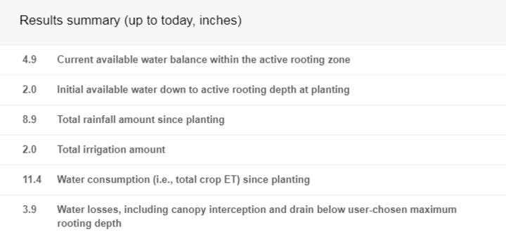
Using real-time weather data from online sources and field-specific information provided by users, CornSoyWater uses computer simulation models to predict crop growth stages, crop water use, amount of water in the soil active rooting zone, and possible crop water stress from planting until the day the data is being accessed (Figure 1). The program will recommend irrigation for a field if the crop water stress is likely occurring or is expected to occur within the next three days (Figure 1). The program also provides an up-to-date summary on the field’s soil-water balance, including total up-to-date rainfall, crop water use, and water balance.
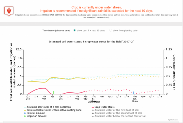
Behind the screen, CornSoyWater uses the SoySim and Hybrid-Maize models to accomplish the following tasks for a field using user-specified crop information and online real-time weather data:
- Predicting the up-to-date crop stage.
- Tracking crop water use and water inputs from rainfall and past irrigations and estimating the amount of crop available water in the soil profile to the maximum rooting depth.
- Assessing possible crop water stress based on soil water depletion and crop water demand.
- Recommending irrigation if crop water stress is likely occurring or will occur in the next three days.
Field-Specific Crop Info Provided By Users
Users start by registering an account and setting up the fields to be included (Figure 2).
The user will provide some basic information about the crop (Figure 2), including:
- Field location by marking it directly on the Google map,
- Soybean maturity group,
- Date of planting, and
- Soil depth and soil moisture status at planting.
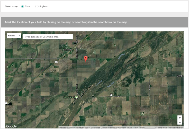
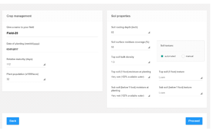
Figure 2. Screenshot of user-specified information for a corn field, including location (left map) and crop and soil information (right).
Data Input is Simple for New and Returning Users
Registration to start a new account is free and easy. If you’re already a user, it’s easy to reuse previous field data.
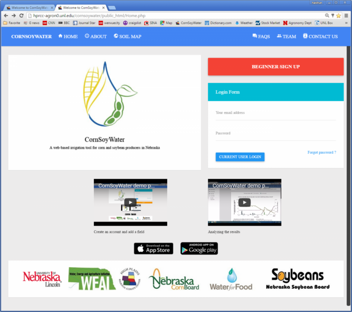
New users must register for a free account. Simply Google cornsoywater.unl.edu to find the link to the program’s home page (Figure 3). Click on BEGINNER SIGNUP on the upper right of the page and the program will take you through the next steps. Follow the instructions on the screen to create your account and sign up of your fields.
Two YouTube videos are available at the website to explain how the program works and how to use it (Figure 3). In addition, CornSoyWater apps for iPhones and Android smartphones are available for free downloading.
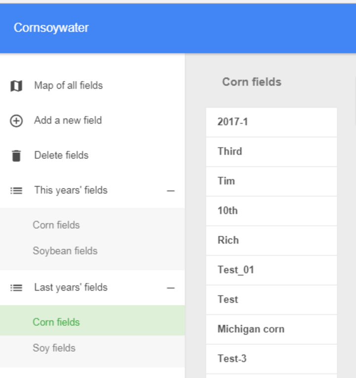
Return users who signed up their fields last year can re-use a field for the same or different crop (corn or soybean) as shown in Figure 4.
A Word of Caution
As with any computer model, CornSoyWater may produce results that deviate from the field’s reality, especially under unusual conditions. As a result, irrigators should exercise caution when using the program and combine results from CornSoyWater with their current irrigation guidelines.
Funding for development of CornSoyWater was provided by the Nebraska Soybean Board, the Nebraska Corn Board, the Water, Energy and Agriculture Initiative (WEAI), and the University of Nebraska-Lincoln Water For Food Institute.

