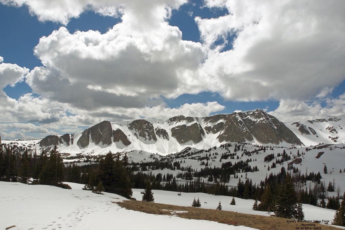

Figure 2. Snow pack in the Snowy Range of the Medicine Bow mountain range.
Minor to moderate lowland flooding is still occurring along the North Platte River from Lewellen west into southeastern Wyoming and will continue for several weeks or months. The areas affected are primarily the river bottom, pasture, and low-lying agricultural production fields. Some areas are near flood stage and others have exceeded flood stage. River levels are expected to remain high until the first of next week.
Nearly all of the snow pack has come off of the North Platte River drainage below Alcova reservoir, but with more than 60% of the snowmelt to come off above Seminoe Reservoir in Wyoming, there will be a lot of water to move through the system into the Central Platte River and east. Estimates for the Upper North Platte River drainage are 151% of normal for the snow water equivalent and 111% of precipitation for this time. The Laramie River estimates are 277% of snow water equivalent and 117% of precipitation. The reservoirs in Colorado which feed into the South Platte River, are also near capacity. A lot of snowmelt still needs to come out to the basins feeding the South Platte drainage. Estimates for that drainage are 180% of snow water equivalent and 114% of precipitation.
I took a long road trip Monday, May 30, 2016 and observed the snow pack in the Snowy Mountains of the Medicine Bow mountain range in southeast Wyoming, along state highway 130. From the photos you can see the snow that will be melting and making its way to the North Platte River (Figures 1-2).
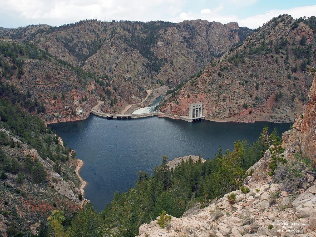
Figure 3. Seminoe dam and reservoir nearly full.
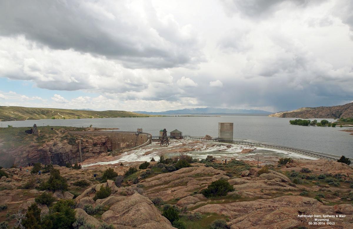
I also observed the water from Pathfinder reservoir going over the new weir/spillway at Pathfinder dam. The spill started Saturday or Sunday of last week. With Seminoe reservoir nearly full and most of the snowpack still to melt and come off, the spill at Pathfinder should continue for several weeks if not more. Right now there is a “moderate” amount of water going over the spillway, but this should increase as inflows increase into Pathfinder. With more water going over the spillway, the sight only gets better (Figures 3-6).
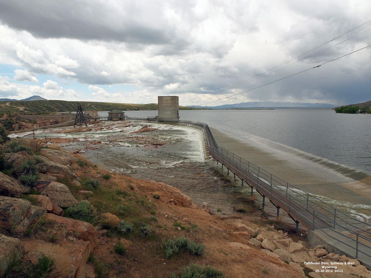
Figure 5. Pathfinder weir in operation
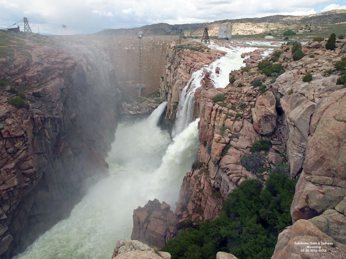
Figure 6. Pathfinder dam and spillway
To view the latest data for the Wyoming reservoirs, go to http://www.usbr.gov/gp/hydromet/teacup_form.html and in the drop-down box click on “NP” – North Platte Basin. Then click on “Submit." You will be shown a “Teacup” model of the reservoirs in Wyoming along the North Platte River. It shows inflows, outflows, capacities, etc.
Lake McConaughy (Figure 7) is approximately 94% full at this time. Current inflows into Lake McConaughy are 8,500 cfs and outflows are 4,685 cfs. Lake McConaughy has approximately 212,000 acre-feet of storage remaining before it is considered full. Information from the Central Nebraska Public Power and Irrigation District on Lake McConaughy Reservoir is at http://www.cnppid.com/wp-content/uploads/2016/05/WPelevation_flows.html.
Resources
For more information and education about the North Platte River Surface Irrigation Projects and Power Generation, dams and reservoirs, view the slideshare presentation found on the UNL Panhandle Research and Extension Center web page. Bureau of Reclamation water operations information can be found at their web site http://www.usbr.gov/gp/wyao/index.html and snow water content and precipitation can be found at http://www.wrds.uwyo.edu/wrds/nrcs/snowprec/snowprec.html. This web link includes the North and South Platte River drainages.
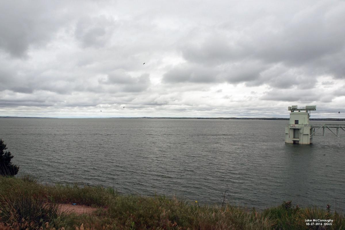
Figure 7. Lake McConaughy near Ogallala.
